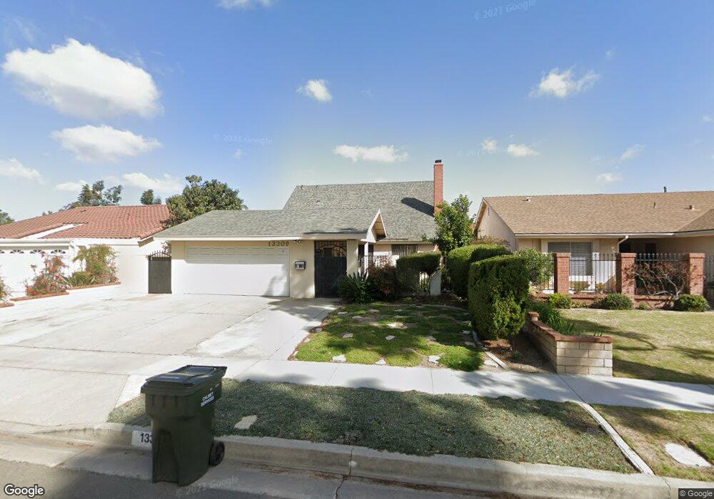
13309 Ashworth St Cerritos, CA 90703
Estimated Value: $1,153,000 - $1,211,000
4
Beds
2
Baths
1,594
Sq Ft
$745/Sq Ft
Est. Value
About This Home
This home is located at 13309 Ashworth St, Cerritos, CA 90703 and is currently estimated at $1,187,974, approximately $745 per square foot. 13309 Ashworth St is a home located in Los Angeles County with nearby schools including Cecil B. Stowers Elementary School, Carmenita Middle School, and Cerritos High School.
Ownership History
Date
Name
Owned For
Owner Type
Purchase Details
Closed on
May 24, 2022
Sold by
Jin Kwon O
Bought by
Kwon Samuel and Kwon Ivy Joy
Current Estimated Value
Purchase Details
Closed on
Dec 27, 1995
Sold by
Kwon Ojin
Bought by
Kwon Helena H
Purchase Details
Closed on
Nov 17, 1995
Sold by
Kwon David J
Bought by
Kwon Helena H
Purchase Details
Closed on
Feb 2, 1995
Sold by
Emc Mtg Corp
Bought by
Kwon David J
Home Financials for this Owner
Home Financials are based on the most recent Mortgage that was taken out on this home.
Original Mortgage
$203,000
Interest Rate
9.23%
Purchase Details
Closed on
Oct 19, 1994
Sold by
Kwon O Jin O and Kwon Hongsook
Bought by
Emc Mtg Corp
Create a Home Valuation Report for This Property
The Home Valuation Report is an in-depth analysis detailing your home's value as well as a comparison with similar homes in the area
Home Values in the Area
Average Home Value in this Area
Purchase History
| Date | Buyer | Sale Price | Title Company |
|---|---|---|---|
| Kwon Samuel | -- | None Listed On Document | |
| Kwon Helena H | -- | -- | |
| Kwon Helena H | -- | -- | |
| Kwon David J | $215,000 | Continental Lawyers Title Co | |
| Emc Mtg Corp | $215,000 | First Southwestern Title |
Source: Public Records
Mortgage History
| Date | Status | Borrower | Loan Amount |
|---|---|---|---|
| Previous Owner | Kwon David J | $203,000 |
Source: Public Records
Tax History Compared to Growth
Tax History
| Year | Tax Paid | Tax Assessment Tax Assessment Total Assessment is a certain percentage of the fair market value that is determined by local assessors to be the total taxable value of land and additions on the property. | Land | Improvement |
|---|---|---|---|---|
| 2025 | $6,203 | $348,839 | $192,694 | $156,145 |
| 2024 | $6,203 | $505,152 | $305,808 | $199,344 |
| 2023 | $4,287 | $335,295 | $185,212 | $150,083 |
| 2022 | $4,222 | $328,722 | $181,581 | $147,141 |
| 2021 | $4,121 | $322,277 | $178,021 | $144,256 |
| 2020 | $4,088 | $318,973 | $176,196 | $142,777 |
| 2019 | $4,028 | $312,720 | $172,742 | $139,978 |
| 2018 | $3,695 | $306,589 | $169,355 | $137,234 |
| 2016 | $3,540 | $294,686 | $162,780 | $131,906 |
| 2015 | $3,496 | $290,260 | $160,335 | $129,925 |
| 2014 | $3,432 | $284,575 | $157,195 | $127,380 |
Source: Public Records
Map
Nearby Homes
- 13210 Sutton St
- 18006 Point Conception Place
- 18517 Betty Way
- 13044 Hedda Ln
- 13010 Artesia Blvd
- 13370 Holly Oak Cir
- 19008 Jeffrey Ave
- 19118 Martha Ave
- 12567 Semora St
- 7152 Caprice Cir
- 5412 Bransford Dr
- 12525 Semora St
- 13548 Village Dr Unit A
- 12417 Rose St
- 12356 Reva St
- 0 Parcel: 7016-014-017 Ave Unit PW25183248
- 12360 Hedda Dr
- 12711 Castleford Ln
- 19335 Derbyshire Ln
- 16611 Shenandoah Ave
- 13315 Ashworth St
- 13303 Ashworth St
- 13310 Felson Place
- 13319 Ashworth St
- 13304 Felson Place
- 13316 Felson Place
- 13320 Felson Place
- 13325 Ashworth St
- 13308 Ashworth St
- 13302 Ashworth St
- 13314 Ashworth St
- 13326 Felson Place
- 13318 Ashworth St
- 17903 Martha Place
- 17821 Martha Place
- 13329 Ashworth St
- 17907 Martha Place
- 17817 Martha Place
- 13324 Ashworth St
- 13332 Felson Place