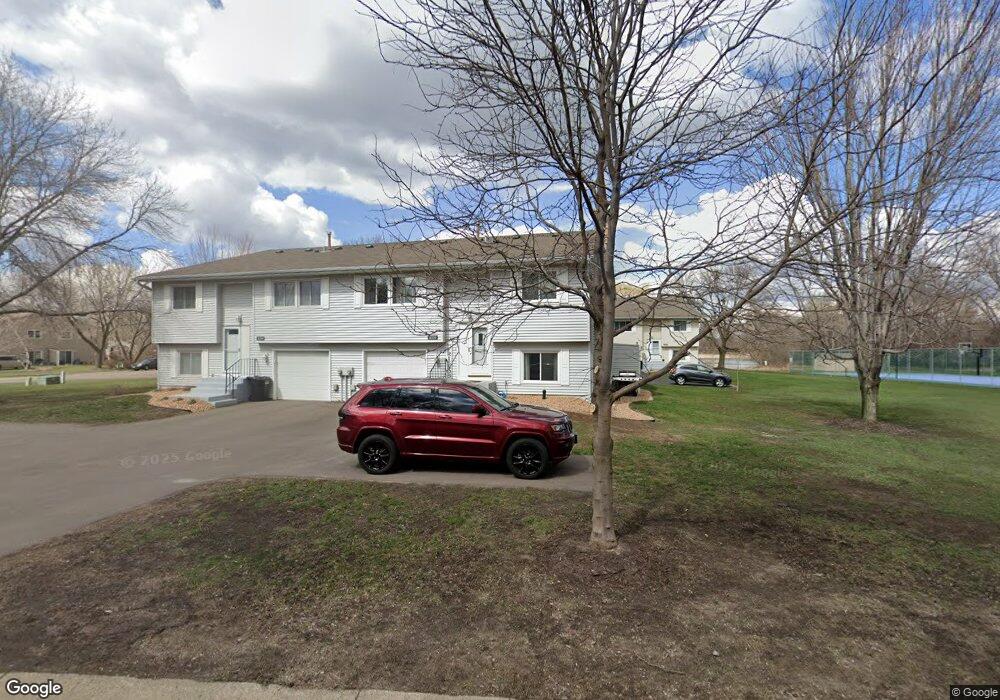
1331 119th Ln NW Coon Rapids, MN 55448
Estimated Value: $227,232 - $238,000
2
Beds
1
Bath
794
Sq Ft
$293/Sq Ft
Est. Value
About This Home
This home is located at 1331 119th Ln NW, Coon Rapids, MN 55448 and is currently estimated at $232,308, approximately $292 per square foot. 1331 119th Ln NW is a home located in Anoka County with nearby schools including Lucile Bruner Elementary School, Eisenhower Elementary School, and Laughlin Junior/Senior High School.
Ownership History
Date
Name
Owned For
Owner Type
Purchase Details
Closed on
Dec 14, 2018
Sold by
Blomberg Elise June
Bought by
Running Matthew Scott
Current Estimated Value
Home Financials for this Owner
Home Financials are based on the most recent Mortgage that was taken out on this home.
Original Mortgage
$154,156
Outstanding Balance
$137,321
Interest Rate
5.37%
Mortgage Type
FHA
Estimated Equity
$94,987
Purchase Details
Closed on
Dec 7, 2011
Sold by
Sec Of Housing & Urban Development
Bought by
Blomberg Elise June
Home Financials for this Owner
Home Financials are based on the most recent Mortgage that was taken out on this home.
Original Mortgage
$43,859
Interest Rate
4.37%
Mortgage Type
FHA
Purchase Details
Closed on
Mar 28, 2002
Sold by
The Berkley Group
Bought by
Kilgore Michael and Smith Joanne E
Create a Home Valuation Report for This Property
The Home Valuation Report is an in-depth analysis detailing your home's value as well as a comparison with similar homes in the area
Home Values in the Area
Average Home Value in this Area
Purchase History
| Date | Buyer | Sale Price | Title Company |
|---|---|---|---|
| Running Matthew Scott | $157,000 | Land Title Inc | |
| Blomberg Elise June | $45,000 | -- | |
| Kilgore Michael | $119,900 | -- |
Source: Public Records
Mortgage History
| Date | Status | Borrower | Loan Amount |
|---|---|---|---|
| Open | Running Matthew Scott | $154,156 | |
| Previous Owner | Blomberg Elise June | $43,859 |
Source: Public Records
Tax History Compared to Growth
Tax History
| Year | Tax Paid | Tax Assessment Tax Assessment Total Assessment is a certain percentage of the fair market value that is determined by local assessors to be the total taxable value of land and additions on the property. | Land | Improvement |
|---|---|---|---|---|
| 2025 | $2,142 | $215,500 | $63,000 | $152,500 |
| 2024 | $2,142 | $218,300 | $48,300 | $170,000 |
| 2023 | $2,037 | $204,600 | $52,500 | $152,100 |
| 2022 | $1,578 | $217,900 | $48,300 | $169,600 |
| 2021 | $1,623 | $157,200 | $27,300 | $129,900 |
| 2020 | $1,576 | $157,600 | $31,500 | $126,100 |
| 2019 | $1,518 | $148,300 | $31,500 | $116,800 |
| 2018 | $1,324 | $139,900 | $0 | $0 |
| 2017 | $1,189 | $122,200 | $0 | $0 |
| 2016 | $1,100 | $103,300 | $0 | $0 |
| 2015 | $917 | $103,300 | $17,500 | $85,800 |
| 2014 | -- | $74,000 | $5,200 | $68,800 |
Source: Public Records
Map
Nearby Homes
- 1449 119th Ln NW
- 11852 Yellow Pine St NW
- 12010 Eagle St NW
- 11923 Wintergreen St NW
- 1660 Northdale Blvd NW
- 1727 121st Ln NW
- 12463 Drake St NW
- 1625 124th Ave NW
- 899 123rd Ln NW
- 12488 Unity St NW
- 12365 Jay St NW
- 633 Sand Creek Dr NW
- 1450 126th Ln NW
- 11350 Jay St NW
- 1593 126th Ln NW
- 12554 Grouse St NW
- 12357 Magnolia St NW
- 11640 Larch St NW
- 11444 Hanson Blvd NW
- 1869 113th Ave NW
- 1339 119th Ln NW
- 11947 Bluebird St NW
- 11955 Bluebird St NW
- 11961 Bluebird St NW
- 11963 Bluebird St NW
- 11969 Bluebird St NW
- 1332 119th Ln NW
- 1346 119th Ln NW
- 1338 119th Ln NW
- 11971 Bluebird St NW
- 1324 119th Ln NW
- 11946 Bluebird St NW
- 1308 119th Ln NW
- 1316 119th Ln NW
- 1348 119th Ln NW
- 11938 Bluebird St NW
- 1363 119th Ln NW
- 1363 119th Ln NW Unit 6
- 1354 119th Ln NW
- 11954 Bluebird St NW