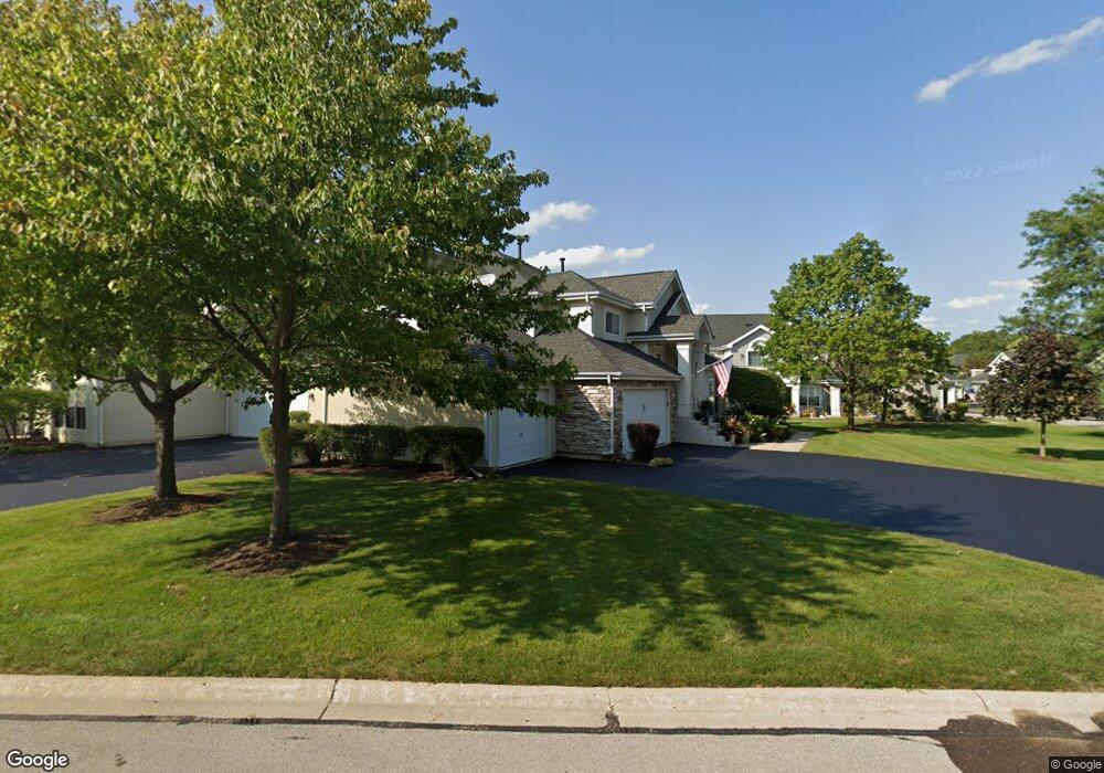
1331 Georgetown Dr Batavia, IL 60510
Northwest Batavia NeighborhoodEstimated Value: $291,128 - $317,000
2
Beds
--
Bath
1,325
Sq Ft
$232/Sq Ft
Est. Value
About This Home
This home is located at 1331 Georgetown Dr, Batavia, IL 60510 and is currently estimated at $306,782, approximately $231 per square foot. 1331 Georgetown Dr is a home located in Kane County with nearby schools including H C Storm Elementary School, Sam Rotolo Middle School, and Batavia Sr High School.
Ownership History
Date
Name
Owned For
Owner Type
Purchase Details
Closed on
Apr 13, 2018
Sold by
Braun Sharon L
Bought by
Speechley Marlene and Speechley Family Trust
Current Estimated Value
Purchase Details
Closed on
Sep 29, 2004
Sold by
Braun Betty I
Bought by
Braun Sharon I and Braun Betty I
Purchase Details
Closed on
Jun 15, 2000
Sold by
Braun Robert J and Braun Betty I
Bought by
Braun Robert J and Braun Betty I
Create a Home Valuation Report for This Property
The Home Valuation Report is an in-depth analysis detailing your home's value as well as a comparison with similar homes in the area
Home Values in the Area
Average Home Value in this Area
Purchase History
| Date | Buyer | Sale Price | Title Company |
|---|---|---|---|
| Speechley Marlene | $182,000 | Fidelity National Title | |
| Braun Sharon I | -- | -- | |
| Braun Robert J | -- | -- |
Source: Public Records
Tax History Compared to Growth
Tax History
| Year | Tax Paid | Tax Assessment Tax Assessment Total Assessment is a certain percentage of the fair market value that is determined by local assessors to be the total taxable value of land and additions on the property. | Land | Improvement |
|---|---|---|---|---|
| 2024 | $2,439 | $75,203 | $5,619 | $69,584 |
| 2023 | -- | $65,248 | $5,100 | $60,148 |
| 2022 | $1,210 | $58,817 | $4,766 | $54,051 |
| 2021 | $1,210 | $55,782 | $4,520 | $51,262 |
| 2020 | $1,210 | $54,710 | $4,433 | $50,277 |
| 2019 | $1,566 | $52,773 | $4,276 | $48,497 |
| 2018 | $1,882 | $50,763 | $4,113 | $46,650 |
| 2017 | $3,032 | $49,089 | $3,977 | $45,112 |
| 2016 | $3,062 | $47,659 | $3,861 | $43,798 |
| 2015 | -- | $46,574 | $3,773 | $42,801 |
| 2014 | -- | $45,108 | $3,654 | $41,454 |
| 2013 | -- | $44,228 | $3,583 | $40,645 |
Source: Public Records
Map
Nearby Homes
- 1270 North Ave Unit 1
- 320 Ellen Ln
- 345 Mill St
- 372 Mill St
- 109 N Van Nortwick Ave
- 103 N Van Nortwick Ave
- Vista Plan at Ashton Ridge
- Bowman Plan at Ashton Ridge - Towns
- Park Place Plan at Ashton Ridge
- Boardwalk Plan at Ashton Ridge
- Fifth Avenue Plan at Ashton Ridge
- Woodward Plan at Ashton Ridge
- 950 Houston St
- 1075 Houston St Unit 89002
- 1067 Houston St Unit 89004
- 1071 Houston St Unit 89003
- 1058 Houston St Unit 74003
- 918 Houston St
- 934 Houston St
- 1054 Houston St Unit 89004
- 1337 Georgetown Dr Unit 372
- 1351 Georgetown Dr Unit 362
- 1357 Georgetown Dr
- 67 Willey Ln Unit 381
- 61 Willey Ln Unit 382
- 1326 Georgetown Dr Unit 323
- 1322 Georgetown Dr Unit 321
- 1324 Georgetown Dr Unit 324
- 1320 Georgetown Dr Unit 322
- 1360 Georgetown Dr Unit 341
- 1360 Georgetown Dr Unit 1360
- 1371 Georgetown Dr Unit 351
- 1362 Georgetown Dr Unit 344
- 1366 Georgetown Dr Unit 342
- 1364 Georgetown Dr
- 1362 Georgetown Dr Unit 1362
- 1346 Georgetown Dr Unit 331
- 1342 Georgetown Dr Unit 333
- 1344 Georgetown Dr Unit 334
- 1304 Georgetown Dr