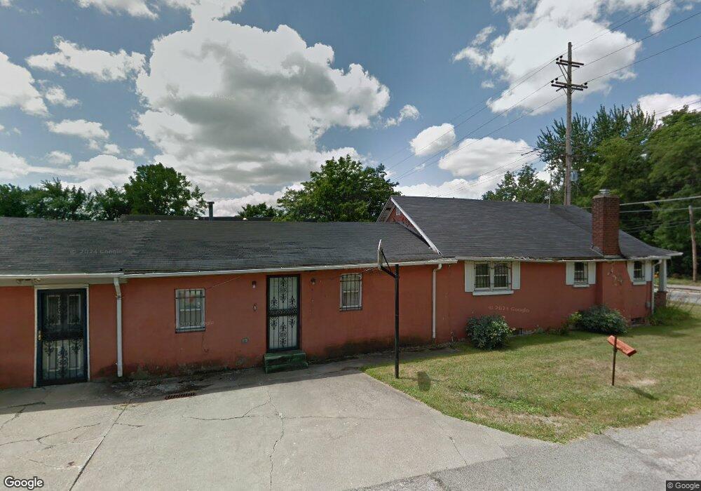
1331 Jacobs Rd Youngstown, OH 44505
McGuffey Heights NeighborhoodEstimated Value: $55,848 - $87,000
2
Beds
1
Bath
1,680
Sq Ft
$47/Sq Ft
Est. Value
About This Home
This home is located at 1331 Jacobs Rd, Youngstown, OH 44505 and is currently estimated at $78,212, approximately $46 per square foot. 1331 Jacobs Rd is a home located in Mahoning County with nearby schools including M.L. King Elementary School, Williamson Elementary School, and East High School.
Ownership History
Date
Name
Owned For
Owner Type
Purchase Details
Closed on
Jun 10, 2021
Bought by
Carmella M Williams
Current Estimated Value
Home Financials for this Owner
Home Financials are based on the most recent Mortgage that was taken out on this home.
Interest Rate
2.96%
Purchase Details
Closed on
Jul 20, 2007
Sold by
Hayes Ida Mae
Bought by
Nicholson Mae E and Lucas Jacqueline A
Purchase Details
Closed on
Mar 18, 1985
Bought by
Hayes Ida M
Create a Home Valuation Report for This Property
The Home Valuation Report is an in-depth analysis detailing your home's value as well as a comparison with similar homes in the area
Home Values in the Area
Average Home Value in this Area
Purchase History
| Date | Buyer | Sale Price | Title Company |
|---|---|---|---|
| Carmella M Williams | $12,000 | -- | |
| Nicholson Mae E | -- | Attorney | |
| Hayes Ida M | -- | -- |
Source: Public Records
Mortgage History
| Date | Status | Borrower | Loan Amount |
|---|---|---|---|
| Closed | Carmella M Williams | -- |
Source: Public Records
Tax History Compared to Growth
Tax History
| Year | Tax Paid | Tax Assessment Tax Assessment Total Assessment is a certain percentage of the fair market value that is determined by local assessors to be the total taxable value of land and additions on the property. | Land | Improvement |
|---|---|---|---|---|
| 2024 | $298 | $6,060 | $320 | $5,740 |
| 2023 | $296 | $6,060 | $320 | $5,740 |
| 2022 | $190 | $2,970 | $280 | $2,690 |
| 2021 | $3 | $2,970 | $280 | $2,690 |
| 2020 | $3 | $2,970 | $280 | $2,690 |
| 2019 | $6 | $2,750 | $260 | $2,490 |
| 2018 | $6 | $2,750 | $260 | $2,490 |
| 2017 | $3 | $2,750 | $260 | $2,490 |
| 2016 | $3 | $2,900 | $260 | $2,640 |
| 2015 | $3 | $2,900 | $260 | $2,640 |
| 2014 | $3 | $2,900 | $260 | $2,640 |
| 2013 | $3 | $2,900 | $260 | $2,640 |
Source: Public Records
Map
Nearby Homes
- 1214 Brighton St
- 1720 Jacobs Rd
- 2051 Blair Ave
- 1003 Liberty Rd
- 2951 Megan Cir
- 2831 Benford Ln
- 2954 Megan Cir
- V/L Jacobs Rd
- 1325 Miami Ave
- 902 Miami St
- 227 Greeley Ln
- 665 Wendemere Dr
- 1538 Republic Ave
- 405 Drake Ave
- 566 Sunshine Ave
- 663 Meadowland Dr
- 71 Duncan Ln
- 366 Westview Ave
- 0 Homestead Rd
- 531 Meadowland Dr
- 1515 Jacobs Rd
- 1519 Jacobs Rd
- 1320 Jacobs Rd
- 1520 Jacobs Rd
- 1303 Brighton St
- 1526 Jacobs Rd
- 1602 Jacobs Rd
- 2971 Edgar Ave
- 1330 Hanover St
- 1609 Jacobs Rd
- 0 Jacobs Rd
- 1612 Jacobs Rd
- 3046 Edgar Ave
- 2974 Edgar Ave
- 1622 Jacobs Rd
- 1623 Jacobs Rd
- 1210 Brighton St
- 2972 Edgar Ave
- 1628 Jacobs Rd
- 3012 Shannon Ave