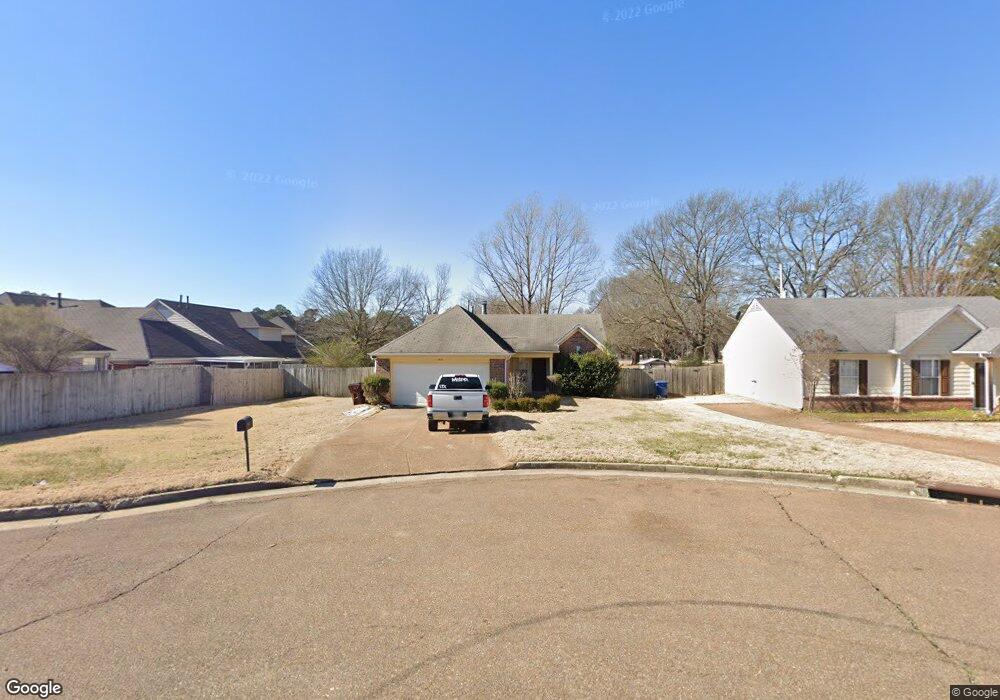
1331 Lagrange Downs Rd Cordova, TN 38018
Cordova NeighborhoodEstimated Value: $183,980 - $220,000
3
Beds
2
Baths
1,248
Sq Ft
$166/Sq Ft
Est. Value
About This Home
This home is located at 1331 Lagrange Downs Rd, Cordova, TN 38018 and is currently estimated at $207,745, approximately $166 per square foot. 1331 Lagrange Downs Rd is a home located in Shelby County with nearby schools including Dexter Elementary School, Dexter Middle School, and Cordova High School.
Ownership History
Date
Name
Owned For
Owner Type
Purchase Details
Closed on
Jun 19, 2003
Sold by
Lester Arthur K and Lester Celeste F
Bought by
Stroud Richard K and Trust #1331
Current Estimated Value
Purchase Details
Closed on
Feb 28, 1997
Sold by
Paragon Properties Llc
Bought by
Lester Arthur K and Lester Celeste F
Home Financials for this Owner
Home Financials are based on the most recent Mortgage that was taken out on this home.
Original Mortgage
$86,902
Interest Rate
7.9%
Mortgage Type
FHA
Create a Home Valuation Report for This Property
The Home Valuation Report is an in-depth analysis detailing your home's value as well as a comparison with similar homes in the area
Home Values in the Area
Average Home Value in this Area
Purchase History
| Date | Buyer | Sale Price | Title Company |
|---|---|---|---|
| Stroud Richard K | -- | -- | |
| Lester Arthur K | $87,900 | -- | |
| Paragon Properties Llc | -- | -- | |
| Lester Arthur K | $87,900 | -- | |
| Paragon Properties Llc | -- | -- |
Source: Public Records
Mortgage History
| Date | Status | Borrower | Loan Amount |
|---|---|---|---|
| Previous Owner | Lester Arthur K | $86,902 |
Source: Public Records
Tax History
| Year | Tax Paid | Tax Assessment Tax Assessment Total Assessment is a certain percentage of the fair market value that is determined by local assessors to be the total taxable value of land and additions on the property. | Land | Improvement |
|---|---|---|---|---|
| 2025 | $1,220 | $47,875 | $6,500 | $41,375 |
| 2024 | $1,220 | $35,975 | $5,325 | $30,650 |
| 2023 | $1,220 | $35,975 | $5,325 | $30,650 |
| 2022 | $1,220 | $35,975 | $5,325 | $30,650 |
| 2021 | $1,241 | $35,975 | $5,325 | $30,650 |
| 2020 | $1,003 | $24,775 | $5,325 | $19,450 |
| 2019 | $1,003 | $24,775 | $5,325 | $19,450 |
| 2018 | $1,003 | $24,775 | $5,325 | $19,450 |
| 2017 | $1,018 | $24,775 | $5,325 | $19,450 |
| 2016 | $1,001 | $22,900 | $0 | $0 |
| 2014 | $1,001 | $22,900 | $0 | $0 |
Source: Public Records
Map
Nearby Homes
- 6864 Lagrange Hill Rd
- 6900 Lagrange Hill Rd
- 6989 Amberly Way Dr
- 6916 Lagrange Pines Rd
- 1239 Whitten Rd
- 1259 Breezy Gate Dr
- 6907 Manslick Rd
- 6880 Wrigley Dr
- 6884 Wrigley Dr
- 7106 Anise Tree Dr
- 1475 S Goodlett Grove Cove
- 0 Harpeth Dr
- 1564 Wynne Rd
- 1077 Jessica Lauren Dr
- 1264 Charles Bryan Rd
- 990 Jessica Lauren Dr
- 6972 Parkbrook Ln
- 6452 Macon Rd
- 1432 Bridgewater Rd
- 7225 Bridgewater Church Rd
- 1337 Lagrange Downs Rd
- 6852 Kamali Ave
- 6848 Kamali Ave
- 6858 Kamali Ave
- 6844 Kamali Ave
- 1343 Lagrange Downs Rd
- 6836 Kamali Ave
- 1349 Lagrange Downs Rd
- 1332 Lagrange Downs Rd
- 1312 Lagrange Downs Rd
- 1336 Lagrange Downs Rd
- 6853 Kamali Ave
- 6849 Kamali Ave
- 6832 Kamali Ave
- 6857 Kamali Ave
- 6845 Kamali Ave
- 6861 Kamali Ave
- 1306 Lagrange Downs Rd
- 1340 Lagrange Downs Rd
- 6841 Kamali Ave
Your Personal Tour Guide
Ask me questions while you tour the home.