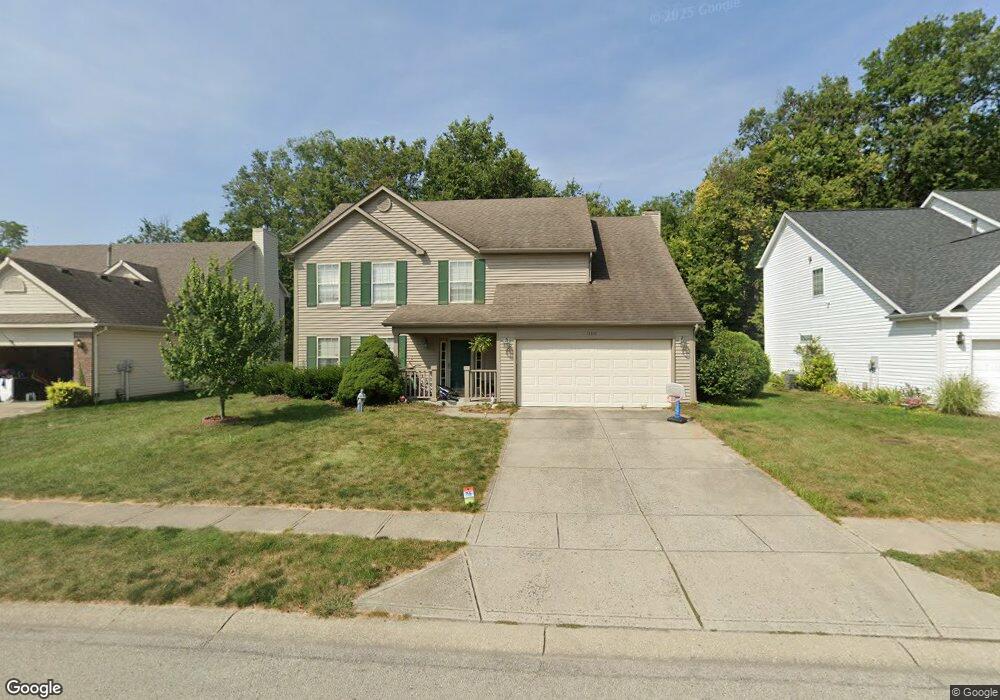
13310 Grouse Point Trail Carmel, IN 46033
East Carmel NeighborhoodEstimated Value: $429,752 - $475,000
4
Beds
3
Baths
2,310
Sq Ft
$198/Sq Ft
Est. Value
About This Home
This home is located at 13310 Grouse Point Trail, Carmel, IN 46033 and is currently estimated at $458,438, approximately $198 per square foot. 13310 Grouse Point Trail is a home located in Hamilton County with nearby schools including Prairie Trace Elementary School, Clay Middle School, and Carmel High School.
Ownership History
Date
Name
Owned For
Owner Type
Purchase Details
Closed on
Jun 15, 2010
Sold by
Sifferlen Matt and Sifferlen Ann M
Bought by
Rhoads Michael I and Rhoads Stephanie M
Current Estimated Value
Home Financials for this Owner
Home Financials are based on the most recent Mortgage that was taken out on this home.
Original Mortgage
$199,315
Outstanding Balance
$137,006
Interest Rate
5.5%
Mortgage Type
FHA
Estimated Equity
$321,432
Purchase Details
Closed on
Jun 30, 2003
Sold by
Evans Darrell E and Evans Caroline C
Bought by
Sifferlen Matt and Sifferlen Ann M
Home Financials for this Owner
Home Financials are based on the most recent Mortgage that was taken out on this home.
Original Mortgage
$152,000
Interest Rate
5.36%
Mortgage Type
Balloon
Create a Home Valuation Report for This Property
The Home Valuation Report is an in-depth analysis detailing your home's value as well as a comparison with similar homes in the area
Home Values in the Area
Average Home Value in this Area
Purchase History
| Date | Buyer | Sale Price | Title Company |
|---|---|---|---|
| Rhoads Michael I | -- | None Available | |
| Sifferlen Matt | -- | -- |
Source: Public Records
Mortgage History
| Date | Status | Borrower | Loan Amount |
|---|---|---|---|
| Open | Rhoads Michael I | $199,315 | |
| Previous Owner | Sifferlen Matt | $152,000 |
Source: Public Records
Tax History Compared to Growth
Tax History
| Year | Tax Paid | Tax Assessment Tax Assessment Total Assessment is a certain percentage of the fair market value that is determined by local assessors to be the total taxable value of land and additions on the property. | Land | Improvement |
|---|---|---|---|---|
| 2024 | $3,547 | $341,200 | $87,100 | $254,100 |
| 2023 | $3,547 | $341,200 | $87,100 | $254,100 |
| 2022 | $2,766 | $249,800 | $84,000 | $165,800 |
| 2021 | $2,569 | $234,200 | $84,000 | $150,200 |
| 2020 | $2,525 | $230,900 | $84,000 | $146,900 |
| 2019 | $2,384 | $222,000 | $44,500 | $177,500 |
| 2018 | $2,085 | $201,100 | $44,500 | $156,600 |
| 2017 | $2,051 | $199,000 | $44,500 | $154,500 |
| 2016 | $2,008 | $194,300 | $44,500 | $149,800 |
| 2014 | $1,802 | $191,300 | $39,200 | $152,100 |
| 2013 | $1,802 | $184,200 | $39,200 | $145,000 |
Source: Public Records
Map
Nearby Homes
- 5298 Ivy Hill Dr
- 5703 Cantigny Way N
- 5305 Breakers Way
- 5310 Gray Eagle Ct
- 5260 Ivy Hill Dr
- 5808 Corralberry Ct
- 5898 Silas Ct
- 5900 Silas Ct
- 12656 Cerromar Ct
- 13213 Mattock Chase
- 5857 Stone Pine Trail
- 13220 Griffin Run
- 5898 Sandalwood Dr
- 5872 Sandalwood Dr
- 12999 Abraham Run
- 5865 Osage Dr
- 14018 Powder Dr
- 13137 Brooks Landing Place
- 13271 Aquamarine Dr
- 14094 Plantation Wood Ln
- 13280 Grouse Point Trail
- 13330 Grouse Point Trail
- 13340 Grouse Point Trail
- 13250 Grouse Point Trail
- 13311 Grouse Point Trail
- 13281 Grouse Point Trail
- 13370 Grouse Point Trail
- 13220 Grouse Point Trail
- 13341 Grouse Point Trail
- 13251 Grouse Point Trail
- 13191 Grouse Point Trail
- 13400 Grouse Point Trail
- 13190 Grouse Point Trail
- 5801 Annandale Dr
- 5805 Annandale Dr
- 5807 Annandale Dr
- 13160 Grouse Point Trail
- 5802 Tanager Ln
- 13279 Colliers Ct
- 5797 Annandale Dr