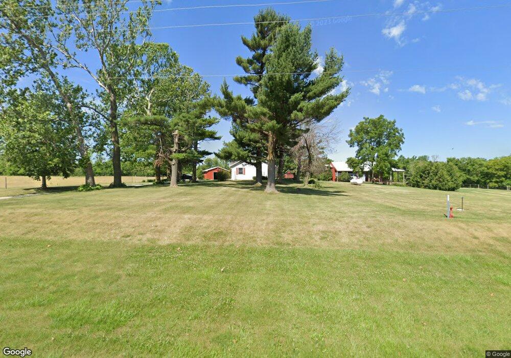
13310 NE 46th St Elkhart, IA 50073
Estimated Value: $402,000 - $753,000
3
Beds
2
Baths
1,695
Sq Ft
$346/Sq Ft
Est. Value
About This Home
This home is located at 13310 NE 46th St, Elkhart, IA 50073 and is currently estimated at $586,000, approximately $345 per square foot. 13310 NE 46th St is a home located in Polk County with nearby schools including North Polk Central Elementary School, North Polk West Elementary School, and North Polk Middle School.
Ownership History
Date
Name
Owned For
Owner Type
Purchase Details
Closed on
Aug 2, 2024
Sold by
Olson Doris Ann Bailey
Bought by
Olson Family Trust and Cory
Current Estimated Value
Purchase Details
Closed on
Feb 20, 2002
Sold by
Seuferer Clifford T and Seuferer Sarah C
Bought by
Olson Doris Bailey
Create a Home Valuation Report for This Property
The Home Valuation Report is an in-depth analysis detailing your home's value as well as a comparison with similar homes in the area
Home Values in the Area
Average Home Value in this Area
Purchase History
| Date | Buyer | Sale Price | Title Company |
|---|---|---|---|
| Olson Family Trust | -- | None Listed On Document | |
| Olson Doris Bailey | $75,000 | -- | |
| Olson Doris Bailey | $74,500 | -- |
Source: Public Records
Mortgage History
| Date | Status | Borrower | Loan Amount |
|---|---|---|---|
| Closed | Olson Doris Bailey | $0 |
Source: Public Records
Tax History Compared to Growth
Tax History
| Year | Tax Paid | Tax Assessment Tax Assessment Total Assessment is a certain percentage of the fair market value that is determined by local assessors to be the total taxable value of land and additions on the property. | Land | Improvement |
|---|---|---|---|---|
| 2025 | $5,788 | $398,700 | $131,100 | $267,600 |
| 2024 | $5,788 | $367,300 | $119,000 | $248,300 |
| 2023 | $5,600 | $367,300 | $119,000 | $248,300 |
| 2022 | $5,528 | $300,400 | $101,200 | $199,200 |
| 2021 | $5,368 | $300,400 | $101,200 | $199,200 |
| 2020 | $5,276 | $278,700 | $93,500 | $185,200 |
| 2019 | $5,060 | $278,700 | $93,500 | $185,200 |
| 2018 | $4,980 | $255,100 | $84,000 | $171,100 |
| 2017 | $4,764 | $255,100 | $84,000 | $171,100 |
| 2016 | $4,676 | $238,100 | $77,300 | $160,800 |
| 2015 | $4,676 | $238,100 | $77,300 | $160,800 |
| 2014 | $4,370 | $217,600 | $69,600 | $148,000 |
Source: Public Records
Map
Nearby Homes
- Hoover C Plan at Kimberly Woods
- Harrison Plan at Kimberly Woods
- Eisenhower Plan at Kimberly Woods
- Hoover B Plan at Kimberly Woods
- Reagan Plan at Kimberly Woods
- Hoover Plan at Kimberly Woods
- Coolidge Plan at Kimberly Woods
- Eisenhower C Plan at Kimberly Woods
- Hoover II Plan at Kimberly Woods
- Grant Plan at Kimberly Woods
- 321 NE Chalet St
- 319 NE Chalet St
- 317 NE Chalet St
- 112 NE Allison Ave
- 503 NE Allison Ave
- 501 NE Madison Ave
- 411 N Allison Ave
- 411 NE Madison Ave
- 802 NE Elm St
- 166 NW Maple St
- 4500 NE 134th Ave
- 4653 NE 134th Ave
- 13430 NE 46th St
- 4530 NE 134th Ave
- 4482 NE 134th Ave
- 4470 NE 134th Ave
- 13464 NE 46th St
- 13483 NE 46th St
- 4943 NE 134th Ave
- 13550 NE 46th St
- 858 N Grant Ave
- 13620 NE 46th St
- 803 N Grant Ave
- 4239 NE 134th Ave
- 5069 NE 134th Ave
- 4197 NE 134th Ave
- 615 N Grant Ave
- 5101 NE 134th Ave
- 5131 NE 134th Ave
- 5171 NE 134th Ave
