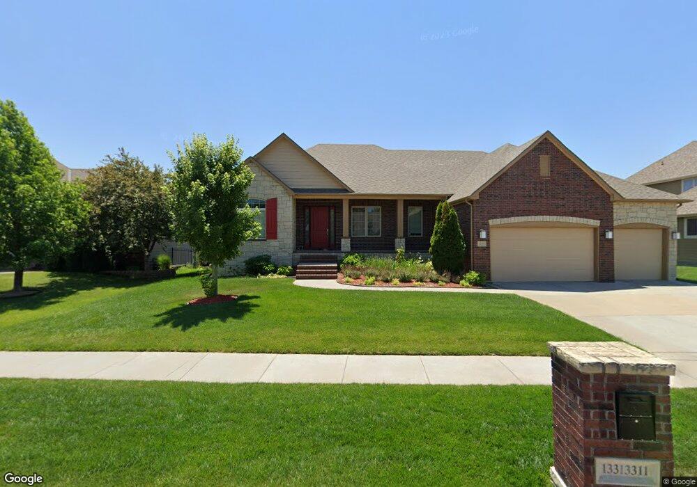
13311 E Mainsgate St Unit HAWTHORNE 3RD ADDITI Wichita, KS 67228
Estimated Value: $710,000 - $712,426
4
Beds
4
Baths
2,341
Sq Ft
$304/Sq Ft
Est. Value
About This Home
This home is located at 13311 E Mainsgate St Unit HAWTHORNE 3RD ADDITI, Wichita, KS 67228 and is currently estimated at $711,213, approximately $303 per square foot. 13311 E Mainsgate St Unit HAWTHORNE 3RD ADDITI is a home located in Sedgwick County with nearby schools including Wheatland Elementary School, Andover Middle School, and Andover High School.
Ownership History
Date
Name
Owned For
Owner Type
Purchase Details
Closed on
Aug 26, 2011
Sold by
Nies Homes Inc
Bought by
Low Kuen M and Kuo Chien
Current Estimated Value
Home Financials for this Owner
Home Financials are based on the most recent Mortgage that was taken out on this home.
Original Mortgage
$380,800
Outstanding Balance
$264,231
Interest Rate
4.54%
Mortgage Type
Construction
Estimated Equity
$446,982
Create a Home Valuation Report for This Property
The Home Valuation Report is an in-depth analysis detailing your home's value as well as a comparison with similar homes in the area
Home Values in the Area
Average Home Value in this Area
Purchase History
| Date | Buyer | Sale Price | Title Company |
|---|---|---|---|
| Low Kuen M | -- | Security 1St Title |
Source: Public Records
Mortgage History
| Date | Status | Borrower | Loan Amount |
|---|---|---|---|
| Open | Low Kuen M | $380,800 |
Source: Public Records
Tax History Compared to Growth
Tax History
| Year | Tax Paid | Tax Assessment Tax Assessment Total Assessment is a certain percentage of the fair market value that is determined by local assessors to be the total taxable value of land and additions on the property. | Land | Improvement |
|---|---|---|---|---|
| 2025 | $10,230 | $82,559 | $15,008 | $67,551 |
| 2023 | $10,230 | $77,154 | $11,109 | $66,045 |
| 2022 | $9,487 | $69,346 | $10,477 | $58,869 |
| 2021 | $10,197 | $66,677 | $9,729 | $56,948 |
| 2020 | $10,030 | $63,204 | $9,729 | $53,475 |
| 2019 | $9,354 | $56,810 | $9,729 | $47,081 |
| 2018 | $10,246 | $63,687 | $8,832 | $54,855 |
| 2017 | $10,243 | $0 | $0 | $0 |
| 2016 | $9,781 | $0 | $0 | $0 |
| 2015 | -- | $0 | $0 | $0 |
| 2014 | -- | $0 | $0 | $0 |
Source: Public Records
Map
Nearby Homes
- 13616 E Mainsgate St
- 2501 N Spring Hollow St
- 2507 N Peckham St
- 2423 N Spring Hollow St
- 14108 E Ayesbury Cir
- 2722 N Woodridge St
- 2730 N Woodridge St
- 2767 N Woodridge Ct
- 2806 N Woodridge St
- 12446 E 27th Ct N
- 12369 E Woodspring Ct
- 12210 E Ayesbury Ct
- 12201 E Boxthorn St
- 2813 N Bracken Ct
- 12106 E Ayesbury St
- 2710 N Bracken Ct
- 14306 E Churchill Cir
- 2846 N Bracken Ct
- 2307 N Sandpiper St
- 12077 E Pepperwood St
- 13311 E Mainsgate St
- 13305 E Mainsgate St
- 2550 N Rosemont Ct
- 2546 N Rosemont Ct
- 2554 N Rosemont Ct
- 13407 E Mainsgate St
- 13316 E Mainsgate St
- 2542 N Rosemont Ct
- 13402 E Mainsgate St
- 13310 E Mainsgate St
- 13302 E Mainsgate Cir
- 13413 E Mainsgate St
- 13221 E Mainsgate Cir
- 13408 E Mainsgate St
- 2538 N Rosemont Ct
- 13222 E Mainsgate Cir
- 2561 N Rosemont Ct
- 2516 N Rosemont Ct
- 13414 E Mainsgate St
- 2520 N Rosemont Cr