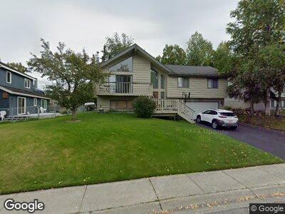
13311 Westwind Dr Anchorage, AK 99516
Huffman-O'Malley NeighborhoodEstimated Value: $390,000 - $502,315
4
Beds
3
Baths
2,142
Sq Ft
$211/Sq Ft
Est. Value
About This Home
This home is located at 13311 Westwind Dr, Anchorage, AK 99516 and is currently estimated at $451,438, approximately $210 per square foot. 13311 Westwind Dr is a home located in Anchorage Municipality with nearby schools including Rabbit Creek Elementary School, Goldenview Middle School, and South Anchorage High School.
Ownership History
Date
Name
Owned For
Owner Type
Purchase Details
Closed on
Dec 13, 2011
Sold by
Chambers Helen Delynne
Bought by
Elgarico Richard E and Elgarico Alexis M
Current Estimated Value
Home Financials for this Owner
Home Financials are based on the most recent Mortgage that was taken out on this home.
Original Mortgage
$326,507
Outstanding Balance
$229,430
Interest Rate
3.75%
Mortgage Type
FHA
Create a Home Valuation Report for This Property
The Home Valuation Report is an in-depth analysis detailing your home's value as well as a comparison with similar homes in the area
Home Values in the Area
Average Home Value in this Area
Purchase History
| Date | Buyer | Sale Price | Title Company |
|---|---|---|---|
| Elgarico Richard E | -- | Stewart Title Company |
Source: Public Records
Mortgage History
| Date | Status | Borrower | Loan Amount |
|---|---|---|---|
| Open | Elgarico Richard E | $9,506 | |
| Open | Elgarico Richard E | $36,600 | |
| Closed | Elgarico Richard E | $10,640 | |
| Open | Elgarico Richard E | $326,507 |
Source: Public Records
Tax History Compared to Growth
Tax History
| Year | Tax Paid | Tax Assessment Tax Assessment Total Assessment is a certain percentage of the fair market value that is determined by local assessors to be the total taxable value of land and additions on the property. | Land | Improvement |
|---|---|---|---|---|
| 2024 | $6,329 | $467,000 | $124,100 | $342,900 |
| 2023 | $7,374 | $433,000 | $124,100 | $308,900 |
| 2022 | $5,982 | $405,200 | $124,100 | $281,100 |
| 2021 | $6,972 | $386,900 | $124,100 | $262,800 |
| 2020 | $5,678 | $384,300 | $124,100 | $260,200 |
| 2019 | $5,458 | $383,600 | $124,100 | $259,500 |
| 2018 | $5,269 | $371,300 | $124,100 | $247,200 |
| 2017 | $5,498 | $371,100 | $124,100 | $247,000 |
| 2016 | $5,213 | $387,400 | $124,100 | $263,300 |
| 2015 | $5,213 | $367,900 | $124,100 | $243,800 |
| 2014 | $5,213 | $349,800 | $119,900 | $229,900 |
Source: Public Records
Map
Nearby Homes
- 2460 Tradewind Dr
- 13030 Galveston Cir
- 2835 Chesapeake Ave
- 13581 Seabreeze Cir
- 2800 Kempton Hills Dr
- 2915 Chesapeake Ave
- 12900 Wellsford Cir
- 12821 Wellsford Cir
- 13381 Seacloud Cir
- 3210 Seawind Dr
- 13438 Stephenson St
- 2800 Merganser Ave
- 12740 Rivulet Cir
- 14210 Specking Ave
- 3670 Eastwind Dr
- 3613 Eastwind Dr
- 12421 Silver Spruce Dr
- 12820 Stephenson St
- 3280 de Armoun Rd
- 13218 Brant Way
- 13311 Westwind Dr
- 13341 Westwind Dr
- 3739 Spinnaker Dr
- 13308 Windrush Cir
- 3725 Spinnaker Dr
- 13312 Windrush Cir
- 2701 Westwind Cir
- 2731 Westwind Cir
- 13349 Westwind Dr
- 13300 Windrush Cir
- 13220 Westwind Dr
- 13340 Westwind Dr
- 13300 Westwind Dr
- 13320 Windrush Cir
- 13211 Westwind Dr
- 2751 Westwind Cir
- 13350 Westwind Dr
- 3730 Spinnaker Dr
- 13311 Windrush Cir
- 3720 Spinnaker Dr