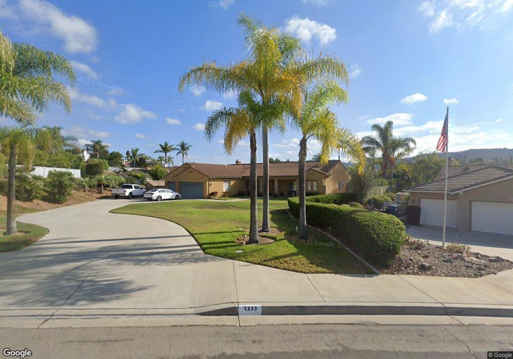
1333 Deerbrook Dr San Marcos, CA 92069
Estimated Value: $1,369,889 - $1,673,000
4
Beds
4
Baths
3,153
Sq Ft
$476/Sq Ft
Est. Value
About This Home
This home is located at 1333 Deerbrook Dr, San Marcos, CA 92069 and is currently estimated at $1,500,472, approximately $475 per square foot. 1333 Deerbrook Dr is a home located in San Diego County with nearby schools including Twin Oaks Elementary School, Woodland Park Middle School, and Mission Hills High School.
Ownership History
Date
Name
Owned For
Owner Type
Purchase Details
Closed on
May 30, 2001
Sold by
Keystone San Marcos 31 Llc
Bought by
King Scott M and King Denyce L
Current Estimated Value
Home Financials for this Owner
Home Financials are based on the most recent Mortgage that was taken out on this home.
Original Mortgage
$275,000
Outstanding Balance
$104,753
Interest Rate
7.14%
Estimated Equity
$1,395,719
Create a Home Valuation Report for This Property
The Home Valuation Report is an in-depth analysis detailing your home's value as well as a comparison with similar homes in the area
Home Values in the Area
Average Home Value in this Area
Purchase History
| Date | Buyer | Sale Price | Title Company |
|---|---|---|---|
| King Scott M | $459,000 | Lawyers Title |
Source: Public Records
Mortgage History
| Date | Status | Borrower | Loan Amount |
|---|---|---|---|
| Open | King Scott M | $275,000 |
Source: Public Records
Tax History
| Year | Tax Paid | Tax Assessment Tax Assessment Total Assessment is a certain percentage of the fair market value that is determined by local assessors to be the total taxable value of land and additions on the property. | Land | Improvement |
|---|---|---|---|---|
| 2025 | $8,627 | $698,385 | $241,083 | $457,302 |
| 2024 | $8,627 | $684,692 | $236,356 | $448,336 |
| 2023 | $8,446 | $671,268 | $231,722 | $439,546 |
| 2022 | $8,290 | $658,107 | $227,179 | $430,928 |
| 2021 | $8,123 | $645,204 | $222,725 | $422,479 |
| 2020 | $8,037 | $638,589 | $220,442 | $418,147 |
| 2019 | $7,938 | $626,069 | $216,120 | $409,949 |
| 2018 | $7,686 | $613,794 | $211,883 | $401,911 |
| 2017 | $133 | $601,760 | $207,729 | $394,031 |
| 2016 | $7,411 | $589,961 | $203,656 | $386,305 |
| 2015 | $7,296 | $581,100 | $200,597 | $380,503 |
| 2014 | $7,133 | $569,718 | $196,668 | $373,050 |
Source: Public Records
Map
Nearby Homes
- 316 Crownview Ct
- 552 Chesterfield Cir
- 561 Chesterfield Cir Unit 5
- 574 Golf Glen Dr
- 564 Golf Glen Dr Unit 5
- 998 Woodhaven Rd
- 1751 Victoria Way
- 1320 Richland Rd
- 1330 Twain Ct
- 825 Bel Esprit Cir
- 362 Borden Rd
- 857 Via Barquero
- 0 Cassou Rd Unit NDP2508052
- 442 Cassou Rd
- 822 Laurelwood Ct
- 0 Easy St
- 286 Glendale Ave
- 787 Cassou Rd
- 320 Rolling Hills Ln
- 1221 Gable Ct
- 1335 Deerbrook Dr
- 1327 Deerbrook Dr
- 1337 Deerbrook Dr
- 1308 Rowena Ave
- 1302 Rowena Ave
- 1314 Rowena Ave
- 1262 Rowena Ave
- 1320 Rowena Ave
- 1256 Rowena Ave
- 1334 Deerbrook Dr
- 1341 Deerbrook Dr
- 1250 Rowena Ave
- 1326 Rowena Ave
- 202 Del Roy Dr
- 1345 Deerbrook Dr
- 1338 Deerbrook Dr
- 1303 Rowena Ave
- 1269 Rowena Ave
- 1332 Rowena Ave
- 1309 Rowena Ave
Your Personal Tour Guide
Ask me questions while you tour the home.