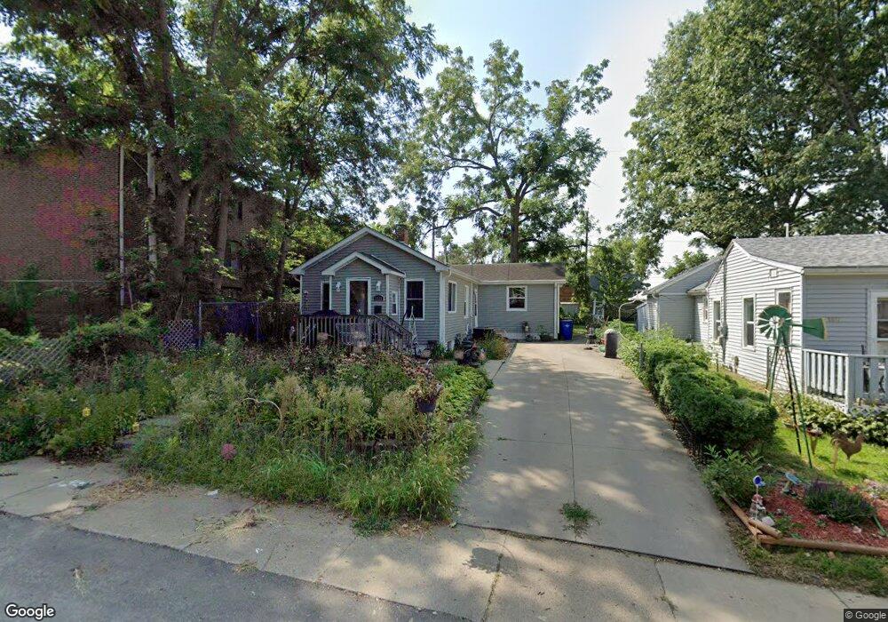
1333 L Ave NE Cedar Rapids, IA 52402
Mound View NeighborhoodEstimated Value: $115,000 - $127,872
3
Beds
1
Bath
1,046
Sq Ft
$117/Sq Ft
Est. Value
About This Home
This home is located at 1333 L Ave NE, Cedar Rapids, IA 52402 and is currently estimated at $121,968, approximately $116 per square foot. 1333 L Ave NE is a home located in Linn County with nearby schools including Franklin Middle School, George Washington High School, and Isaac Newton Christian Academy.
Ownership History
Date
Name
Owned For
Owner Type
Purchase Details
Closed on
Jan 24, 2012
Sold by
Smith Brian
Bought by
Smith Lashay
Current Estimated Value
Purchase Details
Closed on
Aug 22, 2004
Sold by
Kisch Michelle C
Bought by
Smith Brian and Smith Lashay
Home Financials for this Owner
Home Financials are based on the most recent Mortgage that was taken out on this home.
Original Mortgage
$80,330
Outstanding Balance
$40,046
Interest Rate
6.08%
Mortgage Type
FHA
Estimated Equity
$81,922
Purchase Details
Closed on
Jun 26, 1999
Sold by
Willey Diana Lillian and Willey Douglas Herbert
Bought by
Kisch Michelle C
Home Financials for this Owner
Home Financials are based on the most recent Mortgage that was taken out on this home.
Original Mortgage
$56,952
Interest Rate
7.69%
Create a Home Valuation Report for This Property
The Home Valuation Report is an in-depth analysis detailing your home's value as well as a comparison with similar homes in the area
Home Values in the Area
Average Home Value in this Area
Purchase History
| Date | Buyer | Sale Price | Title Company |
|---|---|---|---|
| Smith Lashay | -- | None Available | |
| Smith Brian | $82,000 | -- | |
| Kisch Michelle C | $59,500 | -- |
Source: Public Records
Mortgage History
| Date | Status | Borrower | Loan Amount |
|---|---|---|---|
| Open | Smith Brian | $80,330 | |
| Previous Owner | Kisch Michelle C | $56,952 |
Source: Public Records
Tax History Compared to Growth
Tax History
| Year | Tax Paid | Tax Assessment Tax Assessment Total Assessment is a certain percentage of the fair market value that is determined by local assessors to be the total taxable value of land and additions on the property. | Land | Improvement |
|---|---|---|---|---|
| 2025 | $1,574 | $106,800 | $22,400 | $84,400 |
| 2024 | $1,628 | $99,400 | $20,100 | $79,300 |
| 2023 | $1,628 | $99,400 | $20,100 | $79,300 |
| 2022 | $1,418 | $86,100 | $19,000 | $67,100 |
| 2021 | $1,508 | $77,400 | $15,700 | $61,700 |
| 2020 | $1,508 | $76,900 | $15,700 | $61,200 |
| 2019 | $1,430 | $74,900 | $15,700 | $59,200 |
| 2018 | $1,388 | $74,900 | $15,700 | $59,200 |
| 2017 | $1,447 | $65,800 | $15,700 | $50,100 |
| 2016 | $1,447 | $68,100 | $15,700 | $52,400 |
| 2015 | $1,497 | $70,382 | $15,670 | $54,712 |
| 2014 | $1,312 | $79,403 | $15,986 | $63,417 |
| 2013 | $1,468 | $79,403 | $15,986 | $63,417 |
Source: Public Records
Map
Nearby Homes
- 1046 12th St NE
- 1522 J Ave NE
- 909 Daniels St NE
- 2000 Sierra Cir NE
- 2006 Sierra Cir NE
- 2011 Sierra Cir NE
- 2012 Sierra Cir NE
- 2015 Sierra Cir NE
- 2018 Sierra Cir NE
- 2019 Sierra Cir NE
- 2102 Sierra Cir NE
- 2023 Sierra Cir NE
- 2110 Sierra Cir NE
- 2103 Sierra Cir NE
- 2935 Wildwood Ct NE
- 2116 Sierra Cir NE
- 2109 Sierra Cir NE
- 2122 Sierra Cir NE
- 2115 Sierra Cir NE
- 2944 Oakland Rd NE
- 1327 L Ave NE
- 1215 Oakland Rd NE Unit 19
- 1215 Oakland Rd NE Unit 7
- 1215 Oakland Rd NE Unit 16
- 1215 Oakland Rd NE Unit 17
- 1215 Oakland Rd NE Unit 42
- 1215 Oakland Rd NE Unit 41
- 1215 Oakland Rd NE Unit 10
- 1215 Oakland Rd NE Unit 26
- 1215 Oakland Rd NE Unit 29
- 1215 Oakland Rd NE
- 1325 L Ave NE
- 1340 L Ave NE
- 1321 L Ave NE
- 1324 K Ave NE
- 1320 K Ave NE
- 1317 L Ave NE
- 1318 K Ave NE
- 1328 L Ave NE
- 1326 L Ave NE