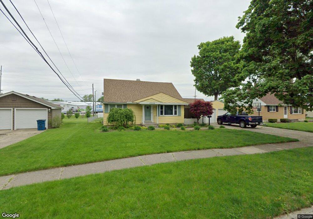
1335 N Park Dr New Haven, IN 46774
Estimated Value: $217,000 - $243,000
3
Beds
3
Baths
1,491
Sq Ft
$156/Sq Ft
Est. Value
About This Home
This home is located at 1335 N Park Dr, New Haven, IN 46774 and is currently estimated at $232,032, approximately $155 per square foot. 1335 N Park Dr is a home located in Allen County with nearby schools including New Haven Primary School, New Haven Intermediate School, and New Haven High School.
Ownership History
Date
Name
Owned For
Owner Type
Purchase Details
Closed on
Nov 11, 2021
Sold by
Being Michelle N Swygart
Bought by
Swygart Matthew David
Current Estimated Value
Purchase Details
Closed on
May 29, 2015
Sold by
Griffin Edward C and Griffin Mary Lou
Bought by
Swygart Matthew David and Swygart Michelle N
Home Financials for this Owner
Home Financials are based on the most recent Mortgage that was taken out on this home.
Original Mortgage
$120,026
Outstanding Balance
$92,597
Interest Rate
3.64%
Mortgage Type
VA
Estimated Equity
$139,435
Purchase Details
Closed on
May 2, 2006
Sold by
Kinsel Ronnie E and Kinsel Kathy
Bought by
Griffin Edward C and Griffin Mary Lou
Home Financials for this Owner
Home Financials are based on the most recent Mortgage that was taken out on this home.
Original Mortgage
$84,000
Interest Rate
6.39%
Mortgage Type
Purchase Money Mortgage
Create a Home Valuation Report for This Property
The Home Valuation Report is an in-depth analysis detailing your home's value as well as a comparison with similar homes in the area
Home Values in the Area
Average Home Value in this Area
Purchase History
| Date | Buyer | Sale Price | Title Company |
|---|---|---|---|
| Swygart Matthew David | -- | None Available | |
| Swygart Matthew David | -- | Centurion Land Title Inc | |
| Griffin Edward C | -- | Lawyers Title |
Source: Public Records
Mortgage History
| Date | Status | Borrower | Loan Amount |
|---|---|---|---|
| Open | Swygart Matthew David | $120,026 | |
| Previous Owner | Griffin Edward C | $84,000 |
Source: Public Records
Tax History Compared to Growth
Tax History
| Year | Tax Paid | Tax Assessment Tax Assessment Total Assessment is a certain percentage of the fair market value that is determined by local assessors to be the total taxable value of land and additions on the property. | Land | Improvement |
|---|---|---|---|---|
| 2024 | $1,489 | $197,400 | $21,000 | $176,400 |
| 2022 | $1,518 | $151,800 | $21,000 | $130,800 |
| 2021 | $1,268 | $126,900 | $21,000 | $105,900 |
| 2020 | $1,343 | $133,800 | $21,000 | $112,800 |
| 2019 | $1,271 | $126,600 | $21,000 | $105,600 |
| 2018 | $1,200 | $119,500 | $21,000 | $98,500 |
| 2017 | $1,158 | $115,300 | $21,000 | $94,300 |
| 2016 | $1,158 | $115,300 | $21,000 | $94,300 |
| 2014 | $1,099 | $109,900 | $21,000 | $88,900 |
| 2013 | $1,061 | $110,100 | $21,000 | $89,100 |
Source: Public Records
Map
Nearby Homes
- 738 Keller Dr
- 1511 State Road 930 E Rd
- 1135 Summit St
- 1415 Summit St
- 1004 Keller Dr
- 347 Twillo Run Dr
- 2427 Valley Creek Run
- 2512 Valley Creek Run
- 627 Main St
- 241 Tweedwood Dr
- 1506 Tartan Ct
- 9224 Havenway Dr
- 1231 Lost Lock Way
- 1710 Richfield Dr
- 1717 E Macgregor Dr
- 928 Straford Rd
- 9915 N Country Knoll
- 3615 Victoria Lakes Ct
- 719 Moeller Rd
- 3602 Kirklynn Dr