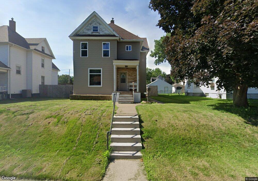
1335 W 17th St Davenport, IA 52804
Northwest Davenport NeighborhoodEstimated Value: $159,000 - $168,000
3
Beds
1
Bath
1,648
Sq Ft
$100/Sq Ft
Est. Value
About This Home
This home is located at 1335 W 17th St, Davenport, IA 52804 and is currently estimated at $164,245, approximately $99 per square foot. 1335 W 17th St is a home located in Scott County with nearby schools including Christian County Day Treatment Center Alt, Christian County Middle School, and Casey County Middle School.
Ownership History
Date
Name
Owned For
Owner Type
Purchase Details
Closed on
Jul 8, 2021
Sold by
Arnold Gary and Arnold Sharon Kay
Bought by
Moss Karie L
Current Estimated Value
Purchase Details
Closed on
Aug 11, 2005
Sold by
Deutsche Bank Trust Company Americas
Bought by
Arnold Gary and Arnold Sharon Kay
Home Financials for this Owner
Home Financials are based on the most recent Mortgage that was taken out on this home.
Original Mortgage
$50,000
Interest Rate
5.8%
Mortgage Type
Purchase Money Mortgage
Create a Home Valuation Report for This Property
The Home Valuation Report is an in-depth analysis detailing your home's value as well as a comparison with similar homes in the area
Home Values in the Area
Average Home Value in this Area
Purchase History
| Date | Buyer | Sale Price | Title Company |
|---|---|---|---|
| Moss Karie L | -- | None Available | |
| Arnold Gary | $42,000 | None Available |
Source: Public Records
Mortgage History
| Date | Status | Borrower | Loan Amount |
|---|---|---|---|
| Previous Owner | Arnold Gary | $50,000 |
Source: Public Records
Tax History Compared to Growth
Tax History
| Year | Tax Paid | Tax Assessment Tax Assessment Total Assessment is a certain percentage of the fair market value that is determined by local assessors to be the total taxable value of land and additions on the property. | Land | Improvement |
|---|---|---|---|---|
| 2025 | $2,712 | $163,490 | $16,250 | $147,240 |
| 2024 | $2,648 | $151,790 | $16,250 | $135,540 |
| 2023 | $2,322 | $151,790 | $16,250 | $135,540 |
| 2022 | $1,604 | $101,560 | $16,250 | $85,310 |
| 2021 | $1,604 | $74,740 | $16,250 | $58,490 |
| 2020 | $1,408 | $64,830 | $16,250 | $48,580 |
| 2019 | $1,495 | $59,870 | $16,250 | $43,620 |
| 2018 | $1,282 | $59,870 | $16,250 | $43,620 |
| 2017 | $1,463 | $58,390 | $16,250 | $42,140 |
| 2016 | $1,278 | $58,390 | $0 | $0 |
| 2015 | $1,278 | $63,000 | $0 | $0 |
| 2014 | $1,400 | $63,000 | $0 | $0 |
| 2013 | $1,376 | $0 | $0 | $0 |
| 2012 | -- | $62,640 | $11,600 | $51,040 |
Source: Public Records
Map
Nearby Homes
- 1514 N Marquette St
- 1203 W Locust St
- 1118 W 15th St
- 1921 Lillie Ave
- 2026 N Marquette St
- 1034 W 14th St
- 2015 Washington St
- 1335 W 13th St
- 1321 W 13th St
- 1505 W 14th St
- 930 W 14th St
- 1207 N Marquette St
- 2038 N Myrtle St
- 4735 W 12th St
- 1525 W High St
- 1925 Vine St
- 1517 W Lombard St
- 1637 W Pleasant St
- 822 W 14th St
- 1319 Warren St