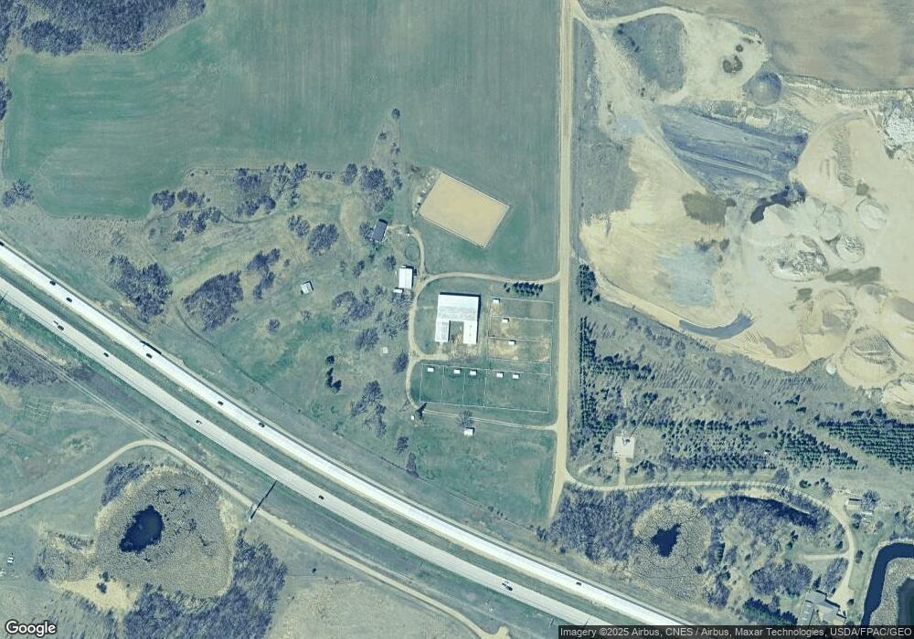
1336 Baker Rd SW Alexandria, MN 56308
Estimated Value: $409,000 - $476,000
--
Bed
--
Bath
1,120
Sq Ft
$404/Sq Ft
Est. Value
About This Home
This home is located at 1336 Baker Rd SW, Alexandria, MN 56308 and is currently estimated at $452,368, approximately $403 per square foot. 1336 Baker Rd SW is a home located in Douglas County with nearby schools including Lincoln Elementary School, Discovery Middle School, and Alexandria Area High School.
Ownership History
Date
Name
Owned For
Owner Type
Purchase Details
Closed on
Nov 27, 2018
Sold by
Wurm Charles A and Kopperud Cheryl K
Bought by
Mcnutt Brian R and Mcnutt David M
Current Estimated Value
Purchase Details
Closed on
May 11, 2017
Sold by
Free Spirit Ranch Llc
Bought by
Mcnutt Brian R and Mcnutt David M
Purchase Details
Closed on
Apr 4, 2012
Sold by
Judson Kenneth E and Judson Doris J
Bought by
Free Spririt Ranch Llc
Home Financials for this Owner
Home Financials are based on the most recent Mortgage that was taken out on this home.
Original Mortgage
$260,000
Interest Rate
3.9%
Mortgage Type
Purchase Money Mortgage
Create a Home Valuation Report for This Property
The Home Valuation Report is an in-depth analysis detailing your home's value as well as a comparison with similar homes in the area
Home Values in the Area
Average Home Value in this Area
Purchase History
| Date | Buyer | Sale Price | Title Company |
|---|---|---|---|
| Mcnutt Brian R | $2,087 | Alexandria Title Co | |
| Mcnutt Brian R | -- | None Available | |
| Free Spririt Ranch Llc | $360,000 | None Available |
Source: Public Records
Mortgage History
| Date | Status | Borrower | Loan Amount |
|---|---|---|---|
| Previous Owner | Free Spririt Ranch Llc | $260,000 |
Source: Public Records
Tax History Compared to Growth
Tax History
| Year | Tax Paid | Tax Assessment Tax Assessment Total Assessment is a certain percentage of the fair market value that is determined by local assessors to be the total taxable value of land and additions on the property. | Land | Improvement |
|---|---|---|---|---|
| 2025 | $1,732 | $443,200 | $247,300 | $195,900 |
| 2024 | $1,732 | $402,100 | $212,800 | $189,300 |
| 2023 | $1,558 | $354,900 | $185,300 | $169,600 |
| 2022 | $1,108 | $303,000 | $148,100 | $154,900 |
| 2021 | $1,068 | $266,200 | $142,500 | $123,700 |
| 2020 | $1,070 | $255,800 | $140,700 | $115,100 |
| 2019 | $1,024 | $247,700 | $134,700 | $113,000 |
| 2018 | $184 | $243,600 | $132,800 | $110,800 |
| 2017 | $1,220 | $147,500 | $129,400 | $18,100 |
| 2016 | $1,386 | $140,359 | $125,906 | $14,453 |
| 2015 | $1,750 | $0 | $0 | $0 |
| 2014 | -- | $176,800 | $133,400 | $43,400 |
Source: Public Records
Map
Nearby Homes
- 7060 10th Ave SW
- Lot 1 B2 Dixie Ln
- 7687 Lindgren Way SW
- 7890 Lawnys Cir SW
- Lot 5 B4 Brittney's Place
- 1346 Faith Hill Dr
- Lot 7 B4 Brittney's Place
- 550 Eldo Ln SW
- 5950 County Road 8 NW
- 4760 Country Shores SW
- 1380 90th St SW
- 8951 Twin Point Rd SW Unit 69
- 5023 W Lake Mary Dr SW
- 2402 Reeds Villa Rd SW
- 1702 Brophy Landing NW
- TBD NW Sundance Cir NW
- 213 Cowdry Heights NW
- Lot 9 Latoka Heights Ln SW
- Lot 7 Latoka Heights Ln SW
- Lot 8 Latoka Heights Ln SW
- 1575 Baker Rd SW
- 1860 Englund Rd SW
- 6020 10th Ave SW
- 6006 10th Ave SW
- 1600 Englund Rd SW
- 0000 0000 10th Ave SW
- 5980 5980 10th Ave W
- TBD 10th Ave SW
- XXXX 10th Ave SW
- 0 10th Ave SW
- 6540 10th Ave SW
- 7077 10th Ave SW
- 5980 10th Ave SW
- 5980 10th Ave SW
- 5900 10th Ave SW
- 5828 10th Ave SW
- 2298 Englund Rd SW
- 6259 10th Ave SW
- 2303 Englund Rd SW
- 6051 10th Ave SW
