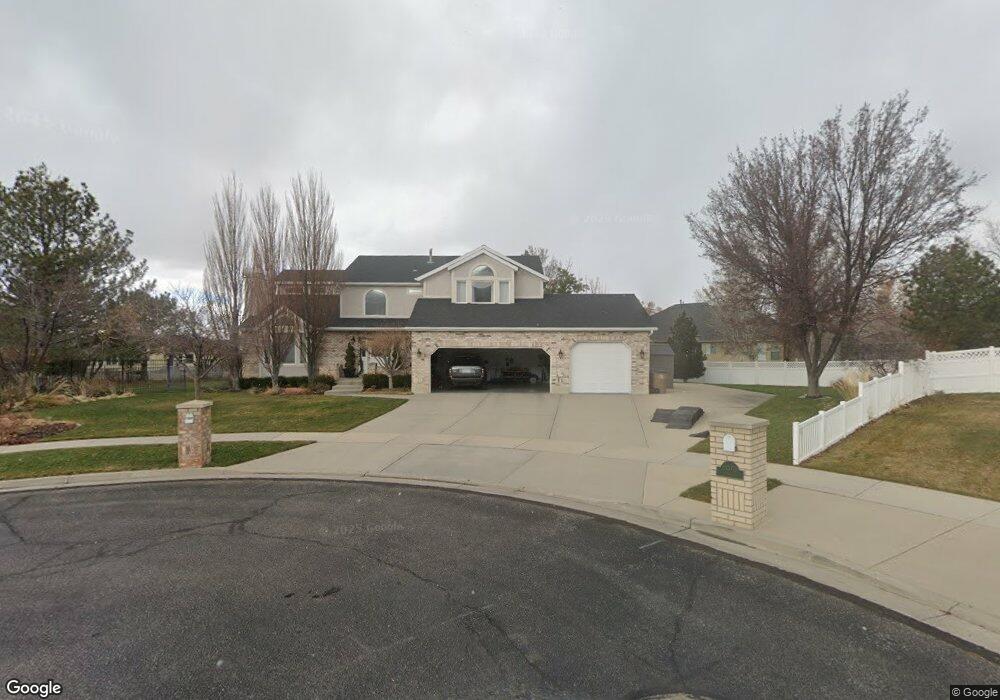
13364 Canyon Spring Cir Draper, UT 84020
Estimated Value: $1,076,000 - $1,225,000
4
Beds
3
Baths
2,602
Sq Ft
$447/Sq Ft
Est. Value
About This Home
This home is located at 13364 Canyon Spring Cir, Draper, UT 84020 and is currently estimated at $1,163,499, approximately $447 per square foot. 13364 Canyon Spring Cir is a home located in Salt Lake County with nearby schools including Draper Elementary School, Corner Canyon High School, and Draper Park Middle School.
Ownership History
Date
Name
Owned For
Owner Type
Purchase Details
Closed on
Nov 3, 2016
Sold by
Lowder Lowder H and Lowder Sharon L
Bought by
Wadsworth Kade and Wadsworth Brittany
Current Estimated Value
Home Financials for this Owner
Home Financials are based on the most recent Mortgage that was taken out on this home.
Original Mortgage
$474,000
Outstanding Balance
$381,258
Interest Rate
3.48%
Mortgage Type
New Conventional
Estimated Equity
$782,241
Purchase Details
Closed on
Mar 26, 2013
Sold by
Lowder Harold Dennis
Bought by
Lowder H Dennis and Lowder Sharon L
Purchase Details
Closed on
Nov 4, 1996
Sold by
Bonham S Craig
Bought by
Lowder H Dennis and Lowder Sharon L
Home Financials for this Owner
Home Financials are based on the most recent Mortgage that was taken out on this home.
Original Mortgage
$150,000
Interest Rate
8.14%
Create a Home Valuation Report for This Property
The Home Valuation Report is an in-depth analysis detailing your home's value as well as a comparison with similar homes in the area
Home Values in the Area
Average Home Value in this Area
Purchase History
| Date | Buyer | Sale Price | Title Company |
|---|---|---|---|
| Wadsworth Kade | -- | Eagle Point Title | |
| Lowder H Dennis | -- | Advanced Title Slc | |
| Lowder Harold Dennis | -- | Advantage Title Slc | |
| Lowder H Dennis | -- | -- |
Source: Public Records
Mortgage History
| Date | Status | Borrower | Loan Amount |
|---|---|---|---|
| Open | Wadsworth Kade | $474,000 | |
| Previous Owner | Lowder H Dennis | $150,000 |
Source: Public Records
Tax History Compared to Growth
Tax History
| Year | Tax Paid | Tax Assessment Tax Assessment Total Assessment is a certain percentage of the fair market value that is determined by local assessors to be the total taxable value of land and additions on the property. | Land | Improvement |
|---|---|---|---|---|
| 2025 | $4,788 | $964,700 | $443,300 | $521,400 |
| 2024 | $4,788 | $914,700 | $426,700 | $488,000 |
| 2023 | $4,372 | $829,000 | $410,300 | $418,700 |
| 2022 | $4,617 | $845,600 | $402,300 | $443,300 |
| 2021 | $4,580 | $716,600 | $296,400 | $420,200 |
| 2020 | $4,690 | $695,600 | $296,400 | $399,200 |
| 2019 | $4,702 | $681,400 | $296,400 | $385,000 |
| 2018 | $4,250 | $629,400 | $266,800 | $362,600 |
| 2017 | $4,064 | $576,700 | $218,600 | $358,100 |
| 2016 | $3,695 | $509,500 | $199,800 | $309,700 |
| 2015 | $3,228 | $412,200 | $217,800 | $194,400 |
| 2014 | $3,051 | $380,600 | $205,800 | $174,800 |
Source: Public Records
Map
Nearby Homes
- 1263 E 13400 S
- 13302 S Corner Wood Dr
- 963 Old English Rd
- 13294 Trail Rider Cir
- 848 E Rosefield Ln
- 13216 S Telemark Ln
- 919 E 13800 S
- 12959 S Fort St
- 1201 E 13200 S Unit 4
- 13448 Saddle Ridge Dr
- 587 Corner Canyon Dr
- 13181 S Woodridge Oak Dr
- 13460 S 1300 E
- 13307 S 1300 E
- 13050 S 1300 E
- 13080 S Crystal Spring Dr
- 847 E Willow Springs Ln
- 439 Midlake Dr
- 760 E Corner Ridge Dr
- 902 E 12650 S
- 13364 S Canyon Spring Cir
- 918 Crosswind Way
- 13386 Canyon Spring Cir
- 917 E 13400 S
- 13363 Canyon Springs Cir
- 13361 Fort St
- 934 Crosswind Way
- 906 E Crosswind Way
- 934 E Crosswind Way
- 906 Crosswind Way
- 13363 Canyon Spring Cir
- 13387 Canyon Spring Cir
- 13373 Fort St
- 13373 S Fort St Unit 2
- 13373 S Fort St
- 952 Crosswind Way
- 952 E Crosswind Way
- 963 E 13400 S
- 13407 Fort St
- 897 E 13400 S