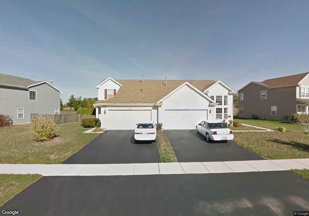
1337 Cape Cod Ln Pingree Grove, IL 60140
Estimated Value: $279,000 - $310,000
Studio
1
Bath
1,424
Sq Ft
$207/Sq Ft
Est. Value
About This Home
This home is located at 1337 Cape Cod Ln, Pingree Grove, IL 60140 and is currently estimated at $295,315, approximately $207 per square foot. 1337 Cape Cod Ln is a home located in Kane County with nearby schools including Hampshire Middle School, Hampshire High School, and Cambridge Lakes Charter School.
Ownership History
Date
Name
Owned For
Owner Type
Purchase Details
Closed on
Aug 29, 2011
Sold by
Lonis Paul C
Bought by
Federal Home Loan Mortgage Corp
Current Estimated Value
Purchase Details
Closed on
Dec 15, 2006
Sold by
Drh Cambridge Homes Inc
Bought by
Hashmi Mir Rashid A and Hashmi Thamina
Home Financials for this Owner
Home Financials are based on the most recent Mortgage that was taken out on this home.
Original Mortgage
$192,600
Interest Rate
6.27%
Mortgage Type
Purchase Money Mortgage
Create a Home Valuation Report for This Property
The Home Valuation Report is an in-depth analysis detailing your home's value as well as a comparison with similar homes in the area
Home Values in the Area
Average Home Value in this Area
Purchase History
| Date | Buyer | Sale Price | Title Company |
|---|---|---|---|
| Federal Home Loan Mortgage Corp | -- | None Available | |
| Hashmi Mir Rashid A | $203,000 | First American Title |
Source: Public Records
Mortgage History
| Date | Status | Borrower | Loan Amount |
|---|---|---|---|
| Previous Owner | Hashmi Mir Rashid A | $192,600 |
Source: Public Records
Tax History
| Year | Tax Paid | Tax Assessment Tax Assessment Total Assessment is a certain percentage of the fair market value that is determined by local assessors to be the total taxable value of land and additions on the property. | Land | Improvement |
|---|---|---|---|---|
| 2024 | $5,859 | $79,005 | $20,937 | $58,068 |
| 2023 | $5,691 | $71,446 | $18,934 | $52,512 |
| 2022 | $5,258 | $61,631 | $17,457 | $44,174 |
| 2021 | $5,116 | $57,967 | $16,419 | $41,548 |
| 2020 | $5,027 | $56,487 | $16,000 | $40,487 |
| 2019 | $4,921 | $54,216 | $15,357 | $38,859 |
| 2018 | $5,097 | $54,819 | $14,413 | $40,406 |
| 2017 | $4,983 | $52,203 | $13,725 | $38,478 |
| 2016 | $4,955 | $49,698 | $13,066 | $36,632 |
| 2015 | -- | $46,938 | $12,340 | $34,598 |
| 2014 | -- | $46,791 | $12,193 | $34,598 |
| 2013 | -- | $47,649 | $12,417 | $35,232 |
Source: Public Records
Map
Nearby Homes
- 2250 Aurora Dr Unit 24
- 1192 Alta Vista Dr
- 2307 Upland Rd
- 2544 Alison Ave
- 2368 Alison Ave
- 1385 Broadland Dr
- 43W428 U S 20
- 1286 Newport Cir
- 1433 Lighthouse Ln
- 1600 Bayberry Ln
- 1882 Southern Cir Unit 1882
- 1561 Sequoia Way
- 1838 Southern Cir Unit 1838
- 43w916 Us Highway 20
- 887 Emerald Dr Unit 2
- 1639 Rochester Rd
- 1533 Yosemite Way
- 1464 Sequoia Way
- 1093 Glendale Rd
- 1594 Hannah Ln Unit 1112
- 1333 Cape Cod Ln
- 1329 Cape Cod Ln
- 1345 Cape Cod Ln
- 1349 Cape Cod Ln
- 1325 Cape Cod Ln
- 1346 Promontory Dr
- 1336 Cape Cod Ln
- 1332 Cape Cod Ln
- 1321 Cape Cod Ln
- 1353 Cape Cod Ln
- 1340 Promontory Dr
- 1324 Cape Cod Ln
- 1334 Promontory Dr
- 1328 Cape Cod Ln
- 2019 Lookout Dr
- 1317 Cape Cod Ln
- 1323 Promontory Dr
- 2027 Lookout Dr
- 1907 Lake Bluff Ln
- 1913 Lake Bluff Ln
Your Personal Tour Guide
Ask me questions while you tour the home.