Estimated Value: $309,000 - $501,000
3
Beds
2
Baths
4,312
Sq Ft
$90/Sq Ft
Est. Value
About This Home
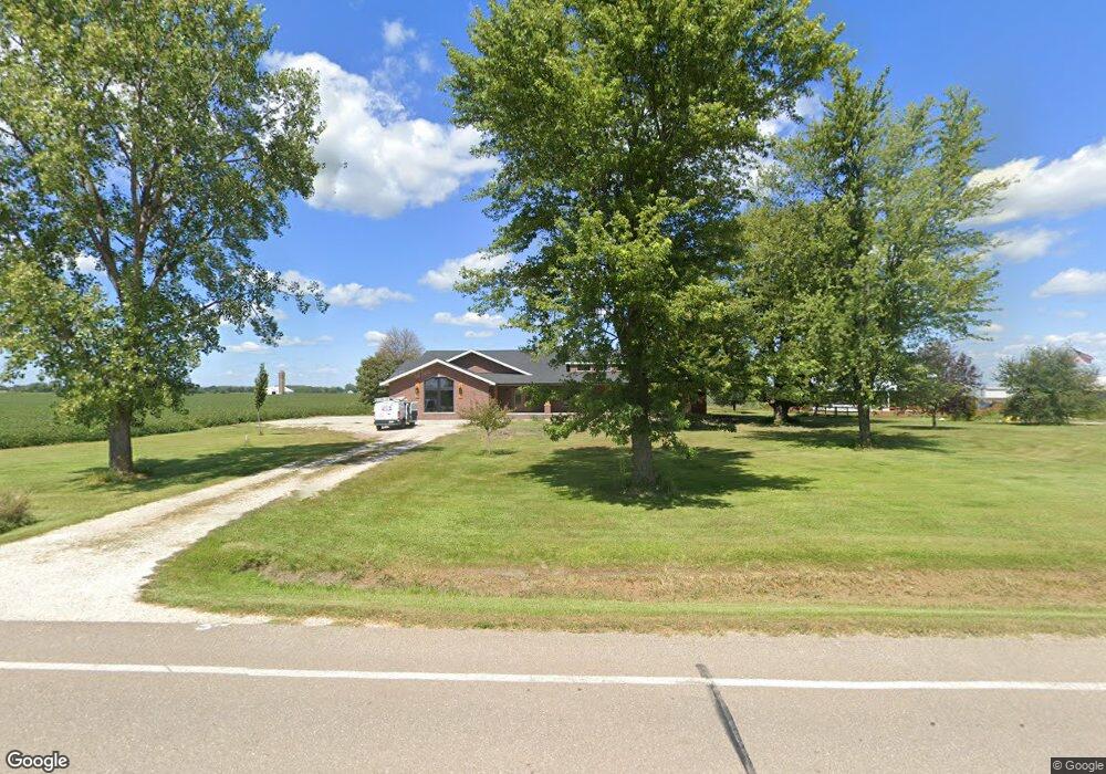
This home is located at 1337 Highway 16, Salem, IA 52649 and is currently estimated at $386,094, approximately $89 per square foot. 1337 Highway 16 is a home located in Lee County with nearby schools including Mount Pleasant High School.
Ownership History
Date
Name
Owned For
Owner Type
Purchase Details
Closed on
Jan 13, 2022
Sold by
Dyer Randall J and Dyer Susan L
Bought by
Cottonwood Ag Llc
Current Estimated Value
Purchase Details
Closed on
Nov 30, 2021
Sold by
Fred Dyer Farms Inc
Bought by
Fred Dyer Farms Llc
Purchase Details
Closed on
Oct 26, 2021
Sold by
Fred Dyer Farms Inc
Bought by
Dyer Randall J
Purchase Details
Closed on
Aug 8, 2017
Sold by
Dyer Randy J and Dyer Susan L
Bought by
Cottonwood Ag Llc
Purchase Details
Closed on
Mar 1, 2012
Sold by
Moeller Robert W and Moeller Kimberly
Bought by
Dyer Randall J and Dyer Susan L
Home Financials for this Owner
Home Financials are based on the most recent Mortgage that was taken out on this home.
Original Mortgage
$306,825
Interest Rate
4.01%
Mortgage Type
Credit Line Revolving
Create a Home Valuation Report for This Property
The Home Valuation Report is an in-depth analysis detailing your home's value as well as a comparison with similar homes in the area
Home Values in the Area
Average Home Value in this Area
Purchase History
| Date | Buyer | Sale Price | Title Company |
|---|---|---|---|
| Cottonwood Ag Llc | -- | None Listed On Document | |
| Fred Dyer Farms Llc | -- | None Listed On Document | |
| Dyer Randall J | $794,500 | None Listed On Document | |
| Cottonwood Ag Llc | -- | None Available | |
| Dyer Randall J | $307,000 | None Available |
Source: Public Records
Mortgage History
| Date | Status | Borrower | Loan Amount |
|---|---|---|---|
| Previous Owner | Dyer Randall J | $306,825 |
Source: Public Records
Tax History Compared to Growth
Tax History
| Year | Tax Paid | Tax Assessment Tax Assessment Total Assessment is a certain percentage of the fair market value that is determined by local assessors to be the total taxable value of land and additions on the property. | Land | Improvement |
|---|---|---|---|---|
| 2025 | $3,886 | $545,330 | $1,590 | $543,740 |
| 2024 | $3,886 | $326,710 | $1,280 | $325,430 |
| 2023 | $3,768 | $326,710 | $1,280 | $325,430 |
| 2022 | $3,398 | $243,330 | $960 | $242,370 |
| 2021 | $3,398 | $243,330 | $960 | $242,370 |
| 2020 | $3,146 | $221,360 | $920 | $220,440 |
| 2019 | $3,016 | $221,360 | $920 | $220,440 |
| 2018 | $2,976 | $210,480 | $0 | $0 |
| 2017 | $2,976 | $199,660 | $0 | $0 |
| 2016 | $2,768 | $193,340 | $0 | $0 |
| 2015 | $2,768 | $194,330 | $0 | $0 |
| 2014 | $2,826 | $215,360 | $0 | $0 |
Source: Public Records
Map
Nearby Homes
- 204 E Main St
- 307 E School St
- 1794 150th St
- 16040 Route W40
- 1847 Salem Rd
- 00 180th St
- 2928 Graham Ave
- 00 287th St
- 1405 Primrose Rd
- 0 145th St
- 0 Rte J40 Unit 24756371
- 0 Rte J40 Unit 24089401
- 504 Washington St
- 206 Texas St
- 303 Washington St
- 108 Washington St
- 2280 Windmill Way
- 808 Pershing St
- 720 Pershing St
- 0 Route J40 Unit NOC6329514