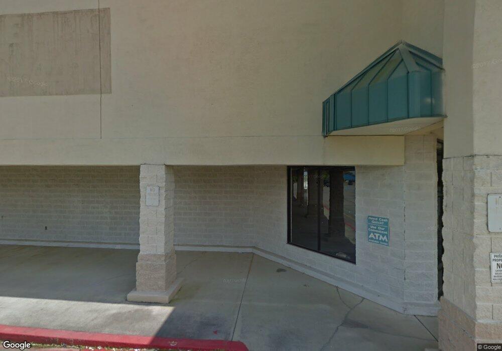
1338 Winchester Rd NE Huntsville, AL 35811
Ryland NeighborhoodEstimated Value: $2,543,826
--
Bed
1
Bath
83,353
Sq Ft
$31/Sq Ft
Est. Value
About This Home
This home is located at 1338 Winchester Rd NE, Huntsville, AL 35811 and is currently estimated at $2,543,826, approximately $30 per square foot. 1338 Winchester Rd NE is a home located in Madison County with nearby schools including Martin Luther King Jr. Elementary School, Chapman Middle School, and Lee High School.
Ownership History
Date
Name
Owned For
Owner Type
Purchase Details
Closed on
May 1, 2015
Sold by
Shields Improvements Llc
Bought by
Lumpkin Edwin B
Current Estimated Value
Purchase Details
Closed on
Dec 12, 2007
Sold by
E And A Southeast Lp
Bought by
Shields Improvements Llc
Home Financials for this Owner
Home Financials are based on the most recent Mortgage that was taken out on this home.
Original Mortgage
$20,000,000
Interest Rate
6.15%
Mortgage Type
Commercial
Create a Home Valuation Report for This Property
The Home Valuation Report is an in-depth analysis detailing your home's value as well as a comparison with similar homes in the area
Home Values in the Area
Average Home Value in this Area
Purchase History
| Date | Buyer | Sale Price | Title Company |
|---|---|---|---|
| Lumpkin Edwin B | $1,300,000 | None Available | |
| Shields Improvements Llc | -- | -- |
Source: Public Records
Mortgage History
| Date | Status | Borrower | Loan Amount |
|---|---|---|---|
| Previous Owner | Shields Improvements Llc | $20,000,000 |
Source: Public Records
Tax History Compared to Growth
Tax History
| Year | Tax Paid | Tax Assessment Tax Assessment Total Assessment is a certain percentage of the fair market value that is determined by local assessors to be the total taxable value of land and additions on the property. | Land | Improvement |
|---|---|---|---|---|
| 2024 | $24,345 | $251,740 | $84,000 | $167,740 |
| 2023 | $14,601 | $251,740 | $84,000 | $167,740 |
| 2022 | $14,136 | $243,720 | $84,000 | $159,720 |
| 2021 | $14,007 | $241,500 | $84,000 | $157,500 |
| 2020 | $13,925 | $240,080 | $84,000 | $156,080 |
| 2019 | $13,890 | $239,480 | $84,000 | $155,480 |
| 2018 | $13,541 | $233,460 | $0 | $0 |
| 2017 | $13,541 | $233,460 | $0 | $0 |
| 2016 | $11,484 | $198,000 | $0 | $0 |
| 2015 | $11,484 | $198,000 | $0 | $0 |
| 2014 | -- | $202,980 | $0 | $0 |
Source: Public Records
Map
Nearby Homes
- Halle II Plan at Southern Trail - Cottages
- Independence II Plan at Southern Trail - Ranchers
- Medallion Plan at Southern Trail - Ranchers
- at Southern Trail - Ranchers
- at Southern Trail - Ranchers
- Tivoli Plan at Southern Trail - Ranchers
- Brio II Plan at Southern Trail - Ranchers
- Princeton Plan at Southern Trail - Ranchers
- Trevi II Plan at Southern Trail - Cottages
- Brio II Plan at Southern Trail - Cottages
- Charle II Plan at Southern Trail - Cottages
- at Southern Trail - Ranchers
- at Southern Trail - Ranchers
- Barton Plan at Southern Trail - Ranchers
- at Southern Trail - Ranchers
- Tivoli II Plan at Southern Trail - Cottages
- Lot 1 Toby Dr
- 0 Winchester Rd NE
- 228 Pennington Ave
- 247 Pennington Ave
- 238 Pennington Ave
- 1291 Winchester Rd NE
- 1337 Winchester Rd NE
- 157 Toby Dr
- 156 Toby Dr
- 188 Toby Dr
- 204 Toby Dr
- 192 Toby Dr
- 144 Toby Dr
- 141 Toby Dr
- 138 Toby Dr
- 1385 Winchester Rd NE
- 148 Southern Trail
- 122 Southern Trail
- 147 Southern Trail
- 149 Southern Trail
- 143 Southern Trail
- 132 Southern Trail
- 144 Southern Trail
- 141 Southern Trail
