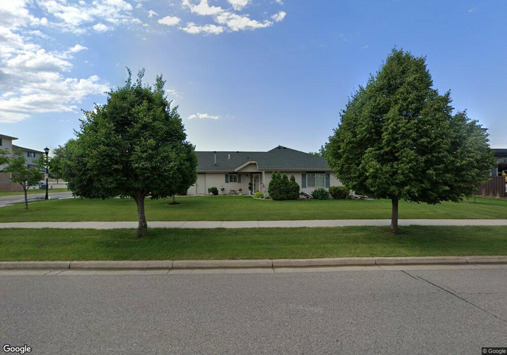
1339 10th Ave E Unit 6 West Fargo, ND 58078
Estimated Value: $222,000 - $344,000
2
Beds
2
Baths
1,383
Sq Ft
$211/Sq Ft
Est. Value
About This Home
This home is located at 1339 10th Ave E Unit 6, West Fargo, ND 58078 and is currently estimated at $291,957, approximately $211 per square foot. 1339 10th Ave E Unit 6 is a home located in Cass County with nearby schools including Eastwood Elementary School, Cheney Middle School, and West Fargo High School.
Ownership History
Date
Name
Owned For
Owner Type
Purchase Details
Closed on
Nov 30, 2021
Sold by
Bucy Michelle L and Schonert Sherri L
Bought by
Dahlstrom Sherry A and Dahlstrom Daniel L
Current Estimated Value
Home Financials for this Owner
Home Financials are based on the most recent Mortgage that was taken out on this home.
Original Mortgage
$95,000
Outstanding Balance
$74,314
Interest Rate
2.37%
Mortgage Type
New Conventional
Estimated Equity
$217,643
Purchase Details
Closed on
Mar 1, 2017
Sold by
Apple Properties Llc
Bought by
Lightstorm Properties Inc
Purchase Details
Closed on
Jul 15, 2013
Sold by
Munsch Kay L
Bought by
Duggan Carol A
Purchase Details
Closed on
Mar 9, 2011
Sold by
Western State Bank
Bought by
13Th Avenue Investments Llc
Create a Home Valuation Report for This Property
The Home Valuation Report is an in-depth analysis detailing your home's value as well as a comparison with similar homes in the area
Home Values in the Area
Average Home Value in this Area
Purchase History
| Date | Buyer | Sale Price | Title Company |
|---|---|---|---|
| Dahlstrom Sherry A | $275,000 | New Title Company Name | |
| Lightstorm Properties Inc | -- | None Available | |
| Duggan Carol A | $180,000 | Us Title & Closing Services | |
| 13Th Avenue Investments Llc | -- | -- |
Source: Public Records
Mortgage History
| Date | Status | Borrower | Loan Amount |
|---|---|---|---|
| Open | Dahlstrom Sherry A | $95,000 |
Source: Public Records
Tax History Compared to Growth
Tax History
| Year | Tax Paid | Tax Assessment Tax Assessment Total Assessment is a certain percentage of the fair market value that is determined by local assessors to be the total taxable value of land and additions on the property. | Land | Improvement |
|---|---|---|---|---|
| 2024 | $3,179 | $126,050 | $20,000 | $106,050 |
| 2023 | $3,642 | $124,000 | $20,000 | $104,000 |
| 2022 | $3,618 | $118,300 | $20,000 | $98,300 |
| 2021 | $3,357 | $103,950 | $12,500 | $91,450 |
| 2020 | $3,301 | $104,650 | $12,500 | $92,150 |
| 2019 | $3,088 | $101,300 | $12,500 | $88,800 |
| 2018 | $2,881 | $97,050 | $12,500 | $84,550 |
| 2017 | $2,856 | $97,050 | $12,500 | $84,550 |
| 2016 | $2,444 | $90,700 | $12,500 | $78,200 |
| 2015 | $2,810 | $88,600 | $9,750 | $78,850 |
| 2014 | $2,761 | $82,800 | $9,750 | $73,050 |
| 2013 | $2,769 | $83,500 | $10,450 | $73,050 |
Source: Public Records
Map
Nearby Homes
- 1511 11th Ave E
- 851 12th Ave E
- 1059 Sommerset Place
- 921 Homestead Ct
- 987 14th Ave E
- 670 13th Ave E
- 1221 Cedar Way
- 437 10th Ave E
- 1438 Suntree Dr
- 4836 9th Ave S
- 1332 Sandstone Dr
- 1726 2nd Ave E
- 631 15th Ave E
- 4704 8th Ave S
- 336 13th Ave E
- 245 12th Ave E
- 237 10th Ave E
- 2120 4th Ave E
- 426 3rd Ave E
- 1522 Baywood Dr
- 1339 10th Ave E Unit 5
- 1339 10th Ave E Unit 4
- 1339 10th Ave E Unit 3
- 1339 10th Ave E Unit 2
- 1339 10th Ave E Unit 1
- 1339 10th Ave E
- 1112 60th Ave W
- 1361 10th Ave E Unit 4
- 1361 10th Ave E Unit 3
- 1361 10th Ave E Unit 2
- 1361 10th Ave E Unit 1
- 1361 10th Ave E Unit D
- 1345 11th Ave E
- 1349 11th Ave E
- 1423 10th Ave E Unit 306
- 1423 10th Ave E Unit 305
- 1423 10th Ave E Unit 303
- 1423 10th Ave E Unit 302
- 1423 10th Ave E Unit 301
- 1423 10th Ave E Unit 206