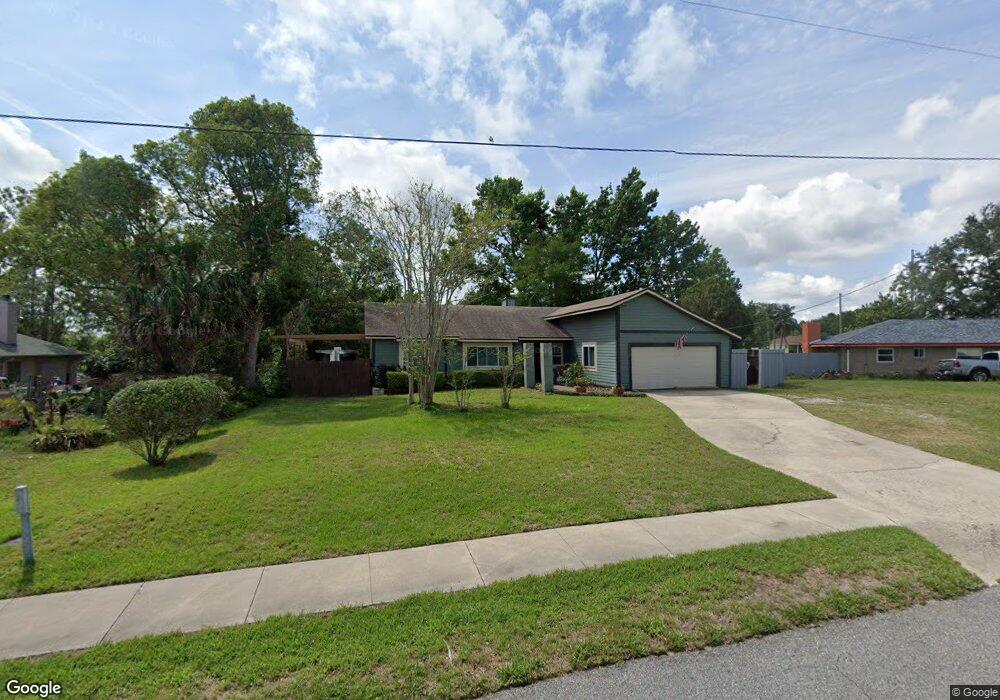
1339 Freeport Dr Unit 7 Deltona, FL 32725
Estimated Value: $281,000 - $327,000
3
Beds
2
Baths
2,890
Sq Ft
$104/Sq Ft
Est. Value
About This Home
This home is located at 1339 Freeport Dr Unit 7, Deltona, FL 32725 and is currently estimated at $301,007, approximately $104 per square foot. 1339 Freeport Dr Unit 7 is a home located in Volusia County with nearby schools including Spirit Elementary School, Deltona Middle School, and Deltona High School.
Ownership History
Date
Name
Owned For
Owner Type
Purchase Details
Closed on
May 16, 2014
Sold by
Perko Property Solutions Llc
Bought by
Mccaskill Scott D and Mccaskill Anita D
Current Estimated Value
Home Financials for this Owner
Home Financials are based on the most recent Mortgage that was taken out on this home.
Original Mortgage
$104,333
Outstanding Balance
$78,938
Interest Rate
4.37%
Mortgage Type
VA
Estimated Equity
$222,069
Purchase Details
Closed on
Mar 10, 2011
Sold by
Harkness Patricia and Harkness Edgar L
Bought by
Perko Property Solutions Llc
Purchase Details
Closed on
Oct 15, 2004
Sold by
Migatz Veronica E
Bought by
Harkness Edgar L and Harkness Patricia
Home Financials for this Owner
Home Financials are based on the most recent Mortgage that was taken out on this home.
Original Mortgage
$130,000
Interest Rate
7.12%
Mortgage Type
Purchase Money Mortgage
Purchase Details
Closed on
Oct 13, 2004
Sold by
Manfre Elizabeth and Maldrelli Elizabeth
Bought by
Harkness Edgar L and Harkness Patricia
Home Financials for this Owner
Home Financials are based on the most recent Mortgage that was taken out on this home.
Original Mortgage
$130,000
Interest Rate
7.12%
Mortgage Type
Purchase Money Mortgage
Purchase Details
Closed on
Oct 12, 2004
Sold by
Lapella Michael
Bought by
Harkness Edgar L and Harkness Patricia
Home Financials for this Owner
Home Financials are based on the most recent Mortgage that was taken out on this home.
Original Mortgage
$130,000
Interest Rate
7.12%
Mortgage Type
Purchase Money Mortgage
Purchase Details
Closed on
Sep 15, 1989
Bought by
Mccaskill Scott D and Mccaskill Anita D
Purchase Details
Closed on
Nov 15, 1982
Bought by
Mccaskill Scott D and Mccaskill Anita D
Purchase Details
Closed on
Jun 15, 1981
Bought by
Mccaskill Scott D and Mccaskill Anita D
Purchase Details
Closed on
Sep 15, 1978
Bought by
Mccaskill Scott D and Mccaskill Anita D
Purchase Details
Closed on
Dec 15, 1977
Bought by
Mccaskill Scott D and Mccaskill Anita D
Create a Home Valuation Report for This Property
The Home Valuation Report is an in-depth analysis detailing your home's value as well as a comparison with similar homes in the area
Home Values in the Area
Average Home Value in this Area
Purchase History
| Date | Buyer | Sale Price | Title Company |
|---|---|---|---|
| Mccaskill Scott D | $101,000 | Attorney | |
| Perko Property Solutions Llc | $49,900 | First Service Title Fl Llc | |
| Harkness Edgar L | $155,000 | B D R Title Corporation | |
| Harkness Edgar L | -- | B D R Title Corporation | |
| Harkness Edgar L | -- | B D R Title Corporation | |
| Harkness Edgar L | -- | B D R Title Corporation | |
| Harkness Edgar L | -- | B D R Title Corporation | |
| Harkness Edgar L | -- | B D R Title Corporation | |
| Mccaskill Scott D | $100 | -- | |
| Mccaskill Scott D | $100 | -- | |
| Mccaskill Scott D | $66,000 | -- | |
| Mccaskill Scott D | $47,000 | -- | |
| Mccaskill Scott D | $5,500 | -- |
Source: Public Records
Mortgage History
| Date | Status | Borrower | Loan Amount |
|---|---|---|---|
| Open | Mccaskill Scott D | $104,333 | |
| Previous Owner | Harkness Edgar L | $130,000 |
Source: Public Records
Tax History
| Year | Tax Paid | Tax Assessment Tax Assessment Total Assessment is a certain percentage of the fair market value that is determined by local assessors to be the total taxable value of land and additions on the property. | Land | Improvement |
|---|---|---|---|---|
| 2026 | $1,896 | $129,879 | -- | -- |
| 2025 | $1,896 | $120,627 | -- | -- |
| 2024 | $1,718 | $117,228 | -- | -- |
| 2023 | $1,718 | $113,814 | $0 | $0 |
| 2022 | $1,687 | $110,499 | $0 | $0 |
| 2021 | $1,714 | $107,281 | $0 | $0 |
| 2020 | $1,688 | $105,800 | $0 | $0 |
| 2019 | $1,693 | $103,421 | $0 | $0 |
| 2018 | $1,665 | $101,493 | $0 | $0 |
| 2017 | $1,635 | $99,405 | $0 | $0 |
| 2016 | $1,578 | $97,360 | $0 | $0 |
| 2015 | $1,604 | $96,683 | $0 | $0 |
| 2014 | $1,897 | $69,217 | $0 | $0 |
Source: Public Records
Map
Nearby Homes
- 1538 Agatha Dr
- 1296 Saxon Blvd
- 1297 Tivoli Dr
- 1227 Tivoli Dr
- 1216 Tivoli Dr
- 1566 Findlay St
- 1483 Meadowlark Dr
- 1541 N Page Dr
- 1490 April Ave
- 1166 Balfour Dr
- 1467 Renton St
- 1175 Bancroft St
- 1164 Madura Dr
- 1217 Bachmann Ave
- 1629 Lindsey Terrace
- 1596 N Page Dr
- 1576 Zinnia Dr
- 1509 Gold Terrace
- 1422 Sharon Rose Trace
- 1056 Wakefield Cir
- 1335 Freeport Dr
- 1387 Maywood Ave
- 1349 Freeport Dr
- 1346 Freeport Dr
- 1338 Freeport Dr
- 1353 Freeport Dr
- 1379 Maywood Ave
- 1350 Freeport Dr
- 1342 Freeport Dr
- 1334 Freeport Dr
- 1390 Maywood Ave
- 1354 Freeport Dr
- 1377 Freeport Dr
- 1386 Maywood Ave
- 1398 Maywood Ave
- 1371 Maywood Ave
- 1330 Freeport Dr
- 1351 Lydia Dr
- 1347 Lydia Dr
- 1380 Maywood Ave
Your Personal Tour Guide
Ask me questions while you tour the home.