
Estimated payment $1,671/month
Total Views
89
3
Beds
2
Baths
2,050
Sq Ft
$140
Price per Sq Ft
Highlights
- Traditional Architecture
- Eat-In Kitchen
- Tile Flooring
- Formal Dining Room
- Laundry Room
- 1-Story Property
About This Home
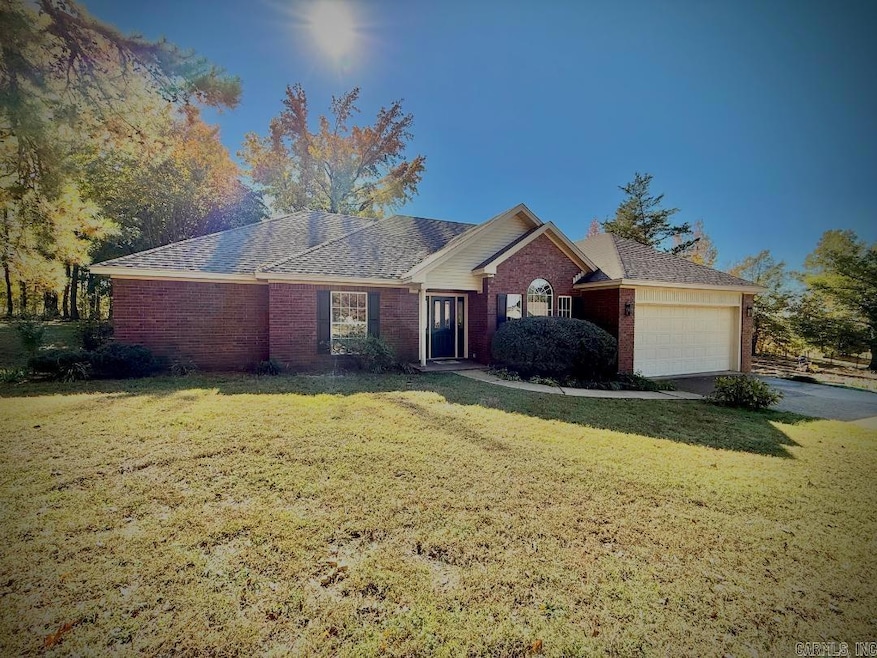
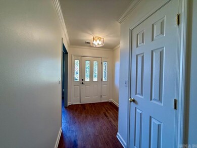
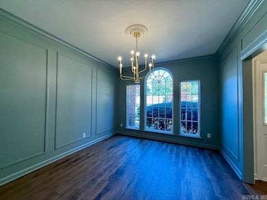
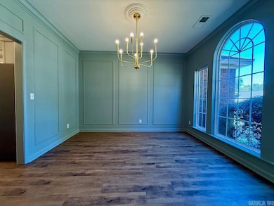
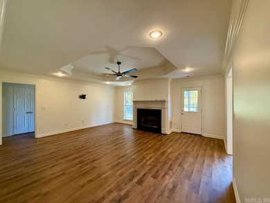
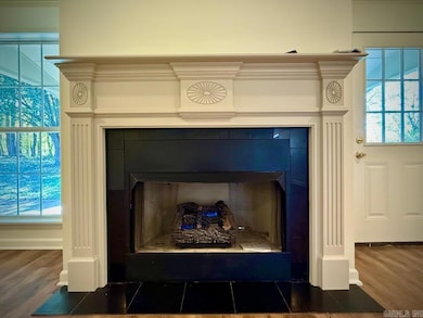
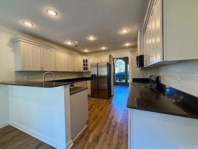
Discover this beautifully updated Wynne home for sale nestled on a quiet street along the edge of Crowley’s Ridge. This move-in ready, energy-efficient home features a spacious family room with a new gas log fireplace and a stunning renovated kitchen with quartz countertops, new stainless steel appliances, and elegant brass hardware. The split floor plan includes a large primary suite with a refreshed bathroom offering a separate tub, shower, and double vanity. Two guest bedrooms—each with walk-in closets—share an updated bath. Recent upgrades include a new roof, HVAC, flooring, fixtures, and fresh paint throughout. Relax or entertain on the large covered back porch overlooking the peaceful, nature-filled backyard. A working solar panel system provides exceptional energy savings. With modern updates, low utility costs, and a prime Crowley’s Ridge location, this move-in ready Wynne home is a must-see!
Home Details
Home Type
- Single Family
Est. Annual Taxes
- $1,870
Year Built
- Built in 2000
Lot Details
- 0.39 Acre Lot
- Cleared Lot
Parking
- 2 Car Garage
Home Design
- Traditional Architecture
- Slab Foundation
- Brick Frame
- Architectural Shingle Roof
Interior Spaces
- 2,050 Sq Ft Home
- 1-Story Property
- Gas Log Fireplace
- Formal Dining Room
- Laundry Room
Kitchen
- Eat-In Kitchen
- Electric Range
- Microwave
- Dishwasher
- Disposal
Flooring
- Carpet
- Tile
- Luxury Vinyl Tile
Bedrooms and Bathrooms
- 3 Bedrooms
- 2 Full Bathrooms
Utilities
- Central Heating and Cooling System
Map
Create a Home Valuation Report for This Property
The Home Valuation Report is an in-depth analysis detailing your home's value as well as a comparison with similar homes in the area
Home Values in the Area
Average Home Value in this Area
Tax History
| Year | Tax Paid | Tax Assessment Tax Assessment Total Assessment is a certain percentage of the fair market value that is determined by local assessors to be the total taxable value of land and additions on the property. | Land | Improvement |
|---|---|---|---|---|
| 2024 | $1,200 | $34,410 | $5,470 | $28,940 |
| 2023 | $1,278 | $34,410 | $5,470 | $28,940 |
| 2022 | $1,306 | $33,640 | $4,790 | $28,850 |
| 2021 | $1,232 | $33,640 | $4,790 | $28,850 |
| 2020 | $1,159 | $33,640 | $4,790 | $28,850 |
| 2019 | $1,086 | $29,520 | $4,000 | $25,520 |
| 2018 | $1,111 | $29,520 | $4,000 | $25,520 |
| 2017 | $1,111 | $29,520 | $4,000 | $25,520 |
| 2016 | $1,111 | $29,520 | $4,000 | $25,520 |
| 2015 | $1,111 | $29,520 | $4,000 | $25,520 |
| 2014 | $1,203 | $31,370 | $4,830 | $26,540 |
Source: Public Records
Property History
| Date | Event | Price | List to Sale | Price per Sq Ft |
|---|---|---|---|---|
| 11/01/2025 11/01/25 | Pending | -- | -- | -- |
| 11/01/2025 11/01/25 | For Sale | $287,000 | -- | $140 / Sq Ft |
Source: Cooperative Arkansas REALTORS® MLS
Purchase History
| Date | Type | Sale Price | Title Company |
|---|---|---|---|
| Warranty Deed | $20,000 | Cowling Title | |
| Warranty Deed | $215,000 | Cowling Title | |
| Warranty Deed | $164,000 | -- | |
| Warranty Deed | $146,000 | -- | |
| Warranty Deed | $20,000 | -- | |
| Quit Claim Deed | -- | -- |
Source: Public Records
About the Listing Agent
As a proud native of Cross County, Jason has always been a real estate enthusiast. Before acquiring his agents license, He worked as an appraiser, interior designer, and real estate investor for 20+ years. In addition to listing and selling real estate, Jason leads the worship team at his church and serves on the Wynne City Council.
Jason's Other Listings
Source: Cooperative Arkansas REALTORS® MLS
MLS Number: 25044831
APN: 900-01483-016
Disclaimer: Certain information contained herein is derived from information provided by parties other than Homes.com. All information provided is deemed reliable, but is not guaranteed to be accurate and should be independently verified.
![]() IDX information is provided exclusively for personal, non-commercial use, and may not be used for any purpose other than to identify prospective properties consumers may be interested in purchasing.
IDX information is provided exclusively for personal, non-commercial use, and may not be used for any purpose other than to identify prospective properties consumers may be interested in purchasing.
Nearby Homes
- 1321 Martin Dr E
- 105 Chickasaw
- 733 Martin Dr E
- 701 Wren St
- 129 Lombardy Ln
- 23 Southridge Cir
- 43 Southridge Cir
- 0 0 Unit 24023180
- 704 Mockingbird Ln
- 206 Maple Dr
- 712 Mockingbird Ln
- 903 Levesque Ave E
- 1484 Hamilton Ave E
- 2 Donegal Cir
- 6 A Londonderry Cir
- 919 Hamilton Ave E
- 568 Killough Rd N
- 320 Lawson Ave E
- CR 1005
- 249 Clifton Dr