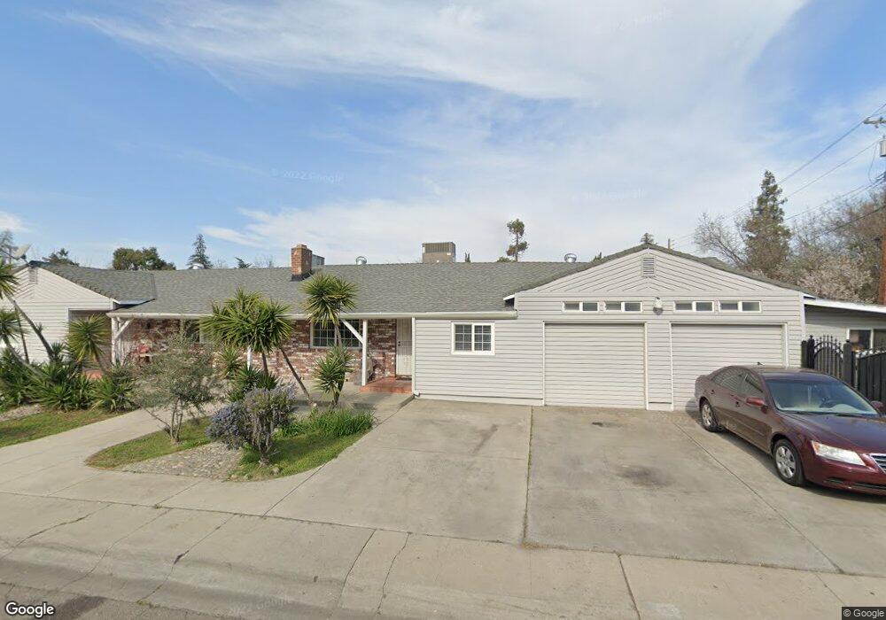
1339 W Longview Ave Unit 1 Stockton, CA 95207
Lincoln Village NeighborhoodEstimated Value: $319,000 - $441,000
3
Beds
2
Baths
1,589
Sq Ft
$242/Sq Ft
Est. Value
About This Home
This home is located at 1339 W Longview Ave Unit 1, Stockton, CA 95207 and is currently estimated at $383,793, approximately $241 per square foot. 1339 W Longview Ave Unit 1 is a home located in San Joaquin County with nearby schools including Lincoln Elementary School, Sierra Middle School, and Lincoln High School.
Ownership History
Date
Name
Owned For
Owner Type
Purchase Details
Closed on
Apr 11, 2003
Sold by
Saleh William D
Bought by
Saleh William D and Saleh Rima B
Current Estimated Value
Home Financials for this Owner
Home Financials are based on the most recent Mortgage that was taken out on this home.
Original Mortgage
$134,000
Interest Rate
5.54%
Purchase Details
Closed on
Nov 17, 1994
Sold by
Lang Lee B and Lang Jeraldene J
Bought by
Brais Joseph and Brais Ikhlas
Create a Home Valuation Report for This Property
The Home Valuation Report is an in-depth analysis detailing your home's value as well as a comparison with similar homes in the area
Home Values in the Area
Average Home Value in this Area
Purchase History
| Date | Buyer | Sale Price | Title Company |
|---|---|---|---|
| Saleh William D | -- | Old Republic Title Co | |
| Brais Joseph | -- | Central Valley Title Company |
Source: Public Records
Mortgage History
| Date | Status | Borrower | Loan Amount |
|---|---|---|---|
| Closed | Saleh William D | $134,000 |
Source: Public Records
Tax History Compared to Growth
Tax History
| Year | Tax Paid | Tax Assessment Tax Assessment Total Assessment is a certain percentage of the fair market value that is determined by local assessors to be the total taxable value of land and additions on the property. | Land | Improvement |
|---|---|---|---|---|
| 2025 | $1,974 | $150,068 | $75,034 | $75,034 |
| 2024 | $1,936 | $147,126 | $73,563 | $73,563 |
| 2023 | $1,922 | $144,242 | $72,121 | $72,121 |
| 2022 | $1,832 | $141,414 | $70,707 | $70,707 |
| 2021 | $1,809 | $138,642 | $69,321 | $69,321 |
| 2020 | $1,808 | $137,222 | $68,611 | $68,611 |
| 2019 | $1,783 | $134,532 | $67,266 | $67,266 |
| 2018 | $1,749 | $131,896 | $65,948 | $65,948 |
| 2017 | $1,716 | $129,310 | $64,655 | $64,655 |
| 2016 | $1,700 | $126,776 | $63,388 | $63,388 |
| 2014 | $1,664 | $122,426 | $61,213 | $61,213 |
Source: Public Records
Map
Nearby Homes
- 1417 W Swain Rd
- 1581 W Swain Rd
- 1583 W Swain Rd
- 1489 W Swain Rd
- 5618 Cascade Ct
- 1629 Porter Way
- 1633 Porter Way
- 1140 Douglas Rd Unit 3
- 1443 San Rocco Cir
- 1707 W Swain Rd Unit 5
- 1545 Douglas Rd
- 1703 Polk Way
- 1929 W Swain Rd
- 1864 Polk Way
- 1947 Rosecrans Way
- 2014 Douglas Rd
- 2005 Cedar Ridge Dr
- 2009 Cedar Ridge Dr
- 6571 Harrisburg Place
- 1834 Venetian Dr
- 1321 W Longview Ave
- 5928 N Pershing Ave
- 5915 Mitchler Ave
- 1334 W Longview Ave
- 5816 N Pershing Ave
- 1307 W Longview Ave
- 1403 W Longview Ave
- 1322 W Longview Ave
- 5927 Mitchler Ave
- 5940 N Pershing Ave
- 1310 W Longview Ave
- 5939 Mitchler Ave
- 5817 N Pershing Ave
- 1415 W Longview Ave
- 5931 N Pershing Ave
- 5950 N Pershing Ave
- 1302 W Longview Ave
- 0 N Pershing Ave
- 5949 Mitchler Ave
- 1420 W Longview Ave