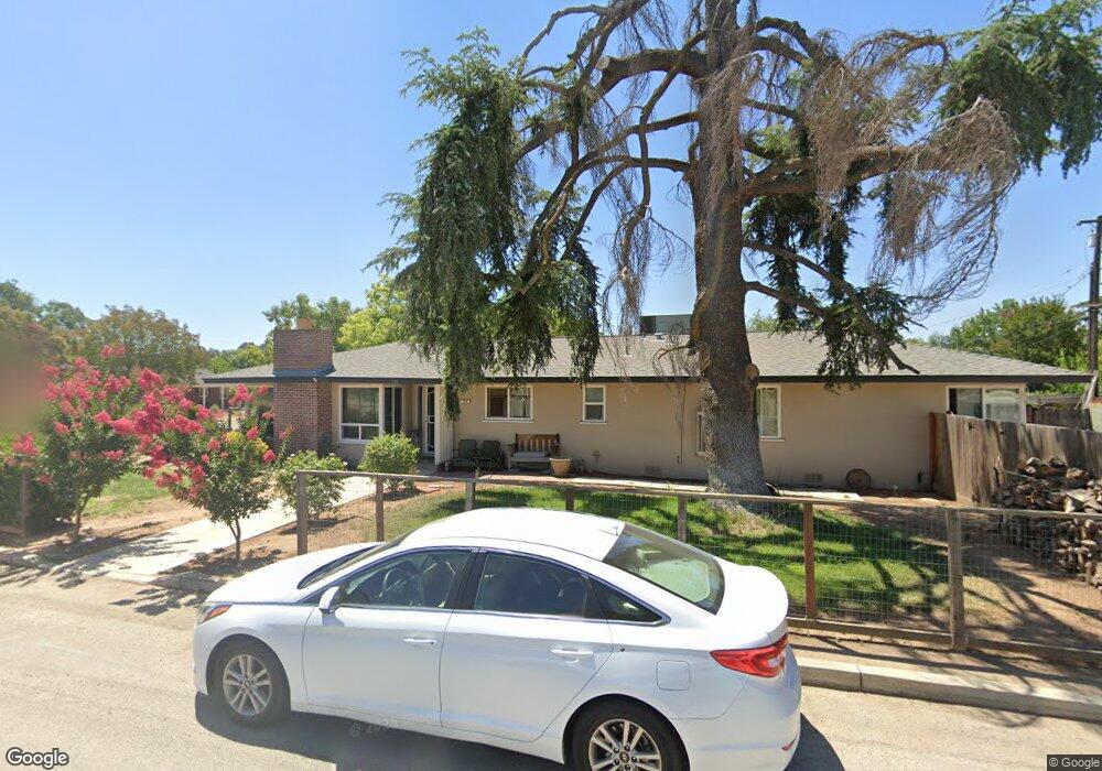
134 E Alamos Ave Fresno, CA 93704
Fig Garden NeighborhoodEstimated Value: $385,000 - $516,000
3
Beds
2
Baths
1,650
Sq Ft
$280/Sq Ft
Est. Value
About This Home
This home is located at 134 E Alamos Ave, Fresno, CA 93704 and is currently estimated at $461,798, approximately $279 per square foot. 134 E Alamos Ave is a home located in Fresno County with nearby schools including Powers-Ginsburg Elementary, Bullard High School, and Endeavor Charter.
Ownership History
Date
Name
Owned For
Owner Type
Purchase Details
Closed on
Oct 3, 2011
Sold by
Hansen Herbert C and Hansen Lois J
Bought by
Atlante Edge Llc
Current Estimated Value
Home Financials for this Owner
Home Financials are based on the most recent Mortgage that was taken out on this home.
Original Mortgage
$166,500
Outstanding Balance
$113,417
Interest Rate
4.15%
Mortgage Type
New Conventional
Estimated Equity
$348,381
Purchase Details
Closed on
Sep 22, 2011
Sold by
The Atlante Edge Llc
Bought by
Bopp Ralph Henry and Bopp Rhonda Beth
Home Financials for this Owner
Home Financials are based on the most recent Mortgage that was taken out on this home.
Original Mortgage
$166,500
Outstanding Balance
$113,417
Interest Rate
4.15%
Mortgage Type
New Conventional
Estimated Equity
$348,381
Purchase Details
Closed on
Aug 18, 2011
Sold by
Brothers Hansen
Bought by
The Atlante Edge Llc
Home Financials for this Owner
Home Financials are based on the most recent Mortgage that was taken out on this home.
Original Mortgage
$166,500
Outstanding Balance
$113,417
Interest Rate
4.15%
Mortgage Type
New Conventional
Estimated Equity
$348,381
Purchase Details
Closed on
Aug 5, 2011
Sold by
Govea America
Bought by
Hansen Bros
Home Financials for this Owner
Home Financials are based on the most recent Mortgage that was taken out on this home.
Original Mortgage
$166,500
Outstanding Balance
$113,417
Interest Rate
4.15%
Mortgage Type
New Conventional
Estimated Equity
$348,381
Purchase Details
Closed on
Oct 30, 2006
Sold by
Mollison Craig Anthony and Kazanjian Kimberley A
Bought by
Govea America
Home Financials for this Owner
Home Financials are based on the most recent Mortgage that was taken out on this home.
Original Mortgage
$298,400
Interest Rate
6.3%
Mortgage Type
Stand Alone First
Purchase Details
Closed on
Jan 10, 2006
Sold by
Riley Ruth L
Bought by
Mollison Craig Anthony and Kazanjian Kimberley A
Home Financials for this Owner
Home Financials are based on the most recent Mortgage that was taken out on this home.
Original Mortgage
$25,950
Interest Rate
6.21%
Mortgage Type
Credit Line Revolving
Create a Home Valuation Report for This Property
The Home Valuation Report is an in-depth analysis detailing your home's value as well as a comparison with similar homes in the area
Home Values in the Area
Average Home Value in this Area
Purchase History
| Date | Buyer | Sale Price | Title Company |
|---|---|---|---|
| Atlante Edge Llc | -- | North American Title Company | |
| Bopp Ralph Henry | $185,000 | North American Title Co Inc | |
| The Atlante Edge Llc | -- | None Available | |
| Hansen Bros | $139,100 | None Available | |
| Govea America | $373,000 | Financial Title Company | |
| Mollison Craig Anthony | $260,000 | Financial Title Company |
Source: Public Records
Mortgage History
| Date | Status | Borrower | Loan Amount |
|---|---|---|---|
| Open | Bopp Ralph Henry | $166,500 | |
| Previous Owner | Govea America | $298,400 | |
| Previous Owner | Mollison Craig Anthony | $25,950 | |
| Previous Owner | Mollison Craig Anthony | $208,000 |
Source: Public Records
Tax History Compared to Growth
Tax History
| Year | Tax Paid | Tax Assessment Tax Assessment Total Assessment is a certain percentage of the fair market value that is determined by local assessors to be the total taxable value of land and additions on the property. | Land | Improvement |
|---|---|---|---|---|
| 2025 | $2,752 | $232,358 | $69,704 | $162,654 |
| 2023 | $2,697 | $223,338 | $66,999 | $156,339 |
| 2022 | $2,659 | $218,960 | $65,686 | $153,274 |
| 2021 | $2,584 | $214,668 | $64,399 | $150,269 |
| 2020 | $2,573 | $212,468 | $63,739 | $148,729 |
| 2019 | $2,471 | $208,303 | $62,490 | $145,813 |
| 2018 | $2,433 | $204,219 | $61,265 | $142,954 |
| 2017 | $2,458 | $200,215 | $60,064 | $140,151 |
| 2016 | $2,376 | $196,290 | $58,887 | $137,403 |
| 2015 | $2,340 | $193,343 | $58,003 | $135,340 |
| 2014 | $2,294 | $189,556 | $56,867 | $132,689 |
Source: Public Records
Map
Nearby Homes
- 116 E Alamos Ave
- 4822 N Safford Ave
- 4843 N Palm Ave
- 4734 N Harrison Ave
- 4895 N Thorne Ave
- 4666 N Harrison Ave
- 4915 N Wishon Ct
- 336 E Gettysburg Ave
- 4689 N Van Ness Blvd
- 705 E Alamos Ave
- 4834 N Wishon Ave
- 4702 N Fruit Ave
- 4939 N Fruit Ave
- 4481 N Palm Ave
- 5090 N Roosevelt Ave Unit 11
- 5048 N Wishon Ave Unit E
- 5180 N Wishon Ave Unit 201
- 5180 N Wishon Ave Unit 103
- 4480 N Palm Ave
- 5076 N Wishon Ave Unit A
- 4833 N Safford Ave
- 4844 N Harrison Ave
- 4834 N Harrison Ave
- 4821 N Safford Ave
- 4844 N Safford Ave
- 4822 N Harrison Ave
- 4834 N Safford Ave
- 4811 N Safford Ave
- 4810 N Harrison Ave
- 205 E Santa Ana Ave
- 4833 N Palm Ave
- 4851 N Harrison Ave
- 4821 N Palm Ave
- 4789 N Safford Ave
- 4790 N Harrison Ave
- 4811 N Palm Ave
- 4788 N Safford Ave
- 4817 N Harrison Ave
- 4833 N Harrison Ave
- 4885 N Harrison Ave