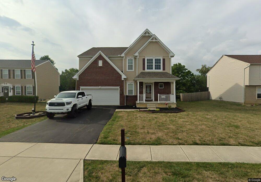
134 Edmonds Dr Commercial Point, OH 43116
Estimated Value: $379,000 - $456,000
4
Beds
3
Baths
3,215
Sq Ft
$134/Sq Ft
Est. Value
About This Home
This home is located at 134 Edmonds Dr, Commercial Point, OH 43116 and is currently estimated at $430,983, approximately $134 per square foot. 134 Edmonds Dr is a home.
Ownership History
Date
Name
Owned For
Owner Type
Purchase Details
Closed on
Apr 17, 2018
Sold by
Sparks Beluham M and Sparks Herbert L
Bought by
Summers Walter E and Summers Angela R
Current Estimated Value
Home Financials for this Owner
Home Financials are based on the most recent Mortgage that was taken out on this home.
Original Mortgage
$208,000
Interest Rate
4.5%
Mortgage Type
Future Advance Clause Open End Mortgage
Purchase Details
Closed on
Oct 3, 2014
Sold by
Maronda Homes Inc
Bought by
Sparks Beulah M and Sparks Herbert L
Home Financials for this Owner
Home Financials are based on the most recent Mortgage that was taken out on this home.
Original Mortgage
$182,745
Interest Rate
4.08%
Mortgage Type
New Conventional
Create a Home Valuation Report for This Property
The Home Valuation Report is an in-depth analysis detailing your home's value as well as a comparison with similar homes in the area
Home Values in the Area
Average Home Value in this Area
Purchase History
| Date | Buyer | Sale Price | Title Company |
|---|---|---|---|
| Summers Walter E | -- | None Available | |
| Sparks Beulah M | $232,800 | None Available |
Source: Public Records
Mortgage History
| Date | Status | Borrower | Loan Amount |
|---|---|---|---|
| Previous Owner | Summers Walter E | $208,000 | |
| Previous Owner | Sparks Beulah M | $182,745 |
Source: Public Records
Tax History Compared to Growth
Tax History
| Year | Tax Paid | Tax Assessment Tax Assessment Total Assessment is a certain percentage of the fair market value that is determined by local assessors to be the total taxable value of land and additions on the property. | Land | Improvement |
|---|---|---|---|---|
| 2024 | -- | $127,960 | $15,360 | $112,600 |
| 2023 | $4,814 | $127,960 | $15,360 | $112,600 |
| 2022 | $4,118 | $100,550 | $12,800 | $87,750 |
| 2021 | $4,130 | $100,550 | $12,800 | $87,750 |
| 2020 | $4,131 | $100,550 | $12,800 | $87,750 |
| 2019 | $3,546 | $83,840 | $12,800 | $71,040 |
| 2018 | $3,268 | $83,840 | $12,800 | $71,040 |
| 2017 | $4,381 | $83,360 | $12,800 | $70,560 |
| 2016 | $2,911 | $72,630 | $9,780 | $62,850 |
| 2015 | $2,913 | $72,630 | $9,780 | $62,850 |
| 2014 | $323 | $7,830 | $7,830 | $0 |
| 2013 | $336 | $7,830 | $7,830 | $0 |
Source: Public Records
Map
Nearby Homes
- 229 Victorian Dr
- 201 Victorian Dr
- 317 Adrien Ct
- 403 Alberta Dr
- 502 Conley Dr
- 513 Heidish Dr
- 500 Walker Pointe Dr
- 211 Cavanaugh Dr
- 49 Front St
- 486 Creekside Dr
- 56 Chambers Bay Rd
- 294 Shady Hollow Dr
- 47 Front St
- 55 Genoa Cir
- 45 Genoa Cir
- 62 Genoa Cir
- 66 Genoa Cir
- 310 Genoa Rd
- 10901 Borror Rd Unit 19
- The Siebert Plan at Genoa Crossing
- 132 Edmonds Dr
- 136 Edmonds Dr
- 130 Edmonds Dr
- 138 Edmonds Dr Unit 71
- 128 Edmonds Dr
- 6 First St
- 25 Harsh Alley
- 131 Brittney Rd
- 243 Victorian Dr
- 244 Victorian Dr
- 126 Edmonds Dr
- 129 Brittney Rd
- 3 Beckman Ln
- 242 Victorian Dr
- 239 Victorian Dr
- 141 Edmonds Dr
- 130 Brittney Rd
- 124 Edmonds Dr
- 127 Brittney Rd
- 27 W Scioto St