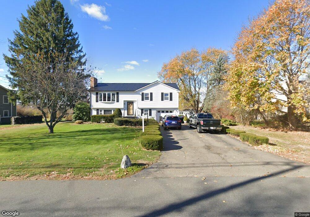
134 Ferry Rd Salisbury, MA 01952
Estimated Value: $657,000 - $775,000
3
Beds
2
Baths
2,015
Sq Ft
$348/Sq Ft
Est. Value
About This Home
This home is located at 134 Ferry Rd, Salisbury, MA 01952 and is currently estimated at $701,401, approximately $348 per square foot. 134 Ferry Rd is a home located in Essex County with nearby schools including Triton Regional High School, River Valley Charter School, and Immaculate Conception School.
Ownership History
Date
Name
Owned For
Owner Type
Purchase Details
Closed on
Jan 23, 2020
Sold by
Willett Cathy B and Willett Robert F
Bought by
Willett Cathy B and Willett Robert F
Current Estimated Value
Purchase Details
Closed on
Oct 30, 1998
Sold by
Kelleher Frances I
Bought by
Willett Robert and Willett Cathy
Create a Home Valuation Report for This Property
The Home Valuation Report is an in-depth analysis detailing your home's value as well as a comparison with similar homes in the area
Home Values in the Area
Average Home Value in this Area
Purchase History
| Date | Buyer | Sale Price | Title Company |
|---|---|---|---|
| Willett Cathy B | -- | None Available | |
| Willett Robert | $1,500 | -- |
Source: Public Records
Mortgage History
| Date | Status | Borrower | Loan Amount |
|---|---|---|---|
| Previous Owner | Willett Robert | $270,000 | |
| Previous Owner | Willett Robert | $60,000 | |
| Previous Owner | Willett Robert | $184,000 |
Source: Public Records
Tax History
| Year | Tax Paid | Tax Assessment Tax Assessment Total Assessment is a certain percentage of the fair market value that is determined by local assessors to be the total taxable value of land and additions on the property. | Land | Improvement |
|---|---|---|---|---|
| 2025 | $5,261 | $521,900 | $205,200 | $316,700 |
| 2024 | $4,960 | $474,600 | $194,400 | $280,200 |
| 2023 | $4,781 | $442,700 | $194,400 | $248,300 |
| 2022 | $4,515 | $405,300 | $172,800 | $232,500 |
| 2021 | $4,220 | $374,800 | $172,800 | $202,000 |
| 2020 | $4,071 | $355,200 | $181,500 | $173,700 |
| 2019 | $3,961 | $334,000 | $172,800 | $161,200 |
| 2018 | $3,728 | $316,500 | $162,000 | $154,500 |
| 2017 | $3,543 | $297,200 | $143,000 | $154,200 |
| 2016 | $3,314 | $284,000 | $133,900 | $150,100 |
| 2015 | $3,263 | $277,700 | $130,100 | $147,600 |
Source: Public Records
Map
Nearby Homes
- 14 Partridge Ln Unit C
- 157 Bridge Rd
- 175 Bridge Rd
- 86 Ferry Rd
- 2 Elbow Ln Unit A
- 10 10th St
- 182 Merrimac St Unit 1
- 158 Merrimac St Unit 3
- 102 Pleasant St Unit 102
- 7 Summer St Unit 7
- 14-18 Market St
- 11 Charter St
- 1 Salem St Unit 2
- 129 Merrimac St Unit 9
- 52 Fair St Unit 2D
- 215 Merrimac St Unit 2
- 58 Lime St Unit 5
- 1 Oakland St Unit 2
- 45 Boardman St Unit 1
- 105 State St Unit 101
- 136 Ferry Rd
- 132 Ferry Rd
- 131 Ferry Rd
- 138 Ferry Rd
- 130 Ferry Rd
- 128 Ferry Rd
- 128 Ferry Rd Unit 1&2
- 128 Ferry Rd Unit B
- 126 Ferry Rd
- 2 Island Way
- 16 Partridge Ln Unit D
- 16 Partridge Ln Unit C
- 16 Partridge Ln Unit B
- 16 Partridge Ln Unit A
- 124 Ferry Rd
- 10 Partidge Ln Unit 10
- 3 Sandpiper Way Unit 16
- 14 Partridge Ln Unit B
- 14 Partridge Ln Unit A
- 2 Sandpiper Way Unit C
Your Personal Tour Guide
Ask me questions while you tour the home.