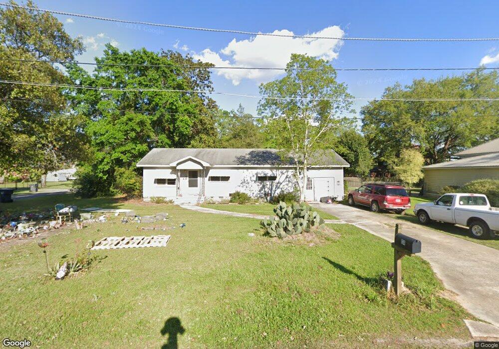
134 Forrester St SW Pelham, GA 31779
Estimated Value: $66,000 - $92,000
2
Beds
1
Bath
1,050
Sq Ft
$75/Sq Ft
Est. Value
About This Home
This home is located at 134 Forrester St SW, Pelham, GA 31779 and is currently estimated at $78,930, approximately $75 per square foot. 134 Forrester St SW is a home located in Mitchell County with nearby schools including Pelham Elementary School, Pelham City Middle School, and Pelham High School.
Ownership History
Date
Name
Owned For
Owner Type
Purchase Details
Closed on
Oct 17, 2018
Sold by
Lds Animal Lovers Inc
Bought by
Godwin Linda Diane
Current Estimated Value
Purchase Details
Closed on
Oct 30, 2007
Sold by
Carlson William Kirk
Bought by
Godwin Linda Diane
Home Financials for this Owner
Home Financials are based on the most recent Mortgage that was taken out on this home.
Original Mortgage
$37,793
Interest Rate
6.26%
Mortgage Type
New Conventional
Purchase Details
Closed on
Aug 18, 1995
Sold by
Haire Lois H
Bought by
Carlson William Kirk
Create a Home Valuation Report for This Property
The Home Valuation Report is an in-depth analysis detailing your home's value as well as a comparison with similar homes in the area
Home Values in the Area
Average Home Value in this Area
Purchase History
| Date | Buyer | Sale Price | Title Company |
|---|---|---|---|
| Godwin Linda Diane | -- | -- | |
| Godwin Linda Diane | $37,000 | -- | |
| Carlson William Kirk | -- | -- |
Source: Public Records
Mortgage History
| Date | Status | Borrower | Loan Amount |
|---|---|---|---|
| Previous Owner | Godwin Linda Diane | $37,793 |
Source: Public Records
Tax History Compared to Growth
Tax History
| Year | Tax Paid | Tax Assessment Tax Assessment Total Assessment is a certain percentage of the fair market value that is determined by local assessors to be the total taxable value of land and additions on the property. | Land | Improvement |
|---|---|---|---|---|
| 2024 | $1,107 | $25,360 | $1,200 | $24,160 |
| 2023 | $1,125 | $25,360 | $1,200 | $24,160 |
| 2022 | $862 | $19,440 | $1,200 | $18,240 |
| 2021 | $784 | $17,680 | $1,200 | $16,480 |
| 2020 | $753 | $17,680 | $1,200 | $16,480 |
| 2019 | $593 | $13,640 | $1,200 | $12,440 |
| 2018 | $617 | $13,640 | $1,200 | $12,440 |
| 2017 | $261 | $13,262 | $1,200 | $12,062 |
| 2016 | $271 | $13,262 | $1,200 | $12,062 |
| 2015 | $271 | $13,262 | $1,200 | $12,062 |
| 2014 | $271 | $13,262 | $1,200 | $12,062 |
| 2013 | $271 | $13,261 | $1,200 | $12,061 |
Source: Public Records
Map
Nearby Homes
- 354 Bennett St NW
- 209 McDonald St SW
- 212 Hand Ave W
- 210 Castleberry St NW
- 233 Cannon St NW
- 254 Sapp Ave SW
- 277 Saunders St SW
- 135 Baggs Ave SE
- 389 Stewart St SW
- 410 Hollis St SW
- 199 Carroll St NE
- 425 Hollis St SW
- 443 Stewart St SW
- 3** Youngs Mill Rd
- 323 Curry St NE
- 335 Curry St NE
- 589 Liberia St NW
- 5854 Mount Olive Rd
- 375 Baggs Ave SE
- 0 Old Ga Highway 3
- 264 Primitive Ave SW
- 250 Primitive Ave SW
- 121 Forrester St SW
- 265 Hand Ave W
- 240 Primitive Ave SW
- 257 Hand Ave W
- 240 Primitive Ave SW
- 281 Hand Ave W
- 245 Hand Ave W
- 261 Primitive Ave SW
- 269 Primitive Ave SW
- 291 Hand Ave W
- 134 Jones St SW
- 279 Primitive Ave SW
- 241 Primitive Ave SW
- 220 Primitive Ave SW
- 251 Primitive Ave SW
- 287 Primitive Ave SW
- 229 Hand Ave W
- 303 Hand Ave W