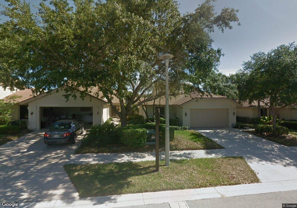
134 Harbourside Cir Jupiter, FL 33477
The Bluffs NeighborhoodEstimated Value: $965,000 - $1,105,000
3
Beds
2
Baths
1,889
Sq Ft
$537/Sq Ft
Est. Value
About This Home
This home is located at 134 Harbourside Cir, Jupiter, FL 33477 and is currently estimated at $1,013,453, approximately $536 per square foot. 134 Harbourside Cir is a home located in Palm Beach County with nearby schools including William T. Dwyer High School, Lighthouse Elementary School, and Beacon Cove Intermediate School.
Ownership History
Date
Name
Owned For
Owner Type
Purchase Details
Closed on
Jun 27, 2025
Sold by
Sampson Robert J
Bought by
Sampco Investments Llc
Current Estimated Value
Purchase Details
Closed on
Nov 1, 2000
Sold by
Berman Ronald
Bought by
Sampson Robert J
Home Financials for this Owner
Home Financials are based on the most recent Mortgage that was taken out on this home.
Original Mortgage
$172,800
Interest Rate
7.94%
Mortgage Type
New Conventional
Purchase Details
Closed on
Nov 17, 1997
Sold by
Rabiner Philip and Rabiner Helen
Bought by
Berman Ronald and Berman Donna
Home Financials for this Owner
Home Financials are based on the most recent Mortgage that was taken out on this home.
Original Mortgage
$119,000
Interest Rate
7.31%
Mortgage Type
Balloon
Create a Home Valuation Report for This Property
The Home Valuation Report is an in-depth analysis detailing your home's value as well as a comparison with similar homes in the area
Home Values in the Area
Average Home Value in this Area
Purchase History
| Date | Buyer | Sale Price | Title Company |
|---|---|---|---|
| Sampco Investments Llc | -- | None Listed On Document | |
| Sampco Investments Llc | -- | None Listed On Document | |
| Sampson Robert J | $192,000 | -- | |
| Berman Ronald | $170,000 | -- |
Source: Public Records
Mortgage History
| Date | Status | Borrower | Loan Amount |
|---|---|---|---|
| Previous Owner | Berman Ronald | $172,800 | |
| Previous Owner | Berman Ronald | $119,000 |
Source: Public Records
Tax History
| Year | Tax Paid | Tax Assessment Tax Assessment Total Assessment is a certain percentage of the fair market value that is determined by local assessors to be the total taxable value of land and additions on the property. | Land | Improvement |
|---|---|---|---|---|
| 2025 | $11,982 | $686,827 | -- | -- |
| 2024 | $11,982 | $624,388 | -- | -- |
| 2023 | $11,417 | $567,625 | $0 | $0 |
| 2022 | $10,075 | $516,023 | $0 | $0 |
| 2021 | $8,821 | $469,112 | $262,500 | $206,612 |
| 2020 | $8,430 | $441,076 | $154,500 | $286,576 |
| 2019 | $7,959 | $410,407 | $0 | $410,407 |
| 2018 | $7,369 | $390,334 | $0 | $390,334 |
| 2017 | $7,336 | $380,334 | $0 | $0 |
| 2016 | $7,138 | $360,334 | $0 | $0 |
| 2015 | $7,090 | $341,624 | $0 | $0 |
| 2014 | $6,627 | $310,567 | $0 | $0 |
Source: Public Records
Map
Nearby Homes
- 125 Harbourside Cir
- 1601 Marina Isle Way Unit 1010
- 1601 Marina Isle Way Unit 4020
- 1601 Marina Isle Way Unit 1060
- 1601 Marina Isle Way Unit 5050
- 1701 Marina Isle Way Unit 2020
- 1401 Tidal Pointe Blvd Unit 1020
- 2601 Marina Isle Way Unit 2020
- 1801 Marina Isle Way Unit 5020
- 501 Seafarer Cir Unit 2040
- 1901 Marina Isle Way Unit 3050
- 1901 Marina Isle Way Unit 3040
- 1320 Tidal Pointe Blvd Unit A1
- 1320 Tidal Pointe Blvd Unit A2
- 105 Ocean Pines Terrace
- 601 Seafarer Cir Unit 5040
- 601 Seafarer Cir Unit 1010
- 601 Seafarer Cir Unit 1040
- 601 Seafarer Cir Unit 2010
- 150 Beach Summit Ct
- 132 Sandbar Dr
- 136 Harbourside Cir
- 134 Sandbar Dr
- 138 Harbourside Cir
- 136 Sandbar Dr
- 140 Harbourside Cir
- 135 Harbourside Cir
- 137 Harbourside Cir
- 139 Harbourside Cir
- 138 Sandbar Dr
- 131 Harbourside Cir
- 141 Harbourside Cir
- 142 Harbourside Cir
- 129 Harbourside Cir
- 140 Sandbar Dr
- 2594 Marcinski Rd
- 2618 Marcinski Rd
- 143 Harbourside Cir
- 2581 Marcinski Rd
- 144 Harbourside Cir
Your Personal Tour Guide
Ask me questions while you tour the home.