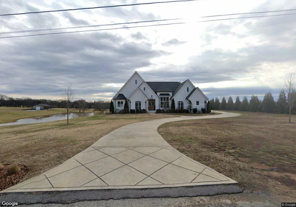
134 Lawrencetown Rd Gallatin, TN 37066
Estimated Value: $621,000 - $1,205,445
4
Beds
4
Baths
3,884
Sq Ft
$235/Sq Ft
Est. Value
About This Home
This home is located at 134 Lawrencetown Rd, Gallatin, TN 37066 and is currently estimated at $913,223, approximately $235 per square foot. 134 Lawrencetown Rd is a home with nearby schools including Howard Elementary School, Rucker Stewart Middle School, and Station Camp High School.
Ownership History
Date
Name
Owned For
Owner Type
Purchase Details
Closed on
Feb 1, 2019
Sold by
Bennett James and Bennett Sandra
Bought by
Mckinzie Stephen T and Mckinzie Amy E
Current Estimated Value
Home Financials for this Owner
Home Financials are based on the most recent Mortgage that was taken out on this home.
Original Mortgage
$134,800
Interest Rate
4.5%
Mortgage Type
Construction
Purchase Details
Closed on
Feb 9, 2018
Sold by
Bone Charles W
Bought by
Bennett James and Bennett Sandra
Home Financials for this Owner
Home Financials are based on the most recent Mortgage that was taken out on this home.
Original Mortgage
$52,094
Interest Rate
3.95%
Mortgage Type
Commercial
Create a Home Valuation Report for This Property
The Home Valuation Report is an in-depth analysis detailing your home's value as well as a comparison with similar homes in the area
Home Values in the Area
Average Home Value in this Area
Purchase History
| Date | Buyer | Sale Price | Title Company |
|---|---|---|---|
| Mckinzie Stephen T | $168,500 | Highland Title Llc | |
| Bennett James | $150,000 | None Available |
Source: Public Records
Mortgage History
| Date | Status | Borrower | Loan Amount |
|---|---|---|---|
| Closed | Mckinzie Stephen T | $134,800 | |
| Previous Owner | Bennett James | $52,094 |
Source: Public Records
Tax History Compared to Growth
Tax History
| Year | Tax Paid | Tax Assessment Tax Assessment Total Assessment is a certain percentage of the fair market value that is determined by local assessors to be the total taxable value of land and additions on the property. | Land | Improvement |
|---|---|---|---|---|
| 2024 | $4,011 | $282,300 | $57,450 | $224,850 |
| 2023 | $4,139 | $183,775 | $35,250 | $148,525 |
| 2022 | $4,157 | $183,775 | $35,250 | $148,525 |
| 2021 | $4,157 | $183,775 | $35,250 | $148,525 |
| 2020 | $4,157 | $183,775 | $35,250 | $148,525 |
| 2019 | $797 | $0 | $0 | $0 |
| 2018 | $419 | $0 | $0 | $0 |
Source: Public Records
Map
Nearby Homes
- 1036 Middleton Ln
- 608 Bradford Dr
- 1017 Wickshire Dr
- 540 Bradford Dr
- 688 Douglas Ln
- 415 Buckingham Blvd
- 420 Dorchester Place
- 1328 Wentworth Dr
- 1273 Wentworth Dr
- 1176 Liberty Ln
- 376 Huntington Dr
- 1239 Wentworth Dr
- 516 Dottie Dr
- 548 Dottie Dr
- 300 Remington Ave
- 204 Sparrow Ln
- 3023 Duvall Dr
- 559 Becks Place
- 305 Remington Ave
- 428 Mya Marie Dr
- 120 Lawrencetown Rd
- 121 Lawrencetown Rd
- 162 Lawrencetown Rd
- 1332 25w Hwy
- 25W Highway Hwy
- 163 Lawrencetown Rd
- 25W Highway
- 1384 Highway 25
- 198 Lawrencetown Rd
- 1388 Highway 25
- 195 Lawrencetown Rd
- 197 Lawrencetown Rd
- 1392 Highway 25
- 1392 Highway 25
- 1332 Highway 25
- 1332 25w Hwy
- 0 25w Hwy Unit 1888470
- 0 25w Hwy Unit 1888467
- 0 25w Hwy Unit 1888466
- 0 25w Hwy Unit 1888462