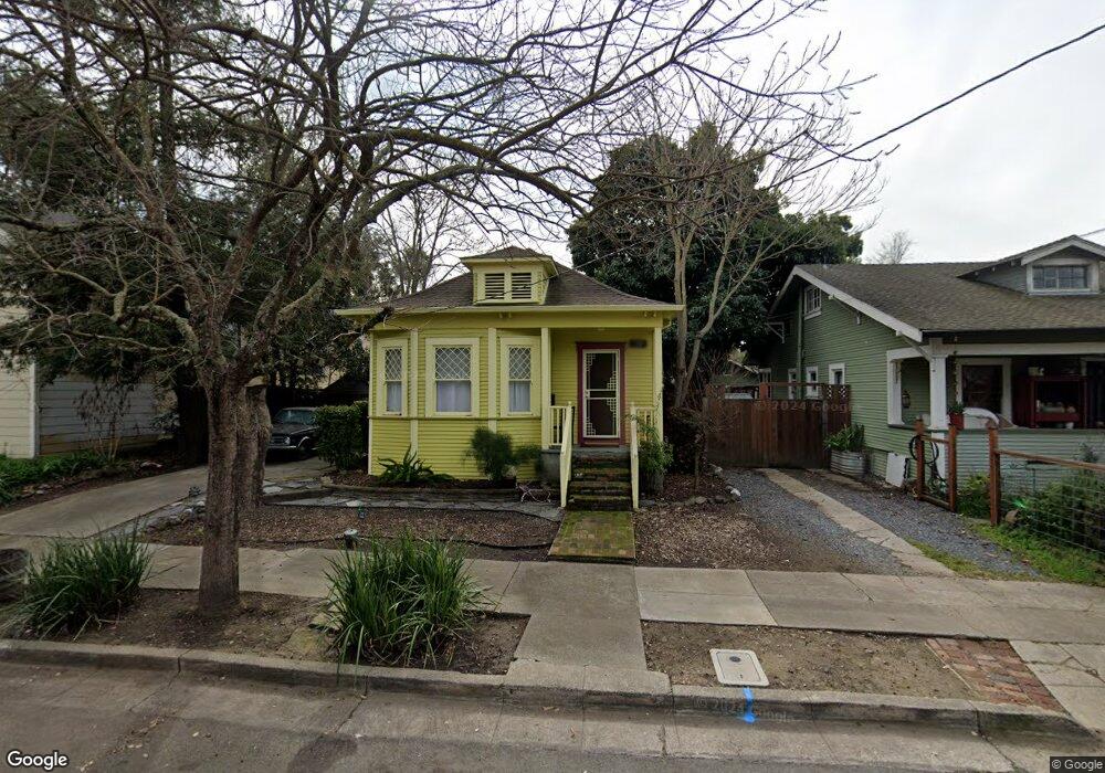
134 Lincoln St Santa Rosa, CA 95401
Historic Railroad Square NeighborhoodEstimated Value: $475,712 - $612,000
2
Beds
1
Bath
1,367
Sq Ft
$394/Sq Ft
Est. Value
About This Home
This home is located at 134 Lincoln St, Santa Rosa, CA 95401 and is currently estimated at $538,428, approximately $393 per square foot. 134 Lincoln St is a home located in Sonoma County with nearby schools including Steele Lane Elementary School, Santa Rosa Middle School, and Santa Rosa High School.
Ownership History
Date
Name
Owned For
Owner Type
Purchase Details
Closed on
Aug 28, 1998
Sold by
Starbuck Stockton George Harbin and Starbuck Susan
Bought by
Shepard Margaret and Shepard Kirsten P
Current Estimated Value
Home Financials for this Owner
Home Financials are based on the most recent Mortgage that was taken out on this home.
Original Mortgage
$75,000
Interest Rate
6.93%
Create a Home Valuation Report for This Property
The Home Valuation Report is an in-depth analysis detailing your home's value as well as a comparison with similar homes in the area
Home Values in the Area
Average Home Value in this Area
Purchase History
| Date | Buyer | Sale Price | Title Company |
|---|---|---|---|
| Shepard Margaret | $136,500 | North American Title Co |
Source: Public Records
Mortgage History
| Date | Status | Borrower | Loan Amount |
|---|---|---|---|
| Previous Owner | Shepard Margaret | $75,000 |
Source: Public Records
Tax History Compared to Growth
Tax History
| Year | Tax Paid | Tax Assessment Tax Assessment Total Assessment is a certain percentage of the fair market value that is determined by local assessors to be the total taxable value of land and additions on the property. | Land | Improvement |
|---|---|---|---|---|
| 2025 | $2,438 | $213,969 | $86,210 | $127,759 |
| 2024 | $2,438 | $209,774 | $84,520 | $125,254 |
| 2023 | $2,438 | $205,662 | $82,863 | $122,799 |
| 2022 | $2,252 | $201,631 | $81,239 | $120,392 |
| 2021 | $2,225 | $197,679 | $79,647 | $118,032 |
| 2020 | $2,220 | $195,653 | $78,831 | $116,822 |
| 2019 | $2,209 | $191,818 | $77,286 | $114,532 |
| 2018 | $2,197 | $188,058 | $75,771 | $112,287 |
| 2017 | $2,158 | $184,372 | $74,286 | $110,086 |
| 2016 | $2,135 | $180,758 | $72,830 | $107,928 |
| 2015 | $2,072 | $178,044 | $71,737 | $106,307 |
| 2014 | $1,946 | $174,557 | $70,332 | $104,225 |
Source: Public Records
Map
Nearby Homes
- 595 N Dutton Ave
- 223 Decker St
- 743 Davis St
- 919 Kingwood St
- 100 W 8th St
- 303 Hewett St
- 432 8th St
- 709 W 8th St
- 714 Mendocino Ave
- 740 Mendocino Ave
- 1239 Eardley Ave
- 415 Duncan St
- 788 Simpson Place
- 706 Simpson Place
- 164 N Dutton Ave Unit 7
- 705 College Ave
- 730 Hewett St
- 493 Umland Dr
- 1580 Herbert St
- 1080 Tijuana Ct