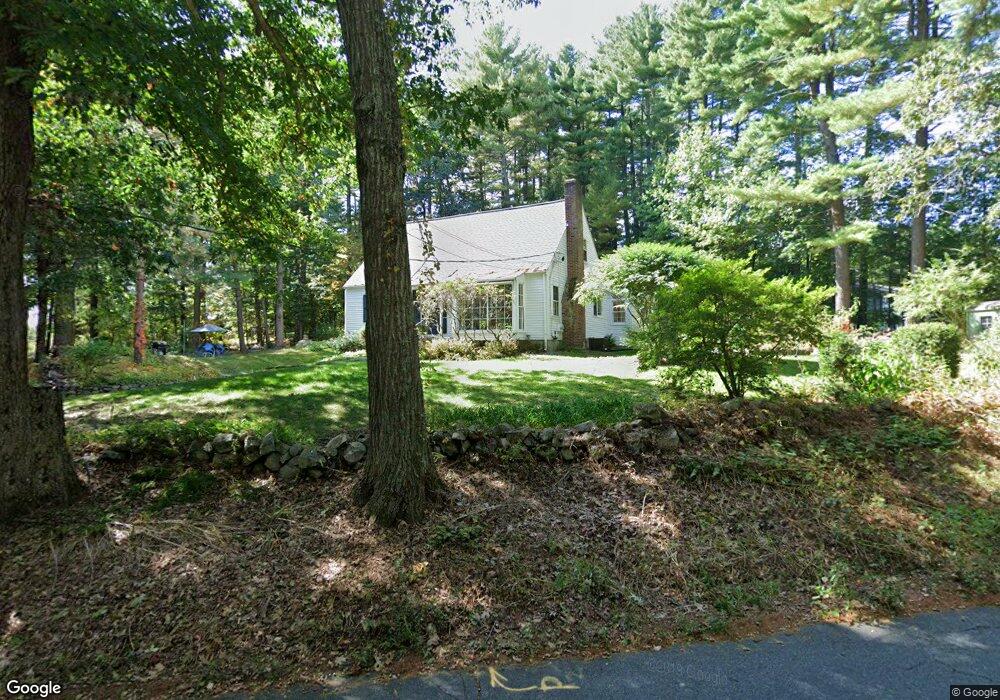
134 Littlefield Rd Boxboro, MA 01719
Estimated Value: $779,771 - $887,000
2
Beds
2
Baths
2,185
Sq Ft
$385/Sq Ft
Est. Value
About This Home
This home is located at 134 Littlefield Rd, Boxboro, MA 01719 and is currently estimated at $841,193, approximately $384 per square foot. 134 Littlefield Rd is a home located in Middlesex County with nearby schools including Acton-Boxborough Regional High School.
Ownership History
Date
Name
Owned For
Owner Type
Purchase Details
Closed on
Feb 14, 2008
Sold by
Ericson Paul G
Bought by
Noonan Nancy M
Current Estimated Value
Purchase Details
Closed on
Jan 20, 1988
Sold by
Goggins Karen E
Bought by
Ericson Paul G
Home Financials for this Owner
Home Financials are based on the most recent Mortgage that was taken out on this home.
Original Mortgage
$131,500
Interest Rate
10.64%
Mortgage Type
Purchase Money Mortgage
Create a Home Valuation Report for This Property
The Home Valuation Report is an in-depth analysis detailing your home's value as well as a comparison with similar homes in the area
Home Values in the Area
Average Home Value in this Area
Purchase History
| Date | Buyer | Sale Price | Title Company |
|---|---|---|---|
| Noonan Nancy M | -- | -- | |
| Noonan Nancy M | -- | -- | |
| Ericson Paul G | $191,500 | -- |
Source: Public Records
Mortgage History
| Date | Status | Borrower | Loan Amount |
|---|---|---|---|
| Previous Owner | Ericson Paul G | $117,150 | |
| Previous Owner | Ericson Paul G | $131,500 |
Source: Public Records
Tax History Compared to Growth
Tax History
| Year | Tax Paid | Tax Assessment Tax Assessment Total Assessment is a certain percentage of the fair market value that is determined by local assessors to be the total taxable value of land and additions on the property. | Land | Improvement |
|---|---|---|---|---|
| 2025 | $10,254 | $677,300 | $283,500 | $393,800 |
| 2024 | $9,773 | $652,000 | $272,000 | $380,000 |
| 2023 | $9,040 | $582,500 | $233,700 | $348,800 |
| 2022 | $8,882 | $509,900 | $233,700 | $276,200 |
| 2020 | $7,716 | $461,500 | $233,700 | $227,800 |
| 2019 | $7,578 | $461,500 | $233,700 | $227,800 |
| 2018 | $91 | $430,900 | $222,800 | $208,100 |
| 2017 | $7,346 | $437,000 | $222,800 | $214,200 |
| 2016 | $6,906 | $422,100 | $222,800 | $199,300 |
| 2015 | $6,762 | $406,100 | $200,600 | $205,500 |
| 2014 | $6,715 | $379,600 | $194,700 | $184,900 |
Source: Public Records
Map
Nearby Homes
- 417 Central St
- 4 Huron Rd
- 31 Mohawk Dr
- 5 Elm St Unit 1
- 200 Newtown Rd
- 134 Russet Ln
- 68 Macintosh Ln
- 777 Depot Rd
- 4 Omega Way
- 62 Waite Rd
- 3 West Rd
- 19 Lincoln Dr
- 27 Lincoln Dr
- 17 Cherry Ridge Rd
- 542 Massachusetts Ave
- 349 Arlington St
- Lot 2 Strawberry Farm
- 31 Springfield Dr
- 70 Loring Ave
- 404 Arlington St
- 152 Littlefield Rd
- 35 Sargent Rd
- 170 Littlefield Rd
- 36 Sargent Rd
- 55 Sargent Rd
- 184 Littlefield Rd
- 80 Littlefield Rd
- 214 Littlefield Rd
- 265 Littlefield Rd
- 232 Littlefield Rd
- 239 Littlefield Rd
- 22 Littlefield Rd
- 252 Littlefield Rd
- 148 Sargent Rd
- 270 Littlefield Rd
- 440 Central St
- 436 Central St
- 455 Central St
- 3 Littlefield Rd
- 5 Littlefield Rd