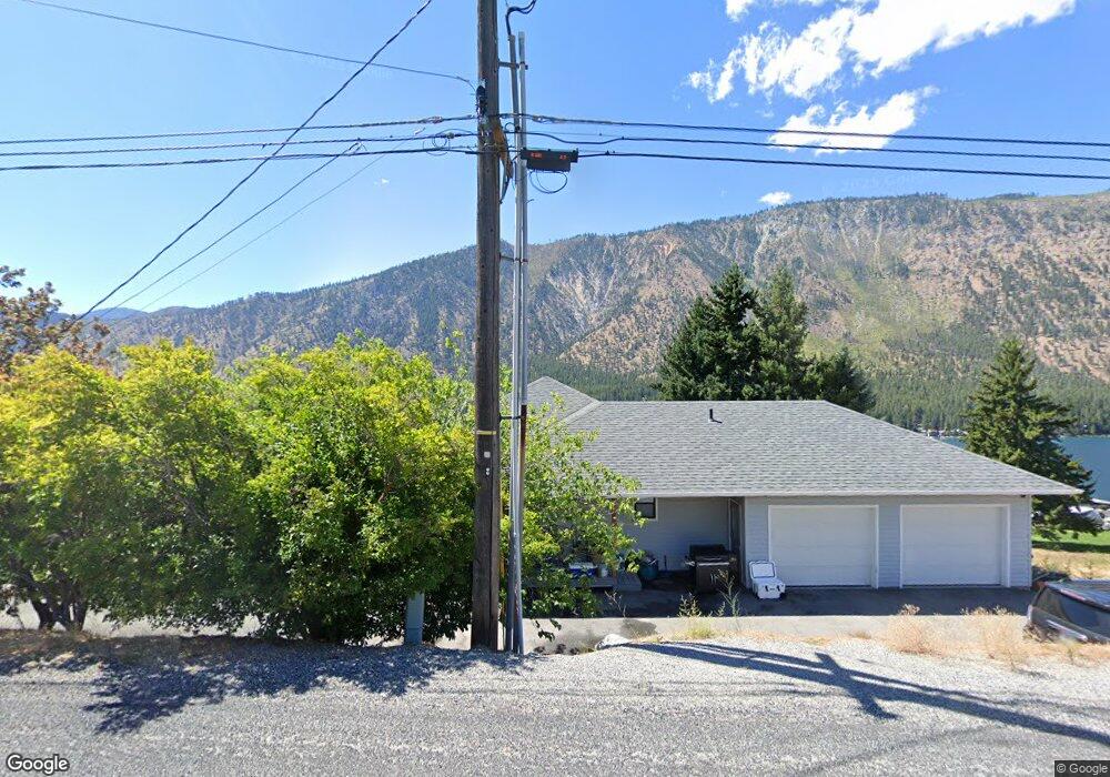
134 Loop Ave Manson, WA 98831
Estimated Value: $506,000 - $1,162,000
2
Beds
2
Baths
1,188
Sq Ft
$652/Sq Ft
Est. Value
About This Home
This home is located at 134 Loop Ave, Manson, WA 98831 and is currently estimated at $774,985, approximately $652 per square foot. 134 Loop Ave is a home located in Chelan County with nearby schools including Manson Elementary School and Manson High School.
Ownership History
Date
Name
Owned For
Owner Type
Purchase Details
Closed on
Apr 12, 2010
Sold by
Rider David A
Bought by
Beazley Samuel D and Beazley Shana L
Current Estimated Value
Home Financials for this Owner
Home Financials are based on the most recent Mortgage that was taken out on this home.
Original Mortgage
$245,618
Outstanding Balance
$165,603
Interest Rate
5.25%
Mortgage Type
FHA
Estimated Equity
$609,382
Purchase Details
Closed on
Apr 20, 2005
Sold by
Hutton Jonathan P and Hutton Amy E
Bought by
Rider David A
Home Financials for this Owner
Home Financials are based on the most recent Mortgage that was taken out on this home.
Original Mortgage
$211,200
Interest Rate
5.92%
Mortgage Type
New Conventional
Create a Home Valuation Report for This Property
The Home Valuation Report is an in-depth analysis detailing your home's value as well as a comparison with similar homes in the area
Purchase History
| Date | Buyer | Sale Price | Title Company |
|---|---|---|---|
| Beazley Samuel D | $250,150 | Pioneer Title Co | |
| Rider David A | $263,719 | First American Title |
Source: Public Records
Mortgage History
| Date | Status | Borrower | Loan Amount |
|---|---|---|---|
| Open | Beazley Samuel D | $245,618 | |
| Previous Owner | Rider David A | $211,200 |
Source: Public Records
Tax History
| Year | Tax Paid | Tax Assessment Tax Assessment Total Assessment is a certain percentage of the fair market value that is determined by local assessors to be the total taxable value of land and additions on the property. | Land | Improvement |
|---|---|---|---|---|
| 2025 | $4,463 | $581,499 | $146,875 | $434,624 |
| 2024 | $5,087 | $591,724 | $146,875 | $444,849 |
| 2023 | $5,087 | $752,920 | $177,650 | $575,270 |
| 2022 | $4,666 | $618,713 | $165,750 | $452,963 |
| 2021 | $3,671 | $539,249 | $110,500 | $428,749 |
| 2020 | $3,325 | $389,056 | $88,988 | $300,068 |
| 2019 | $3,235 | $345,745 | $86,925 | $258,820 |
| 2018 | $3,369 | $333,090 | $74,100 | $258,990 |
| 2017 | $2,872 | $330,774 | $68,900 | $261,874 |
| 2016 | $2,479 | $305,567 | $78,975 | $226,592 |
| 2015 | $2,479 | $291,748 | $80,000 | $211,748 |
| 2013 | $2,479 | $266,377 | $75,000 | $191,377 |
Source: Public Records
Map
Nearby Homes
- 950 Loop Ave
- 984 Loop Ave
- 0 Loop Ave
- 67 Apple Box Ln
- 0 Sapphire Ln Unit NWM2258629
- 1 ABC S Lakeshore Rd
- 1 C S Lakeshore Rd
- 1 B S Lakeshore Rd
- 157 Lainey Ln
- 142 Lainey Ln
- 0 Lainey Ln Unit NWM2355054
- 149 Lainey Ln
- 115 Lainey Ln
- 1190 Summit Blvd
- 11415 S Lakeshore Rd Unit 17
- 917 Lower Joe Creek Rd
- 673 Glory View Ln Unit Lot 1
- 431 Glory View Ln
- 469 Glory View Ln
- 15082 S Lakeshore Rd
- 123 Pine Crest Place
- 129 Loop Ave
- 133 Pine Crest Place
- 129 Loop Ave
- 154 Loop Ave
- 0 nna Loop Ave
- 0 NHN Loop Ave
- 214 Loop Ave Unit 214 Loop Ave Apt B
- 214 Loop Ave
- 108 Kage Ln
- 213 Pine Crest Place
- 427 Pine Crest Place
- 220 Loop Ave
- 433 Pine Crest Place
- 433 Pine Crest Place
- 150 Pine Crest Place
- 130 Pine Crest Place
- 156 Pine Crest Place
- 90 Kage Ln
- 0 Pine Crest Place
Your Personal Tour Guide
Ask me questions while you tour the home.