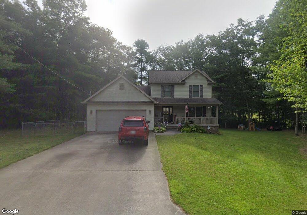
134 Maple Ridge Ln Shady Spring, WV 25918
Estimated Value: $251,519 - $295,000
4
Beds
3
Baths
1,696
Sq Ft
$159/Sq Ft
Est. Value
About This Home
This home is located at 134 Maple Ridge Ln, Shady Spring, WV 25918 and is currently estimated at $268,880, approximately $158 per square foot. 134 Maple Ridge Ln is a home with nearby schools including Shady Spring Elementary School, Shady Spring Middle School, and Shady Spring High School.
Ownership History
Date
Name
Owned For
Owner Type
Purchase Details
Closed on
Sep 27, 2010
Sold by
Cecil Thomas E
Bought by
Cook William L and Cook Michelle D
Current Estimated Value
Home Financials for this Owner
Home Financials are based on the most recent Mortgage that was taken out on this home.
Original Mortgage
$10,012,040
Outstanding Balance
$6,613,606
Interest Rate
4.37%
Mortgage Type
Purchase Money Mortgage
Estimated Equity
-$6,344,726
Purchase Details
Closed on
Apr 12, 2010
Sold by
Maplewood Properties Inc
Bought by
Cecil Thomas E
Purchase Details
Closed on
Aug 7, 2007
Sold by
Lilly David K and Mcmillion Alesia C
Bought by
V & S Properties Inc
Create a Home Valuation Report for This Property
The Home Valuation Report is an in-depth analysis detailing your home's value as well as a comparison with similar homes in the area
Home Values in the Area
Average Home Value in this Area
Purchase History
| Date | Buyer | Sale Price | Title Company |
|---|---|---|---|
| Cook William L | $193,000 | -- | |
| Cecil Thomas E | $190,000 | -- | |
| V & S Properties Inc | $210,000 | -- |
Source: Public Records
Mortgage History
| Date | Status | Borrower | Loan Amount |
|---|---|---|---|
| Open | Cook William L | $10,012,040 |
Source: Public Records
Tax History Compared to Growth
Tax History
| Year | Tax Paid | Tax Assessment Tax Assessment Total Assessment is a certain percentage of the fair market value that is determined by local assessors to be the total taxable value of land and additions on the property. | Land | Improvement |
|---|---|---|---|---|
| 2024 | $965 | $100,320 | $16,500 | $83,820 |
| 2023 | $1,173 | $117,600 | $16,500 | $101,100 |
| 2022 | $1,173 | $117,600 | $16,500 | $101,100 |
| 2021 | $1,145 | $115,320 | $16,500 | $98,820 |
| 2020 | $1,394 | $115,320 | $16,500 | $98,820 |
| 2019 | $1,394 | $115,320 | $16,500 | $98,820 |
| 2018 | $1,394 | $115,320 | $16,500 | $98,820 |
| 2017 | $1,394 | $115,320 | $16,500 | $98,820 |
| 2016 | $1,416 | $115,320 | $16,500 | $98,820 |
| 2015 | $1,355 | $110,340 | $15,540 | $94,800 |
| 2014 | $1,435 | $116,880 | $15,540 | $101,340 |
Source: Public Records
Map
Nearby Homes
- 187 Pluto Rd
- 214 Flat Top Rd
- 135 Anderson St
- 1228 Flat Top Rd
- 214 Mountain Laurel Rd
- 222 Mountain Laurel Rd Unit 43
- 141 Marianna Ln
- 238 Glen Garden Ln
- 222 Glen Garden Ln Unit 4
- 229 Glen Garden Ln
- 108 Mountain Laurel Rd
- 112 Saddle Brook Ln Unit 25
- 110 Saddle Brook Ln Unit 24
- 0 Saddle Brook Ln
- 128 Montgomery Ln
- 111 Hickory Ct Unit 10
- 135 Montgomery Ln Unit 9
- 126 Long Dr
- 218 Delta Road 30
- 411 Riverglade Dr Unit 13
- 133 Maple Ridge Ln
- 123 Maple Ridge Ln
- 114 Maple Ridge Ln
- 113 Maple Ridge Ln
- 470 Hinton Rd
- 152 Division St
- 152 Division St
- 104 Maplewood Ln
- 130 Division St
- 120 Division St
- 486 Hinton Rd
- 494 Hinton Rd
- 504 Hinton Rd
- 103 Oak Ridge Ln
- 454 Hinton Rd
- 129 Division St
- 104 Oak Ridge Ln
- 119 Division St
- 444 Hinton Rd