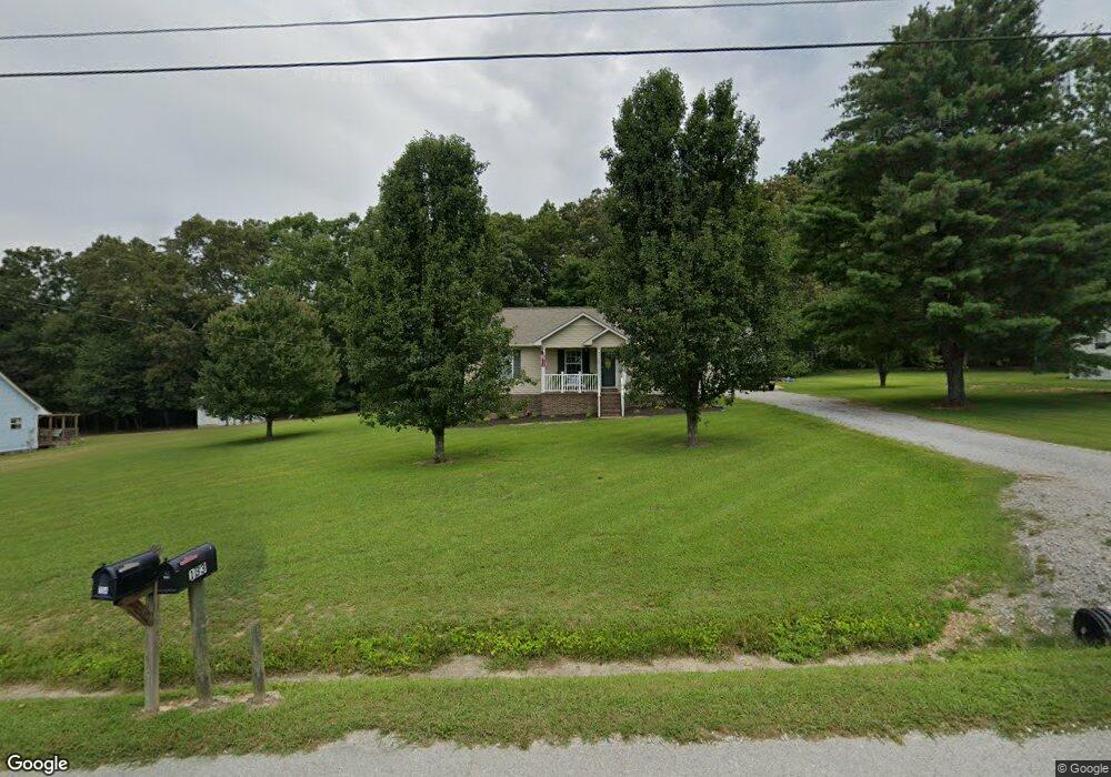
134 Michael Cir Lawrenceburg, TN 38464
Estimated Value: $182,768 - $240,000
--
Bed
2
Baths
1,092
Sq Ft
$198/Sq Ft
Est. Value
About This Home
This home is located at 134 Michael Cir, Lawrenceburg, TN 38464 and is currently estimated at $215,942, approximately $197 per square foot. 134 Michael Cir is a home located in Lawrence County with nearby schools including Ingram Sowell Elementary School, Lawrenceburg Public Elementary School, and David Crockett Elementary School.
Ownership History
Date
Name
Owned For
Owner Type
Purchase Details
Closed on
Jul 26, 2005
Sold by
Ryan Mattox
Bought by
Kris Luffman
Current Estimated Value
Home Financials for this Owner
Home Financials are based on the most recent Mortgage that was taken out on this home.
Original Mortgage
$70,000
Outstanding Balance
$36,417
Interest Rate
5.51%
Estimated Equity
$179,525
Purchase Details
Closed on
Feb 6, 2001
Sold by
Stephenson Tena L
Bought by
Ryan Mattox
Purchase Details
Closed on
Jan 5, 1990
Bought by
Stephenson Tena Lou
Purchase Details
Closed on
Mar 27, 1989
Bought by
Hine David
Purchase Details
Closed on
Sep 23, 1987
Bought by
Appleton Randy Leigh Ann
Purchase Details
Closed on
Jan 1, 1983
Create a Home Valuation Report for This Property
The Home Valuation Report is an in-depth analysis detailing your home's value as well as a comparison with similar homes in the area
Home Values in the Area
Average Home Value in this Area
Purchase History
| Date | Buyer | Sale Price | Title Company |
|---|---|---|---|
| Kris Luffman | $70,000 | -- | |
| Ryan Mattox | $54,500 | -- | |
| Stephenson Tena Lou | $42,900 | -- | |
| Hine David | $2,500 | -- | |
| Appleton Randy Leigh Ann | -- | -- | |
| -- | $3,500 | -- |
Source: Public Records
Mortgage History
| Date | Status | Borrower | Loan Amount |
|---|---|---|---|
| Open | Not Available | $70,000 |
Source: Public Records
Tax History Compared to Growth
Tax History
| Year | Tax Paid | Tax Assessment Tax Assessment Total Assessment is a certain percentage of the fair market value that is determined by local assessors to be the total taxable value of land and additions on the property. | Land | Improvement |
|---|---|---|---|---|
| 2025 | $628 | $31,225 | $0 | $0 |
| 2024 | $628 | $31,225 | $5,000 | $26,225 |
| 2023 | $628 | $31,225 | $5,000 | $26,225 |
| 2022 | $628 | $31,225 | $5,000 | $26,225 |
| 2021 | $536 | $18,125 | $2,500 | $15,625 |
| 2020 | $536 | $18,125 | $2,500 | $15,625 |
| 2019 | $536 | $18,125 | $2,500 | $15,625 |
| 2018 | $536 | $18,125 | $2,500 | $15,625 |
| 2017 | $536 | $18,125 | $2,500 | $15,625 |
| 2016 | $536 | $18,125 | $2,500 | $15,625 |
| 2015 | $496 | $18,125 | $2,500 | $15,625 |
| 2014 | $497 | $18,150 | $2,500 | $15,650 |
Source: Public Records
Map
Nearby Homes
- 1950 Norton Rd
- 206 State Ave
- 380 Lanning Rd
- 2600 Clanton Rd
- 260 Wesley Chapel Rd
- 2073 Choates Creek Rd
- 1194 Harmony Way
- 729 Weakley Creek Rd
- 145 Lantz Rd
- 2342 Pulaski Hwy
- 786 Hillview Dr
- 111 Grandview Dr
- 79 Bishop Rd
- 2024 Powdermill Hill Rd
- 2167 Powdermill Hill Rd
- 2290 Grandview Dr
- 0 Lanning Rd
- 0 Lightfoot Ln
- 123 Quail Dr
- 33 Bishop Rd
- 136 Michael Cir
- 132 Michael Cir
- 133 Michael Cir
- 135 Michael Cir
- 130 Michael Cir
- 138 Michael Cir
- 131 Michael Cir
- 129 Michael Cir
- 137 Michael Cir
- 137 1/2 Michael Cir
- 116 Michael Cir
- 128 Michael Cir
- 140 Michael Cir
- 114 Michael Cir
- 120 Michael Cir
- 127 Michael Cir
- 142 Michael Cir
- 126 Norton Rd
- 110 Michael Cir
- 139 Michael Cir