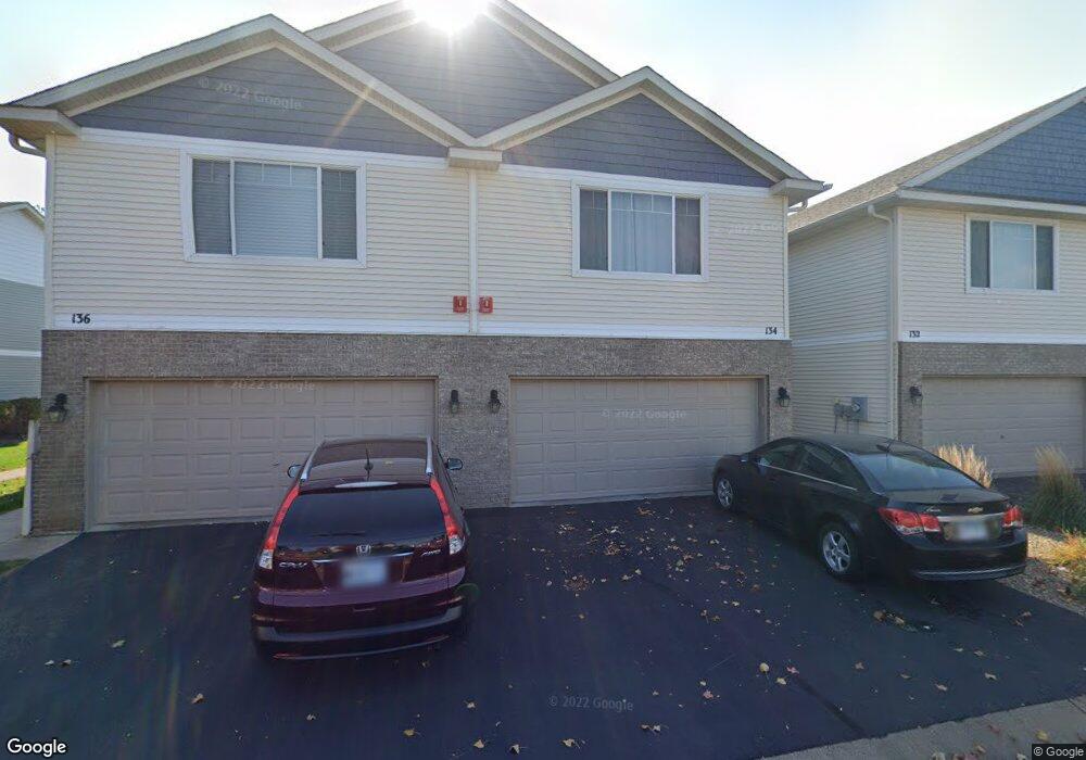
134 Morgan Ln Circle Pines, MN 55014
Estimated Value: $322,000 - $341,000
4
Beds
3
Baths
1,897
Sq Ft
$174/Sq Ft
Est. Value
About This Home
This home is located at 134 Morgan Ln, Circle Pines, MN 55014 and is currently estimated at $330,261, approximately $174 per square foot. 134 Morgan Ln is a home located in Anoka County with nearby schools including Blue Heron Elementary School, Centennial Middle School, and Centennial High School.
Ownership History
Date
Name
Owned For
Owner Type
Purchase Details
Closed on
Apr 10, 2020
Sold by
Hertofsky James and Hertofsky Lynn
Bought by
Dawodu Temitope Abiola
Current Estimated Value
Home Financials for this Owner
Home Financials are based on the most recent Mortgage that was taken out on this home.
Original Mortgage
$251,750
Outstanding Balance
$222,596
Interest Rate
3.3%
Mortgage Type
New Conventional
Estimated Equity
$107,665
Purchase Details
Closed on
Sep 21, 2015
Sold by
Graske Amanda
Bought by
Cheney Robert H and Cheney Lynn R
Home Financials for this Owner
Home Financials are based on the most recent Mortgage that was taken out on this home.
Original Mortgage
$171,800
Interest Rate
3.75%
Mortgage Type
FHA
Create a Home Valuation Report for This Property
The Home Valuation Report is an in-depth analysis detailing your home's value as well as a comparison with similar homes in the area
Home Values in the Area
Average Home Value in this Area
Purchase History
| Date | Buyer | Sale Price | Title Company |
|---|---|---|---|
| Dawodu Temitope Abiola | $265,000 | North Title Inc | |
| Cheney Robert H | $175,000 | Liberty Title Inc |
Source: Public Records
Mortgage History
| Date | Status | Borrower | Loan Amount |
|---|---|---|---|
| Open | Dawodu Temitope Abiola | $251,750 | |
| Previous Owner | Cheney Robert H | $171,800 |
Source: Public Records
Tax History Compared to Growth
Tax History
| Year | Tax Paid | Tax Assessment Tax Assessment Total Assessment is a certain percentage of the fair market value that is determined by local assessors to be the total taxable value of land and additions on the property. | Land | Improvement |
|---|---|---|---|---|
| 2025 | $3,486 | $309,900 | $82,900 | $227,000 |
| 2024 | $3,486 | $305,600 | $77,500 | $228,100 |
| 2023 | $3,239 | $298,900 | $68,400 | $230,500 |
| 2022 | $3,093 | $299,800 | $62,200 | $237,600 |
| 2021 | $2,944 | $250,300 | $40,100 | $210,200 |
| 2020 | $2,811 | $233,600 | $35,000 | $198,600 |
| 2019 | $2,643 | $216,700 | $31,300 | $185,400 |
| 2018 | $2,341 | $195,400 | $0 | $0 |
| 2017 | $1,924 | $190,800 | $0 | $0 |
| 2016 | $2,040 | $157,500 | $0 | $0 |
| 2015 | -- | $157,500 | $20,400 | $137,100 |
| 2014 | -- | $134,200 | $17,800 | $116,400 |
Source: Public Records
Map
Nearby Homes
- 7885 Gotland Ln
- 167 Morgan Ln
- 179 Stallion Ln
- 197 Century Trail
- 7785 Clydesdale Cir
- 227 Palomino Ln
- 12202 Opal St NE
- 12469 National St NE
- 12745 Stutz Ct NE
- 4873 127th Cir NE
- 4941 127th Ln NE
- 4883 127th Cir NE
- 4903 127th Cir NE
- 12820 Stutz Ct NE
- 4891 127th Ln NE
- 4890 127th Ln NE
- 4881 127th Ln NE
- 4872 128th Cir NE
- 4866 128th Cir NE
- Aspen Plan at Oakwood Ponds