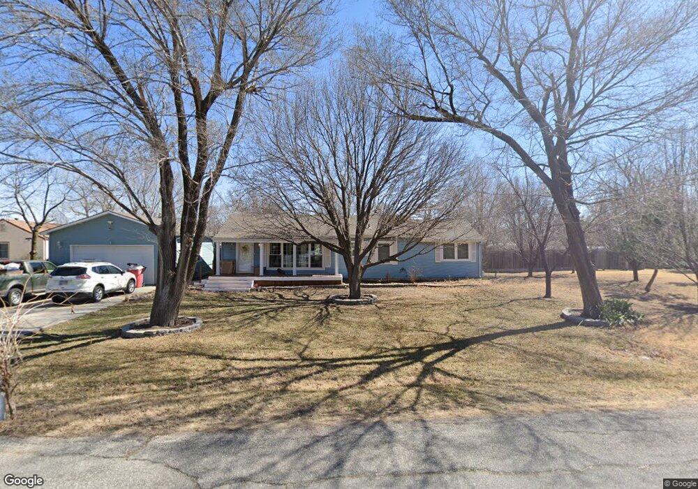
134 N Dowell St Wichita, KS 67206
Northeast Wichita NeighborhoodEstimated Value: $257,320 - $282,000
3
Beds
2
Baths
1,652
Sq Ft
$163/Sq Ft
Est. Value
About This Home
This home is located at 134 N Dowell St, Wichita, KS 67206 and is currently estimated at $269,660, approximately $163 per square foot. 134 N Dowell St is a home located in Sedgwick County with nearby schools including Minneha Core Knowledge Elementary School, Coleman Environmental Magnet Middle School, and Wichita Southeast High School.
Ownership History
Date
Name
Owned For
Owner Type
Purchase Details
Closed on
Sep 29, 2020
Sold by
Howell Michael K and Howell Cynthia K
Bought by
White Amy and Howell Keaton
Current Estimated Value
Home Financials for this Owner
Home Financials are based on the most recent Mortgage that was taken out on this home.
Original Mortgage
$169,750
Outstanding Balance
$150,984
Interest Rate
2.9%
Mortgage Type
New Conventional
Estimated Equity
$118,676
Create a Home Valuation Report for This Property
The Home Valuation Report is an in-depth analysis detailing your home's value as well as a comparison with similar homes in the area
Home Values in the Area
Average Home Value in this Area
Purchase History
| Date | Buyer | Sale Price | Title Company |
|---|---|---|---|
| White Amy | -- | None Available | |
| White Amy | -- | Amrock |
Source: Public Records
Mortgage History
| Date | Status | Borrower | Loan Amount |
|---|---|---|---|
| Open | White Amy | $169,750 | |
| Closed | White Amy | $169,750 |
Source: Public Records
Tax History Compared to Growth
Tax History
| Year | Tax Paid | Tax Assessment Tax Assessment Total Assessment is a certain percentage of the fair market value that is determined by local assessors to be the total taxable value of land and additions on the property. | Land | Improvement |
|---|---|---|---|---|
| 2025 | $2,231 | $22,644 | $5,371 | $17,273 |
| 2023 | $2,231 | $18,723 | $3,945 | $14,778 |
| 2022 | $1,950 | $17,665 | $3,715 | $13,950 |
| 2021 | $1,873 | $16,354 | $3,715 | $12,639 |
| 2020 | $1,642 | $14,410 | $2,657 | $11,753 |
| 2019 | $1,645 | $14,410 | $2,979 | $11,431 |
| 2018 | $1,511 | $13,237 | $3,036 | $10,201 |
| 2017 | $1,426 | $0 | $0 | $0 |
| 2016 | $1,354 | $0 | $0 | $0 |
| 2015 | $1,391 | $0 | $0 | $0 |
| 2014 | $1,363 | $0 | $0 | $0 |
Source: Public Records
Map
Nearby Homes
- 309 N Crest Cir
- 11716 E 2nd St N
- 326 N Clay Cir
- 11725 E 3rd St N
- 345 N Jackson Heights Ct
- 369 N Jackson Heights Ct
- Lot 13 N Jackson Heights Ct
- 389 N Jackson Heights Ct
- 396 N Jackson Heights Ct
- 617 N Bracken Ct
- 12010 E Tipperary St
- 841 N Bristol Ct
- 865 N Bristol Ct
- 11236 E Killarney Cir
- 729 S Bedford Cir
- 1026 N Bristol St
- 838 N Glenmoor Dr
- 1038 N Bristol St
- 11005 E Fawn Grove St
- 1102 N Bedford Ct
- 11416 E Douglas Ave
- 11400 E Douglas Ave
- 144 N Dowell St
- 135 N Dowell St
- 145 N Dowell St
- 11326 E Douglas Ave
- 155 N Dowell St
- 11506 E Douglas Ave
- 11426 E 1st St N
- 11300 E Douglas Ave
- 11516 E Douglas Ave
- 11516 E Douglas Ave Unit 11506 E Douglas
- 210 N Greenwich Rd
- 135 N Ellson St
- 11226 E Douglas Ave
- 145 N Ellson St
- 11525 E 1st St N
- 11526 E Douglas Ave
- 134 N Greenwich Rd
- 11516 E 1st St N