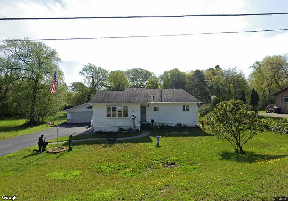
134 Spruce St Rhinelander, WI 54501
Estimated Value: $154,000 - $177,000
Studio
--
Bath
--
Sq Ft
0.54
Acres
About This Home
This home is located at 134 Spruce St, Rhinelander, WI 54501 and is currently estimated at $163,680. 134 Spruce St is a home located in Oneida County with nearby schools including Crescent Elementary School, James Williams Middle School, and Rhinelander High School.
Ownership History
Date
Name
Owned For
Owner Type
Purchase Details
Closed on
Jan 24, 2025
Sold by
Eades Brian
Bought by
Eades Brian and Rose Jennifer
Current Estimated Value
Purchase Details
Closed on
May 22, 2024
Sold by
Eades Tracy
Bought by
Eades Brian
Home Financials for this Owner
Home Financials are based on the most recent Mortgage that was taken out on this home.
Original Mortgage
$125,000
Interest Rate
6.39%
Mortgage Type
New Conventional
Purchase Details
Closed on
Aug 15, 2011
Sold by
Eades Leroy and Eades Shirley
Bought by
Eades Tracy and Eadst Brian
Create a Home Valuation Report for This Property
The Home Valuation Report is an in-depth analysis detailing your home's value as well as a comparison with similar homes in the area
Home Values in the Area
Average Home Value in this Area
Purchase History
| Date | Buyer | Sale Price | Title Company |
|---|---|---|---|
| Eades Brian | $54,500 | None Listed On Document | |
| Eades Brian | $85,000 | None Listed On Document | |
| Eades Tracy | -- | -- |
Source: Public Records
Mortgage History
| Date | Status | Borrower | Loan Amount |
|---|---|---|---|
| Previous Owner | Eades Brian | $125,000 |
Source: Public Records
Tax History
| Year | Tax Paid | Tax Assessment Tax Assessment Total Assessment is a certain percentage of the fair market value that is determined by local assessors to be the total taxable value of land and additions on the property. | Land | Improvement |
|---|---|---|---|---|
| 2024 | $2,665 | $108,900 | $9,900 | $99,000 |
| 2023 | $2,569 | $108,900 | $9,900 | $99,000 |
| 2022 | $1,930 | $108,900 | $9,900 | $99,000 |
| 2021 | $2,543 | $108,900 | $9,900 | $99,000 |
| 2020 | $2,044 | $108,900 | $9,900 | $99,000 |
| 2019 | $2,384 | $121,900 | $9,900 | $112,000 |
| 2018 | $2,376 | $121,900 | $9,900 | $112,000 |
| 2017 | $2,445 | $121,900 | $9,900 | $112,000 |
| 2016 | $2,559 | $121,900 | $9,900 | $112,000 |
| 2015 | $2,495 | $121,900 | $9,900 | $112,000 |
| 2014 | $2,495 | $121,900 | $9,900 | $112,000 |
| 2011 | $2,522 | $130,200 | $9,900 | $120,300 |
Source: Public Records
Map
Nearby Homes
- 773 Balsam St
- 745 W Phillip St
- Lot on Hemlock St
- 1640 Balsam St Unit 26
- 239 Highview Pkwy
- 825 River St
- 923 River St
- 503 Douglas St
- ON Westhill Rd
- Lot 4 W Hill Rd
- 603 Evergreen Ct
- Lot 6 Riverglen Ave
- 504 S Pelham St Unit HOUSE ONLY
- 324 Abner St
- 11 Keenan St
- 608 Alban St
- 35 Randall Ave
- 812 Margaret St
- 406 W Pearl St
- 715 N Stevens St