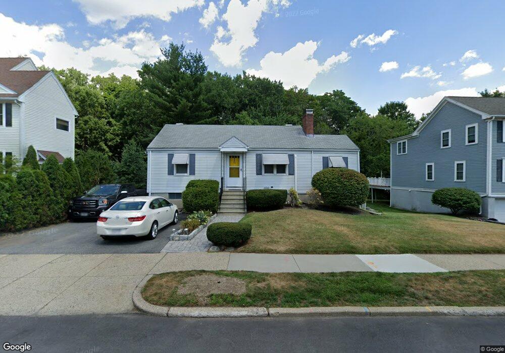
134 Upland Ave Newton Highlands, MA 02461
Newton Highlands NeighborhoodEstimated Value: $805,000 - $1,028,000
3
Beds
2
Baths
933
Sq Ft
$1,001/Sq Ft
Est. Value
About This Home
This home is located at 134 Upland Ave, Newton Highlands, MA 02461 and is currently estimated at $933,939, approximately $1,001 per square foot. 134 Upland Ave is a home located in Middlesex County with nearby schools including Countryside Elementary School, Charles E Brown Middle School, and Newton South High School.
Ownership History
Date
Name
Owned For
Owner Type
Purchase Details
Closed on
Jun 30, 2020
Sold by
Wong Ft
Bought by
Wong Michael K and Wong Cheri-Ann M
Current Estimated Value
Purchase Details
Closed on
Feb 9, 2005
Sold by
Wong Andrea Lam and Wong William Seam
Bought by
Wong Andrea Lam and Wong Cheri-Ann M S
Create a Home Valuation Report for This Property
The Home Valuation Report is an in-depth analysis detailing your home's value as well as a comparison with similar homes in the area
Home Values in the Area
Average Home Value in this Area
Purchase History
| Date | Buyer | Sale Price | Title Company |
|---|---|---|---|
| Wong Michael K | -- | None Available | |
| Wong Andrea Lam | -- | -- |
Source: Public Records
Tax History Compared to Growth
Tax History
| Year | Tax Paid | Tax Assessment Tax Assessment Total Assessment is a certain percentage of the fair market value that is determined by local assessors to be the total taxable value of land and additions on the property. | Land | Improvement |
|---|---|---|---|---|
| 2025 | $7,068 | $721,200 | $0 | $0 |
| 2024 | $6,834 | $0 | $0 | $0 |
| 2023 | $6,429 | $631,500 | $0 | $0 |
| 2022 | $6,151 | $584,700 | $584,700 | $0 |
| 2021 | $5,935 | $551,600 | $551,600 | $0 |
| 2020 | $5,759 | $551,600 | $551,600 | $0 |
| 2019 | $5,596 | $535,500 | $0 | $0 |
| 2018 | $5,308 | $490,600 | $0 | $0 |
| 2017 | $5,146 | $462,800 | $0 | $0 |
| 2016 | $4,922 | $432,500 | $0 | $0 |
| 2015 | $4,693 | $404,200 | $404,200 | $0 |
Source: Public Records
Map
Nearby Homes
- 116 Upland Ave
- 51 Carl St
- 250 Woodcliff Rd
- 3 Glenmore Terrace Unit 2
- 36 Cannon St
- 1292 Walnut St
- 1308 Walnut St
- 128 Charlemont St
- 17 Circuit Ave Unit 2
- 36 Roland St
- 1629 Centre St
- 1077 Boylston St
- 1623-1625 Centre St
- 125 Oakdale Rd
- 15 Buff Cir
- 200 Lincoln St
- 1151 Walnut St Unit 205
- 1151 Walnut St Unit 405
- 1151 Walnut St Unit 207
- 66 Linden St
- 138 Upland Ave
- 128 Upland Ave
- 144 Upland Ave
- 122 Upland Ave
- 135 Upland Ave
- 129 Upland Ave
- 61 Brierfield Rd
- 139 Upland Ave
- 123 Upland Ave
- 150 Upland Ave
- 143 Upland Ave
- 115 Upland Ave
- 160 Winchester St
- 156 Winchester St
- 166 Winchester St
- 152 Winchester St
- 29 Brierfield Rd
- 149 Upland Ave
- 170 Winchester St
- 170 Winchester St