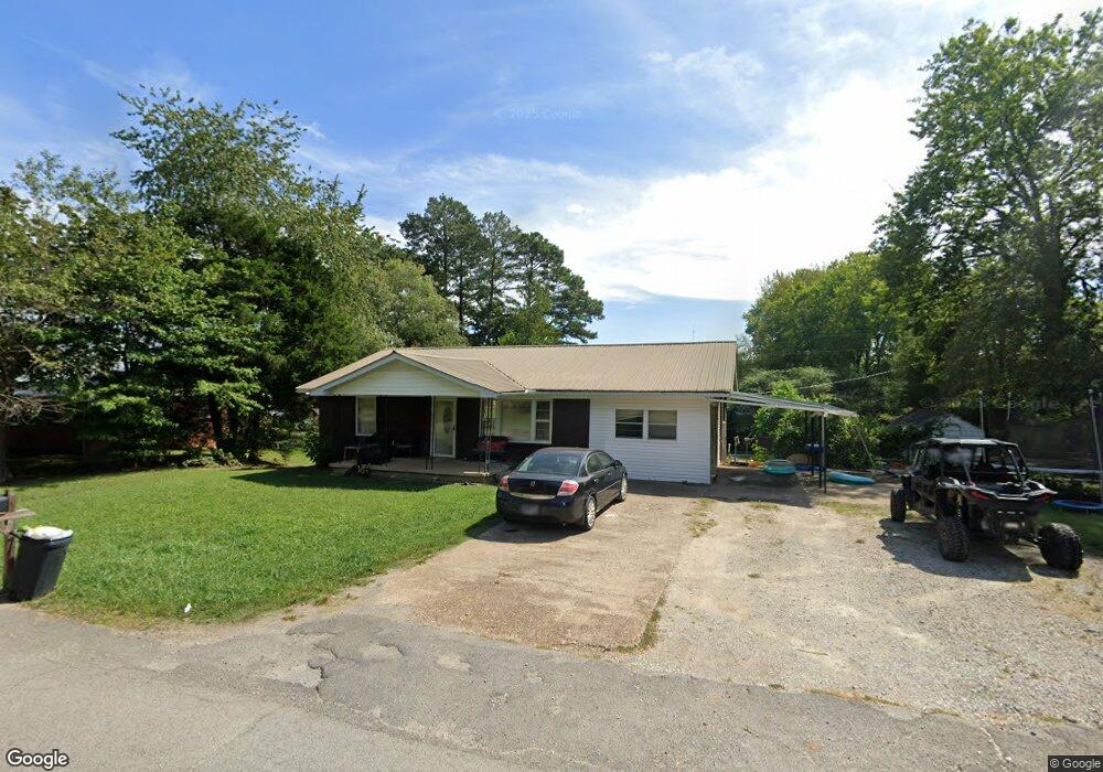
134 W Brooklyn St Linden, TN 37096
Estimated Value: $122,000 - $284,000
--
Bed
1
Bath
1,457
Sq Ft
$141/Sq Ft
Est. Value
About This Home
This home is located at 134 W Brooklyn St, Linden, TN 37096 and is currently estimated at $205,540, approximately $141 per square foot. 134 W Brooklyn St is a home located in Perry County.
Ownership History
Date
Name
Owned For
Owner Type
Purchase Details
Closed on
Apr 28, 2017
Sold by
Hinson Johnny E
Bought by
Futch Christina
Current Estimated Value
Home Financials for this Owner
Home Financials are based on the most recent Mortgage that was taken out on this home.
Original Mortgage
$67,351
Interest Rate
4.14%
Mortgage Type
Closed End Mortgage
Purchase Details
Closed on
May 19, 1997
Bought by
Hinson Johnny E
Purchase Details
Closed on
Dec 3, 1965
Bought by
Anna Hinson B and Anna Mae
Create a Home Valuation Report for This Property
The Home Valuation Report is an in-depth analysis detailing your home's value as well as a comparison with similar homes in the area
Home Values in the Area
Average Home Value in this Area
Purchase History
| Date | Buyer | Sale Price | Title Company |
|---|---|---|---|
| Futch Christina | $82,500 | -- | |
| Hinson Johnny E | -- | -- | |
| Anna Hinson B | -- | -- |
Source: Public Records
Mortgage History
| Date | Status | Borrower | Loan Amount |
|---|---|---|---|
| Closed | Futch Christina | $67,351 |
Source: Public Records
Tax History Compared to Growth
Tax History
| Year | Tax Paid | Tax Assessment Tax Assessment Total Assessment is a certain percentage of the fair market value that is determined by local assessors to be the total taxable value of land and additions on the property. | Land | Improvement |
|---|---|---|---|---|
| 2025 | $598 | $21,375 | $0 | $0 |
| 2024 | $598 | $21,375 | $1,375 | $20,000 |
| 2023 | $599 | $21,375 | $1,375 | $20,000 |
| 2022 | $599 | $21,375 | $1,375 | $20,000 |
| 2021 | $599 | $21,375 | $1,375 | $20,000 |
| 2020 | $491 | $21,375 | $1,375 | $20,000 |
| 2019 | $630 | $21,125 | $1,375 | $19,750 |
| 2018 | $630 | $21,125 | $1,375 | $19,750 |
| 2017 | $624 | $21,125 | $1,375 | $19,750 |
| 2016 | $624 | $21,125 | $1,375 | $19,750 |
| 2015 | $614 | $21,125 | $1,375 | $19,750 |
| 2014 | $614 | $21,125 | $1,375 | $19,750 |
| 2013 | $607 | $20,905 | $0 | $0 |
Source: Public Records
Map
Nearby Homes
- 122 Shelton St
- 218 Cedar Ave
- 130 Elm Ln
- 141 Maple St
- 245 S Mill St
- 0 Church St
- 0 Treadwell Prong Unit RTC2707562
- 628 Starlight Dr
- 107 Possum Trot Ln
- 8884 U S Highway 412
- Lot 5 Campers Ln
- Lot 4 Campers Ln
- Lot 9 Campers Ln
- Lot 7 Campers Ln
- Lot 8 Campers Ln
- Lot 15 Campers Ln
- Lot 6 Campers Ln
- Lot 10 Campers Ln
- Lot 11 Campers Ln
- Lot 17 Campers Ln
- 130 W Brooklyn St
- 130 W Brooklyn St
- 135 College Ave
- 131 College Ave
- 137 W Brooklyn St
- 133 W Brooklyn St
- 127 College Ave
- 124 W Brooklyn St
- 125 W Brooklyn St
- 145 W Brooklyn St
- 130 Shelton St
- 123 College Ave
- 136 Shelton St
- 128 Shelton St
- 140 Shelton St
- 126 Shelton St
- 119 W Brooklyn St
- 118 W Brooklyn St
- 119 W Brooklyn Ave
- 121 College Ave