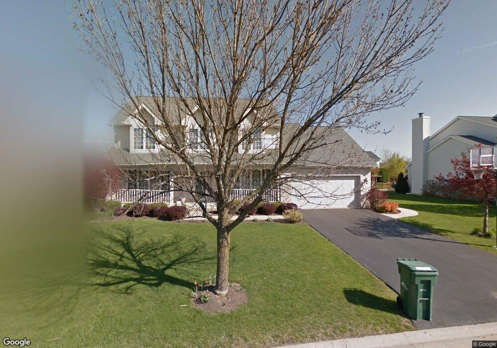
134 Whitehall Ct Grayslake, IL 60030
Estimated Value: $487,000 - $499,000
4
Beds
3
Baths
2,613
Sq Ft
$189/Sq Ft
Est. Value
About This Home
This home is located at 134 Whitehall Ct, Grayslake, IL 60030 and is currently estimated at $493,718, approximately $188 per square foot. 134 Whitehall Ct is a home located in Lake County with nearby schools including Woodland Primary School, Woodland Elementary School, and Woodland Intermediate School.
Ownership History
Date
Name
Owned For
Owner Type
Purchase Details
Closed on
Jun 20, 2002
Sold by
Worklan John J and Worklan Caron E
Bought by
Pulford John J and Pulford Wendy A
Current Estimated Value
Home Financials for this Owner
Home Financials are based on the most recent Mortgage that was taken out on this home.
Original Mortgage
$252,000
Outstanding Balance
$105,722
Interest Rate
6.7%
Estimated Equity
$387,996
Create a Home Valuation Report for This Property
The Home Valuation Report is an in-depth analysis detailing your home's value as well as a comparison with similar homes in the area
Home Values in the Area
Average Home Value in this Area
Purchase History
| Date | Buyer | Sale Price | Title Company |
|---|---|---|---|
| Pulford John J | $315,000 | -- |
Source: Public Records
Mortgage History
| Date | Status | Borrower | Loan Amount |
|---|---|---|---|
| Open | Pulford John J | $252,000 |
Source: Public Records
Tax History Compared to Growth
Tax History
| Year | Tax Paid | Tax Assessment Tax Assessment Total Assessment is a certain percentage of the fair market value that is determined by local assessors to be the total taxable value of land and additions on the property. | Land | Improvement |
|---|---|---|---|---|
| 2024 | $12,743 | $132,495 | $25,391 | $107,104 |
| 2023 | $11,091 | $121,600 | $23,303 | $98,297 |
| 2022 | $11,091 | $104,523 | $16,169 | $88,354 |
| 2021 | $10,926 | $100,464 | $15,541 | $84,923 |
| 2020 | $12,146 | $106,065 | $14,787 | $91,278 |
| 2019 | $11,699 | $101,761 | $14,187 | $87,574 |
| 2018 | $12,371 | $108,423 | $17,385 | $91,038 |
| 2017 | $12,255 | $101,987 | $16,353 | $85,634 |
| 2016 | $11,769 | $94,145 | $15,096 | $79,049 |
| 2015 | $11,314 | $86,008 | $13,791 | $72,217 |
| 2014 | $10,709 | $80,132 | $12,860 | $67,272 |
| 2012 | $10,633 | $83,689 | $13,431 | $70,258 |
Source: Public Records
Map
Nearby Homes
- 23 Bobolink Dr
- 355 Buckingham Dr
- 1191 Hummingbird Ln
- 399 Banbury Ln
- 707 Crossland Dr
- 33276 N Sunset Ave
- 1617 Albany St
- 745 Dillon Ct
- 873 Essex Cir
- 820 Amelia Ct
- 633 Dove Ct Unit 4
- 18740 W Willow Point Dr
- 1544 Syracuse Dr
- 1045 Manchester Cir
- 618 Barron Blvd
- 33978 N Lake Rd
- 33762 N Oak St
- 418 Flanders Ln
- 33670 N Lake Shore Dr
- 33070 N Ridge Rd
- 130 Whitehall Ct
- 140 Whitehall Ct
- 261 Braxton Way
- 251 Braxton Way
- 269 Braxton Way
- 126 Whitehall Ct
- 243 Braxton Way
- 98 Cambridge Dr
- 106 Whitehall Ct
- 235 Braxton Way
- 110 Whitehall Ct
- 122 Whitehall Ct
- 139 Cambridge Dr
- 157 Cambridge Dr
- 121 Cambridge Dr
- 215 Braxton Way
- 74 Cambridge Dr
- 266 Braxton Way
- 258 Braxton Way
- 175 Cambridge Dr