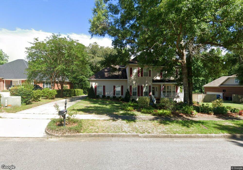
1340 Cameron Dr Mobile, AL 36695
Sheldon NeighborhoodEstimated Value: $352,000 - $372,000
4
Beds
3
Baths
2,612
Sq Ft
$137/Sq Ft
Est. Value
About This Home
This home is located at 1340 Cameron Dr, Mobile, AL 36695 and is currently estimated at $358,539, approximately $137 per square foot. 1340 Cameron Dr is a home located in Mobile County with nearby schools including ER Dickson Elementary School, Bernice J Causey Middle School, and WP Davidson High School.
Ownership History
Date
Name
Owned For
Owner Type
Purchase Details
Closed on
May 28, 2003
Sold by
Lanouette Paul Michael and Lanouette Carol Rublee
Bought by
Brady Michael R and Brady Connie P
Current Estimated Value
Home Financials for this Owner
Home Financials are based on the most recent Mortgage that was taken out on this home.
Original Mortgage
$215,650
Outstanding Balance
$87,380
Interest Rate
4.75%
Mortgage Type
Unknown
Estimated Equity
$271,159
Create a Home Valuation Report for This Property
The Home Valuation Report is an in-depth analysis detailing your home's value as well as a comparison with similar homes in the area
Home Values in the Area
Average Home Value in this Area
Purchase History
| Date | Buyer | Sale Price | Title Company |
|---|---|---|---|
| Brady Michael R | -- | -- |
Source: Public Records
Mortgage History
| Date | Status | Borrower | Loan Amount |
|---|---|---|---|
| Open | Brady Michael R | $215,650 |
Source: Public Records
Tax History Compared to Growth
Tax History
| Year | Tax Paid | Tax Assessment Tax Assessment Total Assessment is a certain percentage of the fair market value that is determined by local assessors to be the total taxable value of land and additions on the property. | Land | Improvement |
|---|---|---|---|---|
| 2024 | $1,435 | $34,880 | $4,500 | $30,380 |
| 2023 | $1,435 | $32,340 | $4,500 | $27,840 |
| 2022 | $1,347 | $33,030 | $4,500 | $28,530 |
| 2021 | $1,169 | $28,810 | $4,500 | $24,310 |
| 2020 | $1,196 | $29,450 | $4,500 | $24,950 |
| 2019 | $1,318 | $28,550 | $5,000 | $23,550 |
| 2018 | $1,346 | $29,140 | $0 | $0 |
| 2017 | $1,280 | $27,780 | $0 | $0 |
| 2016 | $1,307 | $28,340 | $0 | $0 |
| 2013 | $1,219 | $24,220 | $0 | $0 |
Source: Public Records
Map
Nearby Homes
- 1337 Carson Rd W
- 1340 Wellsley Ct
- 1265 Hanover Ct
- 1542 Stone Hedge Dr W
- 7691 Sweetgum Ct
- 7361 Carson Rd S
- 0 Manchester Place Unit 7528070
- 1361 Dellwyn Ct
- 1130 Jonathan Ct
- 1000 Choctaw Bluff Rd
- 7381 Willow Bridge Dr S
- 1735 Ashmoor Dr W
- 7377 Willow Bridge Dr S
- 7260 Pine Station Rd S
- 1350 Schillinger Rd S
- 8050 Saint Jude Cir N
- 7671 Creekwood Dr
- 7971 Suzanne Way
- 8020 Suzanne Way
- 921 Kimberlin Dr N
- 1330 Cameron Dr
- 1350 Cameron Dr
- 1350 Cameron Dr Unit 37
- 0 Cameron Dr Unit 20
- 1320 Cameron Dr
- 33 Pembroke Cir
- 1360 Cameron Dr
- 7633 Pembroke Cir
- 1365 Cameron Dr
- 1290 Cameron Dr
- 1352 Carson Rd W
- 1285 Cameron Dr
- 7632 Pembroke Cir
- 1370 Cameron Dr
- 7643 Pembroke Cir
- 1348 Carson Rd W
- 1280 Cameron Dr Unit 2
- 1364 Carson Rd W
- 1374 Cameron Dr
- 1336 Carson Rd W