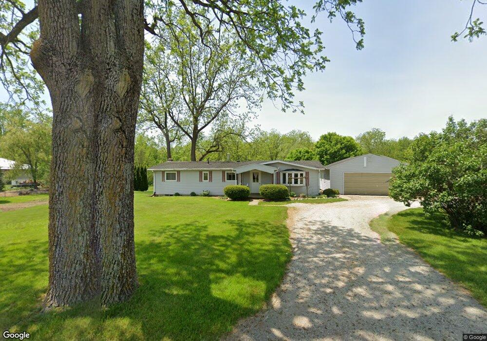
1340 N 450 E Lagrange, IN 46761
Estimated Value: $191,000 - $240,349
3
Beds
2
Baths
1,248
Sq Ft
$179/Sq Ft
Est. Value
About This Home
This home is located at 1340 N 450 E, Lagrange, IN 46761 and is currently estimated at $222,783, approximately $178 per square foot. 1340 N 450 E is a home located in LaGrange County with nearby schools including Lakeland Jr/Sr High School, Little Acorn School, and Bloomfield Hills School.
Ownership History
Date
Name
Owned For
Owner Type
Purchase Details
Closed on
Sep 30, 2022
Sold by
Hochstetler Davon J and Hochstetler Regina K
Bought by
Yoder Daryl L and Yoder Leann V
Current Estimated Value
Purchase Details
Closed on
Jan 14, 2020
Sold by
Schwartz and Lydia
Bought by
Wengerd Wilbur W and Wengerd Rosanna H
Purchase Details
Closed on
Dec 6, 2013
Sold by
Daniel H Graber
Bought by
Wilbur Wilbur W and Wilbur Rosanna
Purchase Details
Closed on
Aug 1, 2008
Sold by
Luann Andrews
Bought by
Daniel H Graber
Create a Home Valuation Report for This Property
The Home Valuation Report is an in-depth analysis detailing your home's value as well as a comparison with similar homes in the area
Purchase History
| Date | Buyer | Sale Price | Title Company |
|---|---|---|---|
| Yoder Daryl L | -- | -- | |
| Wengerd Wilbur W | -- | Attorney Only | |
| Wilbur Wilbur W | $86,000 | Lagrange Title Company | |
| Daniel H Graber | $86,000 | Eberhard & Gastineau, Pc |
Source: Public Records
Tax History
| Year | Tax Paid | Tax Assessment Tax Assessment Total Assessment is a certain percentage of the fair market value that is determined by local assessors to be the total taxable value of land and additions on the property. | Land | Improvement |
|---|---|---|---|---|
| 2025 | $1,097 | $127,300 | $30,500 | $96,800 |
| 2024 | $1,097 | $132,700 | $30,600 | $102,100 |
| 2023 | $1,079 | $128,300 | $29,200 | $99,100 |
| 2022 | $1,059 | $114,700 | $21,700 | $93,000 |
| 2021 | $879 | $102,900 | $20,900 | $82,000 |
| 2020 | $929 | $97,000 | $20,000 | $77,000 |
| 2019 | $962 | $97,500 | $20,200 | $77,300 |
| 2018 | $1,001 | $92,100 | $20,200 | $71,900 |
| 2017 | $956 | $88,600 | $20,400 | $68,200 |
| 2016 | $920 | $86,600 | $20,500 | $66,100 |
| 2014 | $916 | $88,000 | $21,400 | $66,600 |
| 2013 | $916 | $88,300 | $21,000 | $67,300 |
Source: Public Records
Map
Nearby Homes
Your Personal Tour Guide
Ask me questions while you tour the home.