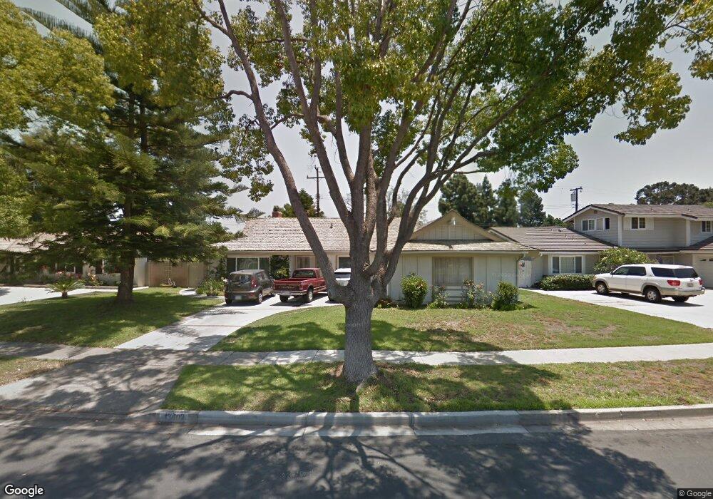
13402 White Sand Dr Tustin, CA 92780
Estimated Value: $1,117,000 - $1,328,000
4
Beds
2
Baths
1,563
Sq Ft
$771/Sq Ft
Est. Value
About This Home
This home is located at 13402 White Sand Dr, Tustin, CA 92780 and is currently estimated at $1,204,675, approximately $770 per square foot. 13402 White Sand Dr is a home located in Orange County with nearby schools including Barbara Benson Elementary School, C. E. Utt Middle School, and Tustin High School.
Ownership History
Date
Name
Owned For
Owner Type
Purchase Details
Closed on
Mar 2, 2021
Sold by
Villegas Richard L and Villegas Kelleni
Bought by
Villegas Richard Larry and Vilegas Kelleni
Current Estimated Value
Purchase Details
Closed on
Mar 9, 2011
Sold by
Solowiej Belinda and Weiderhaft Rhonda L
Bought by
Villegas Richard L and Villegas Keli
Home Financials for this Owner
Home Financials are based on the most recent Mortgage that was taken out on this home.
Original Mortgage
$353,000
Outstanding Balance
$228,763
Interest Rate
3.62%
Mortgage Type
New Conventional
Estimated Equity
$975,912
Purchase Details
Closed on
Aug 28, 1996
Sold by
Wallace William M and Wallace Blanche C
Bought by
Wallace William M and Wallace Blanche C
Create a Home Valuation Report for This Property
The Home Valuation Report is an in-depth analysis detailing your home's value as well as a comparison with similar homes in the area
Home Values in the Area
Average Home Value in this Area
Purchase History
| Date | Buyer | Sale Price | Title Company |
|---|---|---|---|
| Villegas Richard Larry | -- | None Available | |
| Villegas Richard L | $473,000 | -- | |
| Wallace William M | -- | -- |
Source: Public Records
Mortgage History
| Date | Status | Borrower | Loan Amount |
|---|---|---|---|
| Open | Villegas Richard L | $353,000 |
Source: Public Records
Tax History
| Year | Tax Paid | Tax Assessment Tax Assessment Total Assessment is a certain percentage of the fair market value that is determined by local assessors to be the total taxable value of land and additions on the property. | Land | Improvement |
|---|---|---|---|---|
| 2025 | $6,778 | $605,990 | $500,338 | $105,652 |
| 2024 | $6,778 | $594,108 | $490,527 | $103,581 |
| 2023 | $6,611 | $582,459 | $480,909 | $101,550 |
| 2022 | $6,510 | $571,039 | $471,480 | $99,559 |
| 2021 | $6,379 | $559,843 | $462,236 | $97,607 |
| 2020 | $6,345 | $554,103 | $457,496 | $96,607 |
| 2019 | $6,190 | $543,239 | $448,526 | $94,713 |
| 2018 | $6,088 | $532,588 | $439,732 | $92,856 |
| 2017 | $5,981 | $522,146 | $431,110 | $91,036 |
| 2016 | $5,874 | $511,908 | $422,657 | $89,251 |
| 2015 | $5,931 | $504,219 | $416,308 | $87,911 |
| 2014 | $5,778 | $494,343 | $408,154 | $86,189 |
Source: Public Records
Map
Nearby Homes
- 13381 Epping Way
- 13472 Epping Way
- 13192 Silver Birch Dr
- 13691 Red Hill Ave
- 13431 Elizabeth Way
- 13541 Dean St
- 1652 Lance Dr
- 13722 Red Hill Ave Unit 86
- 13722 Red Hill Ave Unit 60
- 2171 Lemon Heights
- 1271 Garland Ave
- 13181 Hickory Branch Rd
- 13120 Hickory Branch Rd
- 1042 San Juan St
- 12911 Dean St
- 1532 Rainbow Dr
- 2061 Pueblo
- 153 Balsawood
- 17956 Irvine Blvd
- 156 Balsawood
- 13412 White Sand Dr
- 13372 White Sand Dr
- 13422 White Sand Dr
- 13362 White Sand Dr
- 1409 Bryan Ave
- 13411 White Sand Dr
- 13381 White Sand Dr
- 1405 Bryan Ave
- 13421 White Sand Dr
- 13391 Coral Reef Rd Unit 2
- 13391 Coral Reef Rd
- 1411 Bryan Ave
- 13442 White Sand Dr
- 1371 Kalua Ln
- 1401 Bryan Ave
- 13352 White Sand Dr
- 13381 Coral Reef Rd
- 13431 White Sand Dr
- 13402 Del Cerro Dr
- 1415 Bryan Ave
Your Personal Tour Guide
Ask me questions while you tour the home.