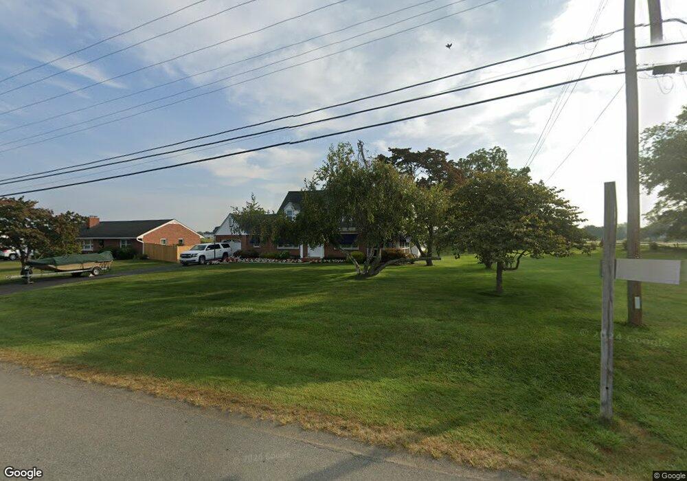
13403 Cearfoss Pike Hagerstown, MD 21740
Maugansville NeighborhoodEstimated Value: $322,084 - $402,000
--
Bed
1
Bath
2,141
Sq Ft
$174/Sq Ft
Est. Value
About This Home
This home is located at 13403 Cearfoss Pike, Hagerstown, MD 21740 and is currently estimated at $372,771, approximately $174 per square foot. 13403 Cearfoss Pike is a home located in Washington County with nearby schools including Maugansville Elementary School, Western Heights Middle School, and North Hagerstown High School.
Ownership History
Date
Name
Owned For
Owner Type
Purchase Details
Closed on
Mar 27, 2019
Sold by
Mitchell Gary J and Mitchell Cherie L
Bought by
Mitchell Gary Joseph and Mitchell Cherie Linda
Current Estimated Value
Purchase Details
Closed on
Apr 9, 1990
Sold by
Delauder G Robert
Bought by
Mitchell Gary J and Mitchell Cherie L
Home Financials for this Owner
Home Financials are based on the most recent Mortgage that was taken out on this home.
Original Mortgage
$78,000
Interest Rate
10.26%
Create a Home Valuation Report for This Property
The Home Valuation Report is an in-depth analysis detailing your home's value as well as a comparison with similar homes in the area
Home Values in the Area
Average Home Value in this Area
Purchase History
| Date | Buyer | Sale Price | Title Company |
|---|---|---|---|
| Mitchell Gary Joseph | -- | None Available | |
| Mitchell Gary J | $97,500 | -- |
Source: Public Records
Mortgage History
| Date | Status | Borrower | Loan Amount |
|---|---|---|---|
| Closed | Mitchell Gary J | $78,000 |
Source: Public Records
Tax History Compared to Growth
Tax History
| Year | Tax Paid | Tax Assessment Tax Assessment Total Assessment is a certain percentage of the fair market value that is determined by local assessors to be the total taxable value of land and additions on the property. | Land | Improvement |
|---|---|---|---|---|
| 2025 | $2,317 | $293,800 | $55,400 | $238,400 |
| 2024 | $2,317 | $261,100 | $0 | $0 |
| 2023 | $2,198 | $228,400 | $0 | $0 |
| 2022 | $2,086 | $195,700 | $55,400 | $140,300 |
| 2021 | $2,017 | $190,567 | $0 | $0 |
| 2020 | $2,017 | $185,433 | $0 | $0 |
| 2019 | $1,971 | $180,300 | $55,400 | $124,900 |
| 2018 | $1,971 | $180,300 | $55,400 | $124,900 |
| 2017 | $1,971 | $180,300 | $0 | $0 |
| 2016 | -- | $185,300 | $0 | $0 |
| 2015 | -- | $183,967 | $0 | $0 |
| 2014 | $1,803 | $182,633 | $0 | $0 |
Source: Public Records
Map
Nearby Homes
- 13501 Scarlet Sage Ct
- 13409 Chads Terrace
- 13605 Cearfoss Pike
- 13171 Salem Church Rd
- 13633 Ivy Way
- 17034 Broadfording Rd
- 13828 Countryside Dr
- 18113 Demon Deacon Ct
- 13020 Yellow Jacket Rd
- 17030 Broadfording Rd
- 17038 Broadfording Rd
- 12922 Nittany Lion Cir
- 12834 Point Salem Rd
- 17937 Leona Ave
- 17028 Broadfording Rd
- 12922 Salem Ave
- 13929 Green Mountain Dr
- 18264 Roy Croft Dr
- 12661 Barton Dr
- 18323 Roy Croft Dr
- 13407 Cearfoss Pike
- 13343 Cearfoss Pike
- 13411 Cearfoss Pike
- 13421 Cearfoss Pike
- 13427 Cearfoss Pike
- 13338 Cearfoss Pike
- 13315 Cearfoss Pike
- 13321 Cearfoss Pike
- 13324 Salem Church Rd
- 13330 Salem Church Rd
- 13322 Salem Church Rd
- 13318 Salem Church Rd
- 13316 Salem Church Rd
- 13312 Salem Church Rd
- 13308 Salem Church Rd
- 13328 Salem Church Rd
- 13306 Salem Church Rd
- 13311 Cearfoss Pike
- 17717 Jennifer Ln
- 17715 Jennifer Ln