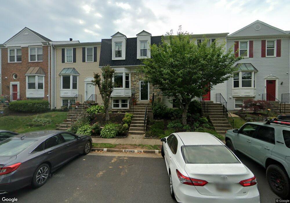
13407 Elevation Ln Herndon, VA 20171
Oak Hill NeighborhoodEstimated Value: $512,000 - $569,000
4
Beds
4
Baths
1,292
Sq Ft
$421/Sq Ft
Est. Value
About This Home
This home is located at 13407 Elevation Ln, Herndon, VA 20171 and is currently estimated at $544,071, approximately $421 per square foot. 13407 Elevation Ln is a home located in Fairfax County with nearby schools including Oak Hill Elementary School, Franklin Middle, and Chantilly High School.
Ownership History
Date
Name
Owned For
Owner Type
Purchase Details
Closed on
May 8, 2020
Sold by
Baldo Edna M and Baldo Ernalyn M
Bought by
Baldo Edna M and Baldo Ernesto S
Current Estimated Value
Home Financials for this Owner
Home Financials are based on the most recent Mortgage that was taken out on this home.
Original Mortgage
$397,100
Outstanding Balance
$351,220
Interest Rate
3.2%
Mortgage Type
New Conventional
Estimated Equity
$192,851
Purchase Details
Closed on
Sep 9, 2005
Sold by
Delisi Joseph E
Bought by
Baldo Edna M and Baldo,Ernalyn M
Home Financials for this Owner
Home Financials are based on the most recent Mortgage that was taken out on this home.
Original Mortgage
$340,000
Interest Rate
5.79%
Mortgage Type
New Conventional
Create a Home Valuation Report for This Property
The Home Valuation Report is an in-depth analysis detailing your home's value as well as a comparison with similar homes in the area
Home Values in the Area
Average Home Value in this Area
Purchase History
| Date | Buyer | Sale Price | Title Company |
|---|---|---|---|
| Baldo Edna M | -- | Westcor Land Title Ins Co | |
| Baldo Edna M | $425,000 | -- |
Source: Public Records
Mortgage History
| Date | Status | Borrower | Loan Amount |
|---|---|---|---|
| Open | Baldo Edna M | $397,100 | |
| Previous Owner | Baldo Edna M | $340,000 |
Source: Public Records
Tax History
| Year | Tax Paid | Tax Assessment Tax Assessment Total Assessment is a certain percentage of the fair market value that is determined by local assessors to be the total taxable value of land and additions on the property. | Land | Improvement |
|---|---|---|---|---|
| 2025 | $6,006 | $552,500 | $185,000 | $367,500 |
| 2024 | $6,006 | $518,430 | $170,000 | $348,430 |
| 2023 | $5,499 | $487,310 | $160,000 | $327,310 |
| 2022 | $5,171 | $452,170 | $140,000 | $312,170 |
| 2021 | $4,853 | $413,570 | $120,000 | $293,570 |
| 2020 | $5,161 | $388,060 | $110,000 | $278,060 |
| 2019 | $4,449 | $375,910 | $100,000 | $275,910 |
| 2018 | $4,194 | $364,680 | $95,000 | $269,680 |
| 2017 | $4,234 | $364,680 | $95,000 | $269,680 |
| 2016 | $4,099 | $353,790 | $90,000 | $263,790 |
Source: Public Records
Map
Nearby Homes
- 13471 Higgs Ct
- 13512 Apple Barrel Ct
- 13214 Stone Heather Dr
- 3124 Ashburton Ave
- 13208 Tuckaway Dr
- 13604 Gladwyn Ct
- 3603 Great Laurel Ln
- 13509 Oak Ivy Ln
- 13172 Ladybank Ln
- 3206 Kilbrennan Ct
- 3514 Armfield Farm Dr
- 3623 Great Laurel Ln
- 13110 Thompson Rd
- 13224 Coralberry Dr
- 3346 Oakshade Ct
- 13730 Rosetree Ct
- 3003 Emerald Chase Dr
- 3621 Buckeye Ct
- 2982 Emerald Chase Dr
- 3606 Canoe Birch Ct
- 13405 Elevation Ln
- 13403 Elevation Ln
- 13409 Elevation Ln
- 13401 Elevation Ln
- 13411 Elevation Ln
- 13415 Elevation Ln
- 13419 Elevation Ln
- 13413 Elevation Ln
- 13400 Elevation Ln
- 13421 Elevation Ln
- 13412 Elevation Ln
- 13402 Elevation Ln
- 13423 Elevation Ln
- 13404 Elevation Ln
- 13414 Elevation Ln
- 13425 Elevation Ln
- 13416 Elevation Ln
- 13406 Elevation Ln
- 13418 Elevation Ln
- 13408 Elevation Ln
Your Personal Tour Guide
Ask me questions while you tour the home.