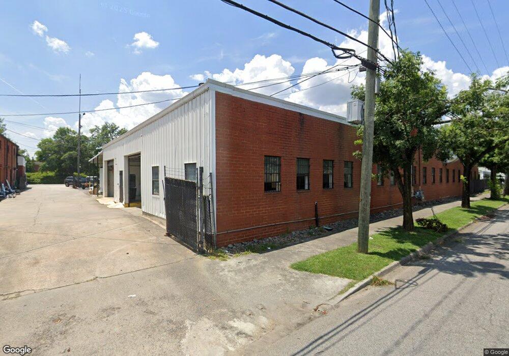
1341 Broad St Unit 2 Augusta, GA 30901
West End NeighborhoodEstimated Value: $216,000 - $293,000
3
Beds
2
Baths
2,370
Sq Ft
$108/Sq Ft
Est. Value
About This Home
This home is located at 1341 Broad St Unit 2, Augusta, GA 30901 and is currently estimated at $255,502, approximately $107 per square foot. 1341 Broad St Unit 2 is a home located in Richmond County with nearby schools including Lamar Elementary School, W.S. Hornsby Elementary School, and Johnson Magnet.
Ownership History
Date
Name
Owned For
Owner Type
Purchase Details
Closed on
Mar 8, 2023
Sold by
Trantham Kevin
Bought by
Tnt Broad Llc
Current Estimated Value
Purchase Details
Closed on
Apr 7, 2020
Sold by
Carl Bradley W
Bought by
Trantham Kevin and Trantham Katrine
Home Financials for this Owner
Home Financials are based on the most recent Mortgage that was taken out on this home.
Original Mortgage
$106,500
Interest Rate
3.4%
Mortgage Type
New Conventional
Create a Home Valuation Report for This Property
The Home Valuation Report is an in-depth analysis detailing your home's value as well as a comparison with similar homes in the area
Home Values in the Area
Average Home Value in this Area
Purchase History
| Date | Buyer | Sale Price | Title Company |
|---|---|---|---|
| Tnt Broad Llc | -- | -- | |
| Trantham Kevin | $142,000 | -- |
Source: Public Records
Mortgage History
| Date | Status | Borrower | Loan Amount |
|---|---|---|---|
| Previous Owner | Trantham Kevin | $106,500 |
Source: Public Records
Tax History Compared to Growth
Tax History
| Year | Tax Paid | Tax Assessment Tax Assessment Total Assessment is a certain percentage of the fair market value that is determined by local assessors to be the total taxable value of land and additions on the property. | Land | Improvement |
|---|---|---|---|---|
| 2025 | $4,221 | $119,700 | $1,879 | $117,821 |
| 2024 | $4,221 | $107,752 | $1,879 | $105,873 |
| 2023 | $3,750 | $88,156 | $1,879 | $86,277 |
| 2022 | $2,702 | $68,052 | $1,879 | $66,173 |
| 2021 | $2,310 | $50,299 | $1,883 | $48,416 |
| 2020 | $1,812 | $36,043 | $1,883 | $34,160 |
| 2019 | $1,870 | $35,281 | $1,883 | $33,398 |
| 2018 | $1,882 | $35,281 | $1,883 | $33,398 |
| 2017 | $1,874 | $35,281 | $1,883 | $33,398 |
| 2016 | $1,875 | $35,282 | $1,883 | $33,398 |
| 2015 | $1,884 | $35,282 | $1,883 | $33,398 |
| 2014 | $1,886 | $35,282 | $1,883 | $33,398 |
Source: Public Records
Map
Nearby Homes
- 1441 Waters Edge Dr
- 111 Landing Dr
- 347 Landing Dr
- 383 Blue Clay Dr
- 0 Lafayette St
- Lot 12 Railroad Ave
- 936 Broad St Unit 416
- 936 Broad St Unit 211
- 936 Broad St Unit 214
- 31 Crystal Lake Dr
- 512 Arrington Ave
- 520 Arrington Ave
- 380 Front St
- 384 Front St
- 376 Front St
- 1642 Broad St
- 1642 Broad St Unit 1642,1644,1646,1648
- 1239 Miller St
- 1237 Miller St
- 2754 Hunt Cliffe Dr
- 13-O None
- 1407 Broad St
- 1409 Broad St
- 1334 Market St
- 204 13th St
- 204 13th St Unit 102
- 204 13th St Unit 302
- 1260 Reynolds St
- 1117 Jones St
- 1290 Broad St
- 1327 Waters Edge Dr
- 1323 Waters Edge Dr
- 1321 Waters Edge Dr
- 1329 Waters Edge Dr
- 1329 Waters Edge Dr Unit 35
- 1319 Waters Edge Dr
- 1317 Waters Edge Dr
- 1335 Waters Edge Dr
- 1425 Broad St