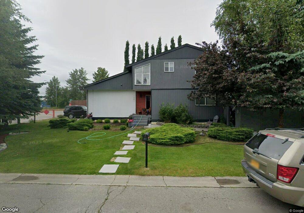
1341 Gram Cir Anchorage, AK 99518
Taku-Campbell NeighborhoodEstimated Value: $260,000 - $458,000
3
Beds
2
Baths
1,336
Sq Ft
$289/Sq Ft
Est. Value
About This Home
This home is located at 1341 Gram Cir, Anchorage, AK 99518 and is currently estimated at $385,902, approximately $288 per square foot. 1341 Gram Cir is a home located in Anchorage Municipality with nearby schools including Campbell Elementary School, Romig Middle School, and West High School.
Ownership History
Date
Name
Owned For
Owner Type
Purchase Details
Closed on
Mar 29, 2006
Sold by
Ennes Paul L
Bought by
Melendez Lester G
Current Estimated Value
Home Financials for this Owner
Home Financials are based on the most recent Mortgage that was taken out on this home.
Original Mortgage
$187,500
Outstanding Balance
$106,752
Interest Rate
6.2%
Mortgage Type
New Conventional
Estimated Equity
$279,150
Purchase Details
Closed on
Feb 5, 2002
Sold by
Melendez Lester G
Bought by
Ennes Paul L
Purchase Details
Closed on
May 14, 1999
Sold by
Guinn Matthew G and Guinn Trina L
Bought by
Melendez Lester G and Farrell Lance P
Home Financials for this Owner
Home Financials are based on the most recent Mortgage that was taken out on this home.
Original Mortgage
$142,383
Interest Rate
6.94%
Mortgage Type
FHA
Purchase Details
Closed on
Aug 31, 1994
Sold by
Bollwinkel Kelly R
Bought by
Guinn Matthew G and Guinn Trina L
Home Financials for this Owner
Home Financials are based on the most recent Mortgage that was taken out on this home.
Original Mortgage
$131,520
Interest Rate
8.65%
Mortgage Type
VA
Create a Home Valuation Report for This Property
The Home Valuation Report is an in-depth analysis detailing your home's value as well as a comparison with similar homes in the area
Home Values in the Area
Average Home Value in this Area
Purchase History
| Date | Buyer | Sale Price | Title Company |
|---|---|---|---|
| Melendez Lester G | $10,500 | None Available | |
| Ennes Paul L | -- | -- | |
| Melendez Lester G | -- | -- | |
| Melendez Lester G | -- | -- | |
| Guinn Matthew G | -- | -- | |
| Guinn Matthew G | -- | -- |
Source: Public Records
Mortgage History
| Date | Status | Borrower | Loan Amount |
|---|---|---|---|
| Open | Melendez Lester G | $187,500 | |
| Previous Owner | Melendez Lester G | $142,383 | |
| Previous Owner | Guinn Matthew G | $131,520 |
Source: Public Records
Tax History Compared to Growth
Tax History
| Year | Tax Paid | Tax Assessment Tax Assessment Total Assessment is a certain percentage of the fair market value that is determined by local assessors to be the total taxable value of land and additions on the property. | Land | Improvement |
|---|---|---|---|---|
| 2025 | $5,084 | $414,500 | $92,100 | $322,400 |
| 2024 | $5,084 | $389,900 | $92,100 | $297,800 |
| 2023 | $6,087 | $357,400 | $92,100 | $265,300 |
| 2022 | $5,161 | $356,500 | $92,100 | $264,400 |
| 2021 | $5,646 | $313,300 | $92,100 | $221,200 |
| 2020 | $4,133 | $293,400 | $92,100 | $201,300 |
| 2019 | $3,931 | $290,300 | $92,100 | $198,200 |
| 2018 | $3,851 | $284,800 | $92,100 | $192,700 |
| 2017 | $4,187 | $287,400 | $92,100 | $195,300 |
| 2016 | $3,304 | $286,900 | $89,600 | $197,300 |
| 2015 | $3,304 | $272,700 | $80,600 | $192,100 |
| 2014 | $3,304 | $254,000 | $80,600 | $173,400 |
Source: Public Records
Map
Nearby Homes
- 1310 Heidi Cir
- 981 Oakridge Dr
- 7520 Papa Cir
- 1121 W 77th Ave
- 1025 W 77th Ave
- 7740 Lars Cir
- 638 W 74th Ave
- 639 W 75th Ave
- 6243 Eula St
- 2131 Sundew Cir
- 1957 Terrebonne Loop
- 1028 W 80th Ave
- 7330 Huntsmen Cir Unit 13F
- 400 W 76th Ave Unit 111
- 8020 Fairwood Cir
- N/A Silverado Tract 2a
- 7232 Foxridge Cir Unit 9A
- 7222 Foxridge Cir Unit 14B
- 7242 Foxridge Cir Unit 10D
- 7510 Foxridge Way Unit 2A