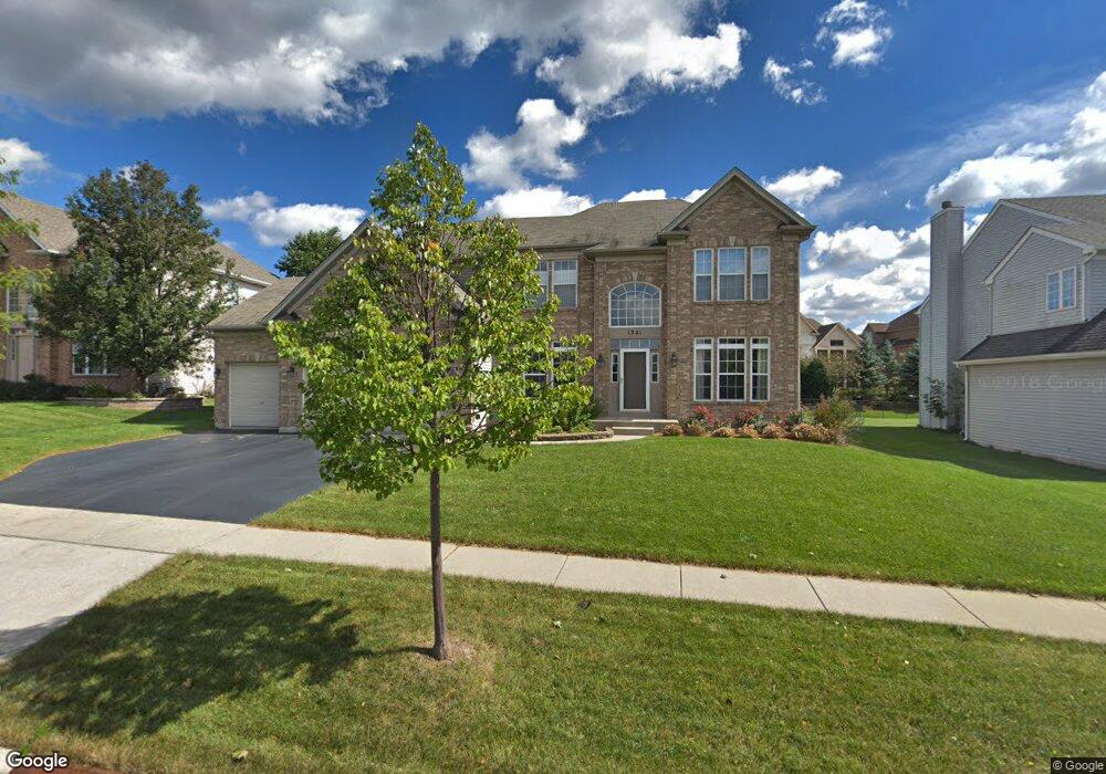
1341 Maple Cir West Dundee, IL 60118
Estimated Value: $544,015 - $636,000
4
Beds
--
Bath
3,106
Sq Ft
$188/Sq Ft
Est. Value
About This Home
This home is located at 1341 Maple Cir, West Dundee, IL 60118 and is currently estimated at $585,004, approximately $188 per square foot. 1341 Maple Cir is a home located in Kane County with nearby schools including Dundee Highlands Elementary School, Dundee Middle School, and Harry D Jacobs High School.
Ownership History
Date
Name
Owned For
Owner Type
Purchase Details
Closed on
Sep 7, 2022
Sold by
Paitl Kenneth A and Demarco-Paitl Laura A
Bought by
Paitl Kenneth A and Demarco-Paitl Laura A
Current Estimated Value
Purchase Details
Closed on
Apr 2, 2004
Sold by
Grand Pointe Meadows Llc
Bought by
Paitl Kenneth A and Demarco Paitl Laura A
Home Financials for this Owner
Home Financials are based on the most recent Mortgage that was taken out on this home.
Original Mortgage
$210,000
Interest Rate
5.85%
Mortgage Type
Purchase Money Mortgage
Create a Home Valuation Report for This Property
The Home Valuation Report is an in-depth analysis detailing your home's value as well as a comparison with similar homes in the area
Home Values in the Area
Average Home Value in this Area
Purchase History
We collect this data history from publicly available records. To have your information removed, we recommend requesting removal directly through your county’s website.
| Date | Buyer | Sale Price | Title Company |
|---|---|---|---|
| Paitl Kenneth A | -- | None Listed On Document | |
| Paitl Kenneth A | $383,000 | Ticor Title Insurance Co |
Source: Public Records
Mortgage History
We collect this data history from publicly available records. To have your information removed, we recommend requesting removal directly through your county’s website.
| Date | Status | Borrower | Loan Amount |
|---|---|---|---|
| Previous Owner | Paitl Kenneth A | $210,000 |
Source: Public Records
Tax History
| Year | Tax Paid | Tax Assessment Tax Assessment Total Assessment is a certain percentage of the fair market value that is determined by local assessors to be the total taxable value of land and additions on the property. | Land | Improvement |
|---|---|---|---|---|
| 2024 | $11,660 | $151,045 | $25,730 | $125,315 |
| 2023 | $10,945 | $135,905 | $23,151 | $112,754 |
| 2022 | $10,434 | $124,434 | $23,151 | $101,283 |
| 2021 | $10,074 | $117,490 | $21,859 | $95,631 |
| 2020 | $9,890 | $114,849 | $21,368 | $93,481 |
| 2019 | $10,246 | $116,222 | $20,285 | $95,937 |
| 2018 | $9,932 | $110,139 | $19,883 | $90,256 |
| 2017 | $9,466 | $103,030 | $18,600 | $84,430 |
| 2016 | $9,652 | $99,758 | $18,009 | $81,749 |
| 2015 | -- | $104,744 | $21,296 | $83,448 |
| 2014 | -- | $101,852 | $20,708 | $81,144 |
| 2013 | -- | $104,970 | $21,342 | $83,628 |
Source: Public Records
Map
Nearby Homes
- 1403 Karen Dr
- 2725 Acorn Ct Unit 3
- 36W340 Huntley Rd
- 1601 Higgins Rd
- 414 Spring Ct W Unit 13414
- 1021 Shagbark Ln
- 1015 Shagbark Ln
- 1013 Shagbark Ln
- 1011 Shagbark Ln
- 1009 Shagbark Ln
- 6850 Huntley Rd
- lot 009 Huntley Rd
- 1005 Shagbark Ln
- 176 Tay River Dr
- 1003 Shagbark Ln
- 1001 Shagbark Ln
- 804 Lindsay Ln
- 1023 Shagbark Ln
- 1031 Shagbark Ln
- 8113 Sierra Woods Ln Unit 2
- 1351 Maple Cir Unit 1
- 1339 Maple Cir Unit 1
- 1348 Karen Dr
- 1363 Maple Cir
- 1327 Maple Cir Unit 1
- 1336 Karen Dr
- 1340 Maple Cir
- 1324 Karen Dr
- 1315 Maple Cir Unit 1
- 1375 Maple Cir Unit 1
- 1326 Maple Cir
- 1362 Karen Dr
- 1312 Karen Dr
- 1383 Acorn Ct
- Lot 8 Karen Dr
- 1303 Maple Cir
- 1383 Acorn Dr
- 1387 Maple Cir
- 1381 Acorn Ct
- 1359 Karen Dr
Your Personal Tour Guide
Ask me questions while you tour the home.