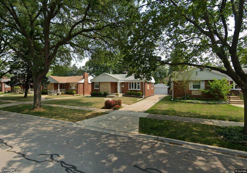
1341 Portsmouth Ave Westchester, IL 60154
Estimated Value: $327,000 - $363,000
3
Beds
2
Baths
1,341
Sq Ft
$258/Sq Ft
Est. Value
About This Home
This home is located at 1341 Portsmouth Ave, Westchester, IL 60154 and is currently estimated at $346,368, approximately $258 per square foot. 1341 Portsmouth Ave is a home located in Cook County with nearby schools including Westchester Primary School, Westchester Intermediate School, and Westchester Middle School.
Ownership History
Date
Name
Owned For
Owner Type
Purchase Details
Closed on
Oct 25, 2018
Sold by
Flint Deborah J and Mullane Joseph J
Bought by
Flint Deborah J and Mullane Joseph J
Current Estimated Value
Purchase Details
Closed on
Nov 27, 2017
Sold by
Zenian John and Dufek Debra
Bought by
Flint Deborah J
Home Financials for this Owner
Home Financials are based on the most recent Mortgage that was taken out on this home.
Original Mortgage
$180,500
Interest Rate
3.94%
Mortgage Type
New Conventional
Purchase Details
Closed on
Jul 11, 2005
Sold by
Zuniga Isabel and Lopez Isabel Z
Bought by
Zenian John and Dufek Debra
Home Financials for this Owner
Home Financials are based on the most recent Mortgage that was taken out on this home.
Original Mortgage
$220,000
Interest Rate
5.69%
Mortgage Type
Fannie Mae Freddie Mac
Purchase Details
Closed on
Sep 25, 1995
Sold by
Bove Edward J and Bove Lillian M
Bought by
Zuniga Isabel
Home Financials for this Owner
Home Financials are based on the most recent Mortgage that was taken out on this home.
Original Mortgage
$95,000
Interest Rate
8%
Create a Home Valuation Report for This Property
The Home Valuation Report is an in-depth analysis detailing your home's value as well as a comparison with similar homes in the area
Home Values in the Area
Average Home Value in this Area
Purchase History
| Date | Buyer | Sale Price | Title Company |
|---|---|---|---|
| Flint Deborah J | -- | Attorney | |
| Flint Deborah J | $190,000 | Attorney | |
| Zenian John | $275,000 | Multiple | |
| Zuniga Isabel | $145,000 | Land Title Group Inc |
Source: Public Records
Mortgage History
| Date | Status | Borrower | Loan Amount |
|---|---|---|---|
| Previous Owner | Flint Deborah J | $180,500 | |
| Previous Owner | Zenian John | $220,000 | |
| Previous Owner | Zuniga Isabel | $95,000 |
Source: Public Records
Tax History Compared to Growth
Tax History
| Year | Tax Paid | Tax Assessment Tax Assessment Total Assessment is a certain percentage of the fair market value that is determined by local assessors to be the total taxable value of land and additions on the property. | Land | Improvement |
|---|---|---|---|---|
| 2024 | $4,733 | $24,000 | $5,159 | $18,841 |
| 2023 | $4,295 | $24,000 | $5,159 | $18,841 |
| 2022 | $4,295 | $20,235 | $4,422 | $15,813 |
| 2021 | $5,976 | $20,235 | $4,422 | $15,813 |
| 2020 | $5,838 | $20,235 | $4,422 | $15,813 |
| 2019 | $5,368 | $19,000 | $4,053 | $14,947 |
| 2018 | $5,297 | $19,000 | $4,053 | $14,947 |
| 2017 | $4,273 | $19,000 | $4,053 | $14,947 |
| 2016 | $4,643 | $18,418 | $3,685 | $14,733 |
| 2015 | $4,547 | $18,418 | $3,685 | $14,733 |
| 2014 | $4,458 | $18,418 | $3,685 | $14,733 |
| 2013 | $4,384 | $20,069 | $3,685 | $16,384 |
Source: Public Records
Map
Nearby Homes
- 10072 Drury Ln
- 1500 Bristol Ave
- 1119 Newcastle Ave
- 1623 Manchester Ave
- 1601 Bristol Ave
- 920 Suffolk Ave
- 1247 S Mannheim Rd Unit 3
- 923 Manchester Ave
- 1816 Manchester Ave
- 814 Norfolk Ave
- 805 Norfolk Ave
- 1907 Suffolk Ave
- 1840 Gardner Rd
- 1900 Manchester Ave
- 750 Bristol Ave
- 1932 Newcastle Ave
- 10524 Camelot St
- 10531 Camelot St
- 723 Balmoral Ave
- 626 Manchester Ave
- 1347 Portsmouth Ave
- 1335 Portsmouth Ave
- 1353 Portsmouth Ave
- 1331 Portsmouth Ave
- 1342 Suffolk Ave
- 1336 Suffolk Ave
- 1346 Suffolk Ave
- 1359 Portsmouth Ave
- 1332 Suffolk Ave
- 1325 Portsmouth Ave
- 1352 Suffolk Ave
- 1326 Suffolk Ave
- 1342 Portsmouth Ave
- 1342 Portsmouth Ave
- 1336 Portsmouth Ave
- 1358 Suffolk Ave
- 1346 Portsmouth Ave
- 1321 Portsmouth Ave
- 1332 Portsmouth Ave
- 1352 Portsmouth Ave