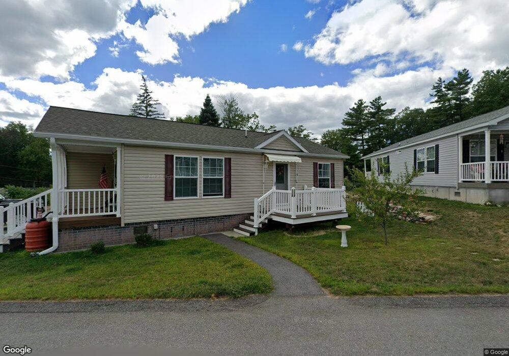
1341 Rindge Rd Fitchburg, MA 01420
Estimated Value: $459,000 - $1,809,991
2
Beds
2
Baths
1,056
Sq Ft
$1,074/Sq Ft
Est. Value
About This Home
This home is located at 1341 Rindge Rd, Fitchburg, MA 01420 and is currently estimated at $1,134,496, approximately $1,074 per square foot. 1341 Rindge Rd is a home located in Worcester County with nearby schools including Crocker Elementary School, Fitchburg High School, and South Street Elementary School.
Ownership History
Date
Name
Owned For
Owner Type
Purchase Details
Closed on
Jan 13, 2005
Sold by
Whitney Rt and Hickey Stanley G
Bought by
Chase Road Nt and Joanne Jeffreys Re Inc
Current Estimated Value
Home Financials for this Owner
Home Financials are based on the most recent Mortgage that was taken out on this home.
Original Mortgage
$250,000
Interest Rate
5.81%
Mortgage Type
Purchase Money Mortgage
Create a Home Valuation Report for This Property
The Home Valuation Report is an in-depth analysis detailing your home's value as well as a comparison with similar homes in the area
Home Values in the Area
Average Home Value in this Area
Purchase History
| Date | Buyer | Sale Price | Title Company |
|---|---|---|---|
| Chase Road Nt | $200,000 | -- | |
| Whitney Rt | $3,500 | -- | |
| Chase Road Nt | $200,000 | -- |
Source: Public Records
Mortgage History
| Date | Status | Borrower | Loan Amount |
|---|---|---|---|
| Open | Chase Road Nt | $750,000 | |
| Closed | Whitney Rt | $250,000 |
Source: Public Records
Tax History Compared to Growth
Tax History
| Year | Tax Paid | Tax Assessment Tax Assessment Total Assessment is a certain percentage of the fair market value that is determined by local assessors to be the total taxable value of land and additions on the property. | Land | Improvement |
|---|---|---|---|---|
| 2025 | $249 | $1,839,700 | $1,411,800 | $427,900 |
| 2024 | $19,748 | $1,333,400 | $1,035,200 | $298,200 |
| 2023 | $18,832 | $1,175,500 | $877,300 | $298,200 |
| 2022 | $11,714 | $665,200 | $483,000 | $182,200 |
| 2021 | $13,001 | $683,200 | $471,200 | $212,000 |
| 2020 | $10,760 | $545,900 | $379,200 | $166,700 |
| 2019 | $10,227 | $499,100 | $364,900 | $134,200 |
| 2018 | $10,142 | $482,700 | $360,900 | $121,800 |
| 2017 | $10,373 | $482,700 | $360,900 | $121,800 |
| 2016 | $10,248 | $482,700 | $360,900 | $121,800 |
| 2015 | $6,152 | $297,500 | $220,300 | $77,200 |
| 2014 | $6,131 | $309,200 | $232,100 | $77,100 |
Source: Public Records
Map
Nearby Homes
- 277 Stoneybrook Rd
- 1088 Ashby State Rd
- 179 Ashby State Rd
- 794 Ashburnham Hill Rd
- 550 Rindge Rd
- 1 High Rock Rd
- Lot 7 Old Northfield Rd
- Lot 6 Old Northfield Rd
- Lot 8 Old Northfield Rd
- Lot 3 Old Northfield Rd
- 1249 Richardson Rd
- 0 Rindge Rd
- 344 Pearl Hill Rd
- 182 Sheldon Rd
- 15 Will Thompson Way
- 468 Elm St Unit 3
- 218 Marshall St
- 705 Richardson Rd
- 205-207 High St
- 202 High St
- 1341 Rindge Rd
- 1341 Rindge Rd Unit 47
- 1341 Rindge Rd
- 1341 Rindge Rd Unit 3
- 1341 Rindge Rd Unit 17
- 1341 Rindge Rd
- 1341 Rindge Rd Unit 15
- 119 Nijal Ct
- 123 Nijal Ct
- 115 Nijal Ct
- 127 Nijal Ct
- 124 Nijal Ct Unit 1
- 130 Nijal Ct
- 118 Nijal Ct
- 124 Nijal Ct
- 133 Nijal Ct
- 133 Nijal Ct Unit 133
- 107 Nijal Ct
- Lot 15 1341 Rindge Rd Unit 15
- 137 Nijal Ct