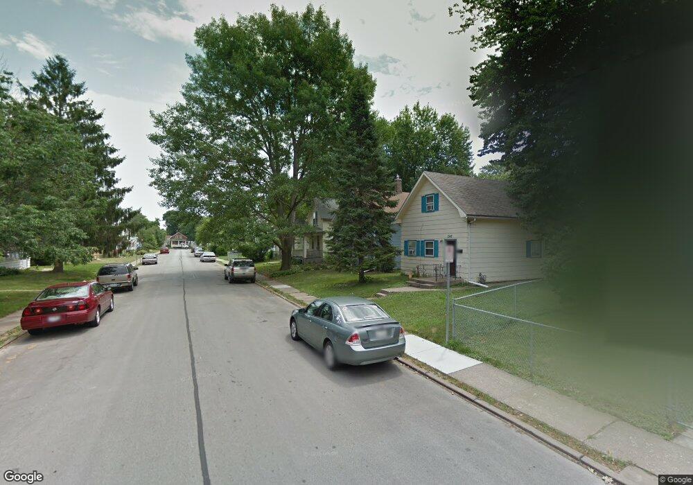
1341 W 14th St Davenport, IA 52804
Northwest Davenport NeighborhoodEstimated Value: $81,000 - $135,000
2
Beds
1
Bath
1,244
Sq Ft
$90/Sq Ft
Est. Value
About This Home
This home is located at 1341 W 14th St, Davenport, IA 52804 and is currently estimated at $112,172, approximately $90 per square foot. 1341 W 14th St is a home located in Scott County with nearby schools including Walnut Hill Elementary School, Christian County Middle School, and Casey County Middle School.
Ownership History
Date
Name
Owned For
Owner Type
Purchase Details
Closed on
Oct 13, 2023
Sold by
Benson Revocable Trust
Bought by
Benson Land Llc
Current Estimated Value
Purchase Details
Closed on
Mar 27, 2014
Sold by
Benson Gerald A and Benson Shirley A
Bought by
Carlton Richard D and Marland Michael L
Purchase Details
Closed on
Jun 30, 2008
Sold by
Benson Gerald A and Benson Shirley A
Bought by
Lykam Joshua David and Lykam Tracy
Home Financials for this Owner
Home Financials are based on the most recent Mortgage that was taken out on this home.
Original Mortgage
$67,500
Interest Rate
7%
Mortgage Type
Seller Take Back
Purchase Details
Closed on
Mar 31, 2008
Sold by
Northwest Bank & Trust Co
Bought by
Benson Gerald A and Benson Shirley A
Create a Home Valuation Report for This Property
The Home Valuation Report is an in-depth analysis detailing your home's value as well as a comparison with similar homes in the area
Home Values in the Area
Average Home Value in this Area
Purchase History
| Date | Buyer | Sale Price | Title Company |
|---|---|---|---|
| Benson Land Llc | -- | None Listed On Document | |
| Carlton Richard D | $75,000 | None Available | |
| Lykam Joshua David | $68,000 | None Available | |
| Benson Gerald A | $30,000 | None Available |
Source: Public Records
Mortgage History
| Date | Status | Borrower | Loan Amount |
|---|---|---|---|
| Previous Owner | Lykam Joshua David | $67,500 | |
| Closed | Carlton Richard D | $0 |
Source: Public Records
Tax History Compared to Growth
Tax History
| Year | Tax Paid | Tax Assessment Tax Assessment Total Assessment is a certain percentage of the fair market value that is determined by local assessors to be the total taxable value of land and additions on the property. | Land | Improvement |
|---|---|---|---|---|
| 2025 | $1,548 | $97,780 | $19,500 | $78,280 |
| 2024 | $1,510 | $86,600 | $19,500 | $67,100 |
| 2023 | $1,816 | $86,600 | $19,500 | $67,100 |
| 2022 | $1,836 | $85,050 | $19,500 | $65,550 |
| 2021 | $1,836 | $85,570 | $19,500 | $66,070 |
| 2020 | $1,702 | $78,370 | $19,500 | $58,870 |
| 2019 | $1,650 | $73,560 | $19,500 | $54,060 |
| 2018 | $1,550 | $73,560 | $19,500 | $54,060 |
| 2017 | $1,604 | $70,560 | $19,500 | $51,060 |
| 2016 | $1,546 | $70,560 | $0 | $0 |
| 2015 | $1,546 | $64,910 | $0 | $0 |
| 2014 | $1,442 | $65,780 | $0 | $0 |
| 2013 | $1,436 | $0 | $0 | $0 |
| 2012 | -- | $59,880 | $13,920 | $45,960 |
Source: Public Records
Map
Nearby Homes
- 1335 W 13th St
- 1321 W 13th St
- 4735 W 12th St
- 1514 N Marquette St
- 1207 N Marquette St
- 1505 W 14th St
- 1118 W 15th St
- 1034 W 14th St
- 930 W 14th St
- 1309 Clay St
- 1203 W Locust St
- 1414 W 9th St
- 817 N Marquette St
- 1319 Warren St
- 822 W 14th St
- 1921 Lillie Ave
- 1419 N Division St
- 903 Vine St
- 1604 W 9th St
- 1119 W 8th St
- 1343 W 14th St
- 1335 W 14th St
- 1347 W 14th St
- 1333 W 14th St
- 1329 W 14th St
- 1321 N Fillmore St
- 1351 W 14th St
- 1325 W 14th St
- 1340 W 13th St
- 1344 W 13th St
- 1334 - 1336 W 13th
- 1323 W 14th St
- 1348 W 13th St
- 1332 W 13th St
- 1330 W 13th St
- 1342 W 14th St
- 1334 W 13th St Unit 36
- 1334 W 13th St
- 1321 W 14th St
- 1346 W 14th St